
Articles | Volume 18, issue 12
https://doi.org/10.5194/hess-18-4861-2014
© Author(s) 2014. This work is distributed under
the Creative Commons Attribution 3.0 License.
the Creative Commons Attribution 3.0 License.
https://doi.org/10.5194/hess-18-4861-2014
© Author(s) 2014. This work is distributed under
the Creative Commons Attribution 3.0 License.
the Creative Commons Attribution 3.0 License.
Research article
| 
05 Dec 2014
Research article |
| 05 Dec 2014
A constraint-based search algorithm for parameter identification of environmental models
S. Gharari
CORRESPONDING AUTHOR
Public Research Center–Gabriel Lippmann, Belvaux, Luxembourg
Water Resources Section, Faculty of Civil Engineering and Geosciences, Delft University of Technology, Delft, the Netherlands
M. Shafiei
Department of Water Engineering, Faculty of Agriculture, Ferdowsi University of Mashhad, Mashhad, Iran
Water Resources Section, Faculty of Civil Engineering and Geosciences, Delft University of Technology, Delft, the Netherlands
M. Hrachowitz
Water Resources Section, Faculty of Civil Engineering and Geosciences, Delft University of Technology, Delft, the Netherlands
UFZ – Helmholtz Centre for Environmental Research, Leipzig, Germany
F. Fenicia
Eawag, Swiss Federal Institute of Aquatic Science and Technology, Dübendorf, Switzerland
Water Resources Section, Faculty of Civil Engineering and Geosciences, Delft University of Technology, Delft, the Netherlands
H. V. Gupta
Department of Hydrology and Water Resources, The University of Arizona, Tucson, AZ, USA
H. H. G. Savenije
Water Resources Section, Faculty of Civil Engineering and Geosciences, Delft University of Technology, Delft, the Netherlands
Related authors
Shervan Gharari, Paul H. Whitfield, Alain Pietroniro, Jim Freer, Hongli Liu, and Martyn P. Clark
Hydrol. Earth Syst. Sci., 28, 4383–4405, https://doi.org/10.5194/hess-28-4383-2024, https://doi.org/10.5194/hess-28-4383-2024, 2024
Short summary
Short summary
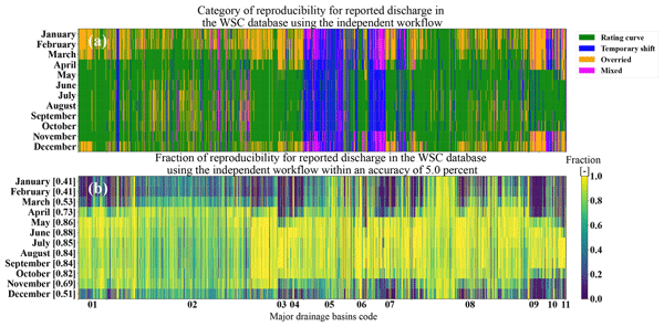
This study provides insight into the practices that are incorporated into discharge estimation across the national Canadian hydrometric network operated by the Water Survey of Canada (WSC). The procedures used to estimate and correct discharge values are not always understood by end-users. Factors such as ice cover and sedimentation limit accurate discharge estimation. Highlighting these challenges sheds light on difficulties in discharge estimation and the associated uncertainty.

Inne Vanderkelen, Shervan Gharari, Naoki Mizukami, Martyn P. Clark, David M. Lawrence, Sean Swenson, Yadu Pokhrel, Naota Hanasaki, Ann van Griensven, and Wim Thiery
Geosci. Model Dev., 15, 4163–4192, https://doi.org/10.5194/gmd-15-4163-2022, https://doi.org/10.5194/gmd-15-4163-2022, 2022
Short summary
Short summary
Human-controlled reservoirs have a large influence on the global water cycle. However, dam operations are rarely represented in Earth system models. We implement and evaluate a widely used reservoir parametrization in a global river-routing model. Using observations of individual reservoirs, the reservoir scheme outperforms the natural lake scheme. However, both schemes show a similar performance due to biases in runoff timing and magnitude when using simulated runoff.

Tam V. Nguyen, Rohini Kumar, José L. J. Ledesma, Pia Ebeling, Jan H. Fleckenstein, and Andreas Musolff
Hydrol. Earth Syst. Sci., 30, 5749–5768, https://doi.org/10.5194/hess-30-5749-2026, https://doi.org/10.5194/hess-30-5749-2026, 2026
Short summary
Short summary
Lumped and landscape-explicit dissolved organic carbon (DOC) models are commonly calibrated using stream DOC concentrations, while internal DOC dynamics in different model compartments are not given enough attention. Our study shows that stream DOC alone is insufficient to constrain internal DOC dynamics. Applying models calibrated in this way under changing boundary conditions may therefore lead to unrealistic results.
Mohammad A. Farmani, Andrew Bennet, Sadaf Moghisi, Hoshin Gupta, Muhammad Jawad, Ali Behrangi, Ahmad A. Tavakoly, and Guo-Yue Niu
EGUsphere, https://doi.org/10.5194/egusphere-2026-4157, https://doi.org/10.5194/egusphere-2026-4157, 2026
This preprint is open for discussion and under review for Hydrology and Earth System Sciences (HESS).
Short summary
Short summary
This study presents RiverGraphNet, an artificial intelligence framework for predicting how runoff moves through connected river networks. Applied to Arizona’s Salt–Verde watershed, the method improved daily streamflow prediction relative to a standard physics-based routing model, especially for event timing and flow distributions. The results show that combining river-network structure with artificial intelligence can support better flood, reservoir, and water-resource prediction.
Muhammad Ibrahim, Markus Hrachowitz, Miriam Coenders-Gerrits, and Ruud van der Ent
EGUsphere, https://doi.org/10.5194/egusphere-2026-4226, https://doi.org/10.5194/egusphere-2026-4226, 2026
This preprint is open for discussion and under review for Hydrology and Earth System Sciences (HESS).
Short summary
Short summary
Root zone storage capacity is an important parameter in hydrological and land-surface models and is often estimated using the memory method rather than through model calibration. We evaluated the uncertainty associated with this widely used method across thousands of catchments worldwide. Our results show that uncertainty varies systematically with climate, while memory method estimates remain in close agreement with calibrated values, supporting the commonly used 20-year return period.

Daniel Klotz, Peter Miersch, Thiago V. M. do Nascimento, Fabrizio Fenicia, Corinna Frank, Martin Gauch, and Jakob Zscheischler
Earth Syst. Sci. Data, 18, 5485–5504, https://doi.org/10.5194/essd-18-5485-2026, https://doi.org/10.5194/essd-18-5485-2026, 2026
Short summary
Short summary
Data availability is central to hydrological science. It is the basis for advancing our understanding of hydrological processes, building prediction models, and anticipatory water management. We present a data-driven daily runoff reconstruction product for natural streamflow. We name it EARLS: European aggregated reconstruction for large-sample studies. The reconstructions represent daily simulations of natural streamflow across Europe and cover the period from 1953 to 2020.
Julia M. Rudlang, Thiago V. M. do Nascimento, Ruud van der Ent, Fabrizio Fenicia, and Markus Hrachowitz
Hydrol. Earth Syst. Sci., 30, 4481–4508, https://doi.org/10.5194/hess-30-4481-2026, https://doi.org/10.5194/hess-30-4481-2026, 2026
Short summary
Short summary
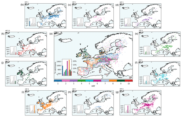
River flow (streamflow) behaviour varies across Europe and is shaped by climate and landscape. Using data from more than 7000 European catchments, we identified 10 hydrological response types based on flow magnitude, timing, and seasonality. At the continental scale, streamflow behaviour is mainly driven by climate, but landscape features are equally or more influential in several regions. These results show that streamflow behaviour emerges from the combined effects of climate and landscape.
Katja Frieler, Stefan Lange, Jacob Schewe, Matthias Mengel, Simon Treu, Christian Otto, Jan Volkholz, Christopher P. O. Reyer, Stefanie Heinicke, Colin Jones, Julia L. Blanchard, Cheryl S. Harrison, Colleen M. Petrik, Tyler D. Eddy, Kelly Ortega-Cisneros, Camilla Novaglio, Ryan Heneghan, Derek P. Tittensor, Olivier Maury, Matthias Büchner, Thomas Vogt, Dánnell Quesada-Chacón, Kerry Emanuel, Chia-Ying Lee, Suzana J. Camargo, Linn Hamester, Jonas Jägermeyr, Sam Rabin, Jochen Klar, Iliusi D. Vega del Valle, Lisa Novak, Inga J. Sauer, Gitta Lasslop, Sarah Chadburn, Eleanor Burke, Angela Gallego-Sala, Noah Smith, Jinfeng Chang, Stijn Hantson, Chantelle Burton, Anne Gädeke, Fang Li, Simon N. Gosling, Hannes Müller Schmied, Fred Hattermann, Thomas Hickler, Rafael Marcé, Don Pierson, Wim Thiery, Daniel Mercado-Bettín, Robert Ladwig, Ana Isabel Ayala, Matthew Forrest, Michel Bechtold, Robert Reinecke, Inge de Graaf, Jed O. Kaplan, Alexander Koch, Matthieu Lengaigne, Rohini Kumar, and Maryna Strokal
Geosci. Model Dev., 19, 4095–4135, https://doi.org/10.5194/gmd-19-4095-2026, https://doi.org/10.5194/gmd-19-4095-2026, 2026
Short summary
Short summary
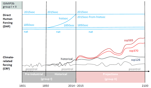
This paper describes the experiments and data sets necessary to run historic and future impact projections, and the underlying assumptions of future climate change as defined by the 3rd round of the ISIMIP Project (Inter-sectoral Impactmodel Intercomparison Project, isimip.org). ISIMIP provides a framework for cross-sectorally consistent climate impact simulations to contribute to a comprehensive and consistent picture of the world under different climate-change scenarios.
Malve Heinz, Annelie Holzkämper, Rohini Kumar, Sélène Ledain, Pascal Horton, and Bettina Schaefli
Hydrol. Earth Syst. Sci., 30, 2879–2911, https://doi.org/10.5194/hess-30-2879-2026, https://doi.org/10.5194/hess-30-2879-2026, 2026
Short summary
Short summary
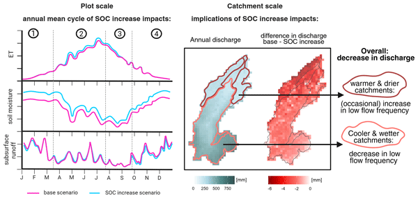
Droughts increasingly threaten agriculture. Improving soils to store more water, for example by increasing soil organic carbon, can help. We simulated this in a Swiss catchment and found that more soil carbon slightly increased soil water storage and evapotranspiration, modestly reduced floods, and shortened periods with very little streamflow. However in warmer, drier areas, these periods with little streamflow could sometimes last longer.
Katoria Lekarkar, Oldrich Rakovec, Rohini Kumar, Stefaan Dondeyne, and Ann van Griensven
Hydrol. Earth Syst. Sci., 30, 2817–2835, https://doi.org/10.5194/hess-30-2817-2026, https://doi.org/10.5194/hess-30-2817-2026, 2026
Short summary
Short summary
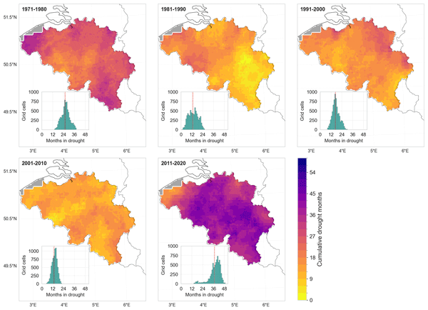
Belgium has faced intense droughts in recent years, causing major losses across sectors. To assess their rarity, we used a hydrological model to reconstruct fifty years of soil moisture in the country. We show that 2011–2020 experienced the most severe droughts since 1971, with nearly 30% of the decade under drought. We also show that rainfall-based indicators underestimate soil moisture droughts, so including soil-moisture monitoring can give decision-makers a clearer picture of drought risks.
Benedikt Heudorfer, Hoshin Gupta, Alexander Dolich, and Ralf Loritz
EGUsphere, https://doi.org/10.5194/egusphere-2026-1965, https://doi.org/10.5194/egusphere-2026-1965, 2026
This preprint is open for discussion and under review for Hydrology and Earth System Sciences (HESS).
Short summary
Short summary
For most rivers, water level is not measured, making flood prediction difficult. But it's still possible with certain models. We want to improve these models and test if better models or better data help when predicting floods with these models in the United States. Results show that better data (measured by satellites) improves predictions more than better model designs. Actually, simple models often worked best. And we show that we need better measurement of landscape information.
Sadaf Nasreen, Oldrich Rakovec, Rohini Kumar, Manuela I. Brunner, Ujjwal Singh, Petr Maca, Yannis Markonis, and Martin Hanel
EGUsphere, https://doi.org/10.5194/egusphere-2026-973, https://doi.org/10.5194/egusphere-2026-973, 2026
Short summary
Short summary
European droughts threaten water and agriculture, but how distinct drought processes will change under warming is uncertain. We examine seven mechanisms across Europe using 1971 to 2000 observations and 2070 to 2099 projections. Changes are regional: the Mediterranean shifts to longer, more severe droughts, while Northern and Western Central Europe often improve. Temperature-driven mechanisms, especially rain to snow transitions, respond most, guiding targeted adaptation.
Hatice Türk, Christine Stumpp, Markus Hrachowitz, Peter Strauss, Günter Blöschl, and Michael Stockinger
Hydrol. Earth Syst. Sci., 30, 1053–1076, https://doi.org/10.5194/hess-30-1053-2026, https://doi.org/10.5194/hess-30-1053-2026, 2026
Short summary
Short summary
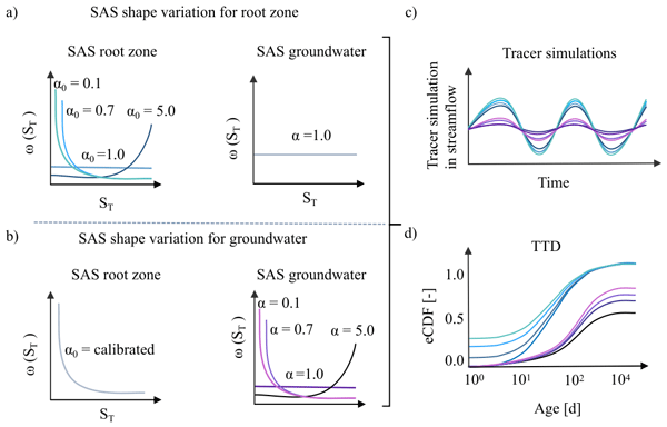
This study shows that streamflow isotope data in a catchment-scale isotope-based transport model were sufficient to isolate preferential flow in the unsaturated zone but insufficient to isolate the preferential release of young groundwater, as isotope signals were strongly damped by large passive groundwater storage. As a result, groundwater age-selection assumptions affected estimates of long transit times, making it difficult to quantify the fraction of stream water older than 100 days.
Cristina Prieto, Dmitri Kavetski, Fabrizio Fenicia, James Kirchner, David McInerney, Mark Thyer, and César Álvarez
EGUsphere, https://doi.org/10.5194/egusphere-2026-483, https://doi.org/10.5194/egusphere-2026-483, 2026
Short summary
Short summary
Hourly streamflow data are increasingly available and can improve streamflow predictions. We tested simple ways to describe uncertainty by transforming flow values and by accounting for how errors persist from hour to hour, using seven catchments in Spain, Switzerland and the United States. Simple transformations and short-term error memory improve the reliability of probabilistic predictions and help combine hourly results into longer time scales for practical operational contexts.
Pia Ebeling, Alexander Hubig, Alexander Wachholz, Ulrike Scharfenberger, Sarah Haug, Tam Nguyen, Fanny Sarrazin, Masooma Batool, Andreas Musolff, and Rohini Kumar
Earth Syst. Sci. Data, 18, 691–712, https://doi.org/10.5194/essd-18-691-2026, https://doi.org/10.5194/essd-18-691-2026, 2026
Short summary
Short summary
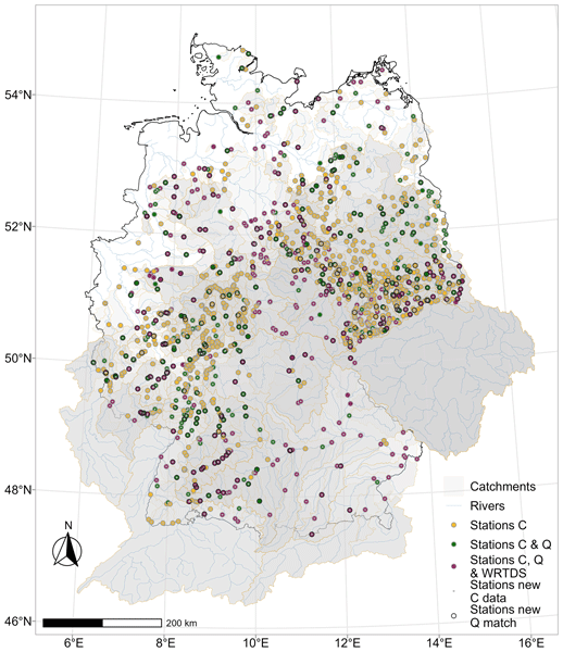
The updated river water quality data set for Germany offers longer records, new variables such as water temperature and oxygen, and time series of pollution sources, and it adds more stations with both water quality and flow data. These improvements provide clearer insights into how stream water quality changes over time and how human activities affect aquatic ecosystems.
Robert Reinecke, Tanjila Akhter, Annemarie Bäthge, Ricarda Dietrich, Sebastian Gnann, Simon N. Gosling, Danielle Grogan, Andreas Hartmann, Stefan Kollet, Rohini Kumar, Richard Lammers, Sida Liu, Yan Liu, Nils Moosdorf, Bibi Naz, Sara Nazari, Chibuike Orazulike, Yadu Pokhrel, Jacob Schewe, Mikhail Smilovic, Maryna Strokal, Wim Thiery, Yoshihide Wada, Shan Zuidema, and Inge de Graaf
Geosci. Model Dev., 19, 523–542, https://doi.org/10.5194/gmd-19-523-2026, https://doi.org/10.5194/gmd-19-523-2026, 2026
Short summary
Short summary
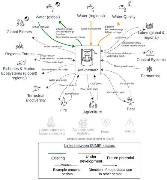
Here we describe a collaborative effort to improve predictions of how climate change will affect groundwater. The ISIMIP (The Inter-Sectoral Impact Model Intercomparison Project) groundwater sector combines multiple global groundwater models to capture a range of possible outcomes and reduce uncertainty. Initial comparisons reveal significant differences between models in key metrics like water table depth and recharge rates, highlighting the need for structured model intercomparisons.
Thiago V. M. do Nascimento, Julia Rudlang, Sebastian Gnann, Jan Seibert, Markus Hrachowitz, and Fabrizio Fenicia
Hydrol. Earth Syst. Sci., 29, 7173–7200, https://doi.org/10.5194/hess-29-7173-2025, https://doi.org/10.5194/hess-29-7173-2025, 2025
Short summary
Short summary
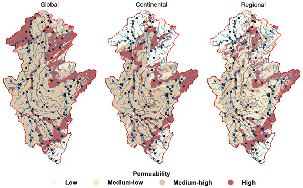
We show that geological maps with varying levels of detail may influence the identification of geology–streamflow relationships across European catchments at multiple scales. At the large scale, controls varied between basins, with no map consistently superior. At the intermediate and small scales, however, higher geological detail consistently strengthened correlations, particularly for baseflow signatures, with the regional map highlighting controls more consistent with process understanding.
Nathalie Rombeek, Markus Hrachowitz, and Remko Uijlenhoet
Hydrol. Earth Syst. Sci., 29, 6715–6733, https://doi.org/10.5194/hess-29-6715-2025, https://doi.org/10.5194/hess-29-6715-2025, 2025
Short summary
Short summary
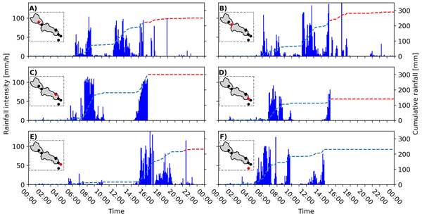
On 29 October 2024 Valencia (Spain) was struck by torrential rainfall, triggering devastating floods in this area. In this study, we quantify and describe the spatial and temporal structure of this rainfall event using personal weather stations (PWSs). These PWSs provide near real-time observations at a temporal resolution of ~5 min. This study shows the potential of PWSs for real-time rainfall monitoring and potentially flood early warning systems by complementing dedicated rain gauge networks.
Ashish Manoj J, Ralf Loritz, Hoshin Gupta, and Erwin Zehe
Hydrol. Earth Syst. Sci., 29, 6115–6135, https://doi.org/10.5194/hess-29-6115-2025, https://doi.org/10.5194/hess-29-6115-2025, 2025
Short summary
Short summary
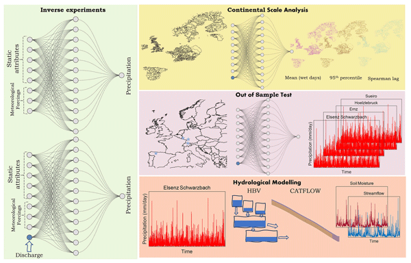
Traditional hydrological models typically operate in a forward mode, simulating streamflow and other catchment fluxes based on precipitation input. In this study, we explored the possibility of reversing this process, inferring precipitation from streamflow data, to improve flood event modelling. We then used the generated precipitation series to run hydrological models, resulting in more accurate estimates of streamflow and soil moisture.
Nathalie Rombeek, Markus Hrachowitz, Arjan Droste, and Remko Uijlenhoet
Hydrol. Earth Syst. Sci., 29, 4585–4606, https://doi.org/10.5194/hess-29-4585-2025, https://doi.org/10.5194/hess-29-4585-2025, 2025
Short summary
Short summary
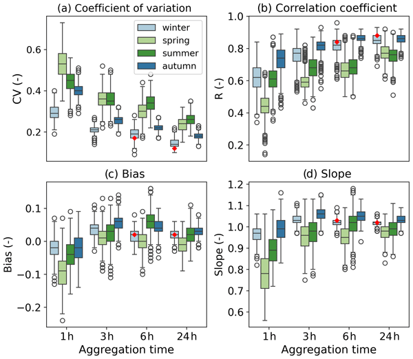
Rain gauge networks from personal weather stations (PWSs) have a network density 100 times higher than dedicated rain gauge networks in the Netherlands. However, PWSs are prone to several sources of error, as they are generally not installed and maintained according to international guidelines. This study systematically quantifies and describes the uncertainties arising from PWS rainfall estimates. In particular, the focus is on the highest rainfall accumulations.
Vishal Thakur, Yannis Markonis, Rohini Kumar, Johanna Ruth Thomson, Mijael Rodrigo Vargas Godoy, Martin Hanel, and Oldrich Rakovec
Hydrol. Earth Syst. Sci., 29, 4395–4416, https://doi.org/10.5194/hess-29-4395-2025, https://doi.org/10.5194/hess-29-4395-2025, 2025
Short summary
Short summary
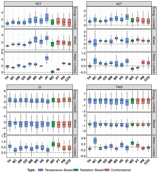
Understanding the changes in water movement in earth is crucial for everyone. To quantify this water movement there are several techniques. We examined how different methods of estimating evaporation impact predictions of various types of water movement across Europe. We found that, while these methods generally agree on whether changes are increasing or decreasing, they differ in magnitude. This means selecting the right evaporation method is crucial for accurate predictions of water movement.
Hatice Türk, Christine Stumpp, Markus Hrachowitz, Karsten Schulz, Peter Strauss, Günter Blöschl, and Michael Stockinger
Hydrol. Earth Syst. Sci., 29, 3935–3956, https://doi.org/10.5194/hess-29-3935-2025, https://doi.org/10.5194/hess-29-3935-2025, 2025
Short summary
Short summary
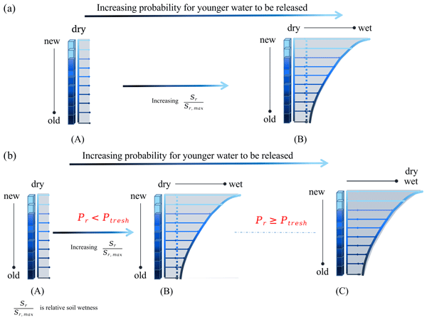
Using advances in transit time estimation and tracer data, we tested if fast-flow transit times are controlled solely by soil moisture or if they are also controlled by precipitation intensity. We used soil-moisture-dependent and precipitation-intensity-conditional transfer functions. We showed that a significant portion of event water bypasses the soil matrix through fast flow paths (overland flow, tile drains, preferential-flow paths) in dry soil conditions for both low- and high-intensity precipitation.
Magali Ponds, Sarah Hanus, Harry Zekollari, Marie-Claire ten Veldhuis, Gerrit Schoups, Roland Kaitna, and Markus Hrachowitz
Hydrol. Earth Syst. Sci., 29, 3545–3568, https://doi.org/10.5194/hess-29-3545-2025, https://doi.org/10.5194/hess-29-3545-2025, 2025
Short summary
Short summary
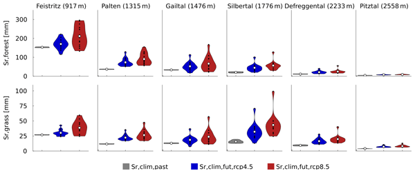
This research examines how future climate changes impact root zone storage, a key hydrological model parameter. Root zone storage – the soil water accessible to plants – adapts to climate but is often kept constant in models. We estimated climate-adapted storage in six Austrian Alps catchments. While storage increased, streamflow projections showed minimal change, which suggests that dynamic root zone representation is less critical in humid regions but warrants further study in arid areas.
Jan Řehoř, Rudolf Brázdil, Oldřich Rakovec, Martin Hanel, Milan Fischer, Rohini Kumar, Jan Balek, Markéta Poděbradská, Vojtěch Moravec, Luis Samaniego, Yannis Markonis, and Miroslav Trnka
Hydrol. Earth Syst. Sci., 29, 3341–3358, https://doi.org/10.5194/hess-29-3341-2025, https://doi.org/10.5194/hess-29-3341-2025, 2025
Short summary
Short summary
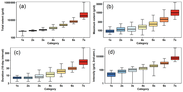
We present a robust method for identification and classification of global land drought events (GLDEs) based on soil moisture. Two models were used to calculate soil moisture and delimit soil drought over global land from 1980–2022, with clusters of 775 and 630 GLDEs. Using four spatiotemporal and three motion-related characteristics, we categorized GLDEs into seven severity and seven dynamic categories. The frequency of GLDEs has generally increased in recent decades.
Pia Ebeling, Andreas Musolff, Rohini Kumar, Andreas Hartmann, and Jan H. Fleckenstein
Hydrol. Earth Syst. Sci., 29, 2925–2950, https://doi.org/10.5194/hess-29-2925-2025, https://doi.org/10.5194/hess-29-2925-2025, 2025
Short summary
Short summary
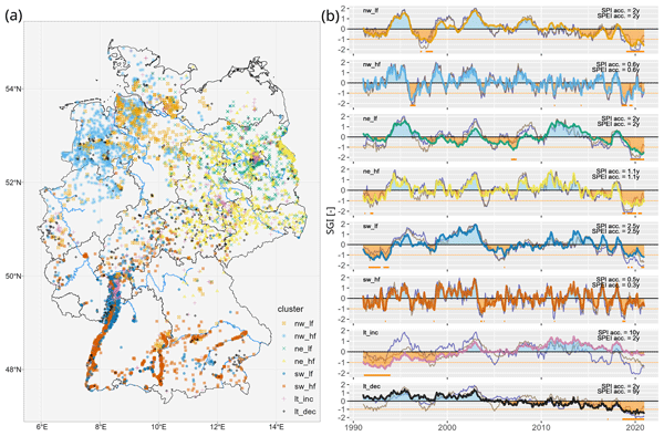
Groundwater is a crucial resource at risk due to droughts. To understand drought effects on groundwater levels in Germany, we grouped 6626 wells into six regional and two national patterns. Weather explained half of the level variations with varied response times. Shallow groundwater responds fast and is more vulnerable to short droughts (a few months). Dampened deep heads buffer short droughts but suffer from long droughts and recoveries. Two nationwide trend patterns were linked to human water use.
Hannes Müller Schmied, Simon Newland Gosling, Marlo Garnsworthy, Laura Müller, Camelia-Eliza Telteu, Atiq Kainan Ahmed, Lauren Seaby Andersen, Julien Boulange, Peter Burek, Jinfeng Chang, He Chen, Lukas Gudmundsson, Manolis Grillakis, Luca Guillaumot, Naota Hanasaki, Aristeidis Koutroulis, Rohini Kumar, Guoyong Leng, Junguo Liu, Xingcai Liu, Inga Menke, Vimal Mishra, Yadu Pokhrel, Oldrich Rakovec, Luis Samaniego, Yusuke Satoh, Harsh Lovekumar Shah, Mikhail Smilovic, Tobias Stacke, Edwin Sutanudjaja, Wim Thiery, Athanasios Tsilimigkras, Yoshihide Wada, Niko Wanders, and Tokuta Yokohata
Geosci. Model Dev., 18, 2409–2425, https://doi.org/10.5194/gmd-18-2409-2025, https://doi.org/10.5194/gmd-18-2409-2025, 2025
Short summary
Short summary
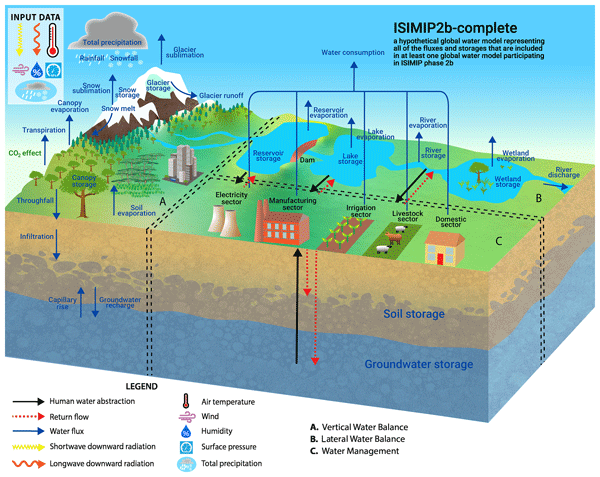
Global water models contribute to the evaluation of important natural and societal issues but are – as all models – simplified representation of reality. So, there are many ways to calculate the water fluxes and storages. This paper presents a visualization of 16 global water models using a standardized visualization and the pathway towards this common understanding. Next to academic education purposes, we envisage that these diagrams will help researchers, model developers, and data users.
Muhammad Ibrahim, Miriam Coenders-Gerrits, Ruud van der Ent, and Markus Hrachowitz
Hydrol. Earth Syst. Sci., 29, 1703–1723, https://doi.org/10.5194/hess-29-1703-2025, https://doi.org/10.5194/hess-29-1703-2025, 2025
Short summary
Short summary
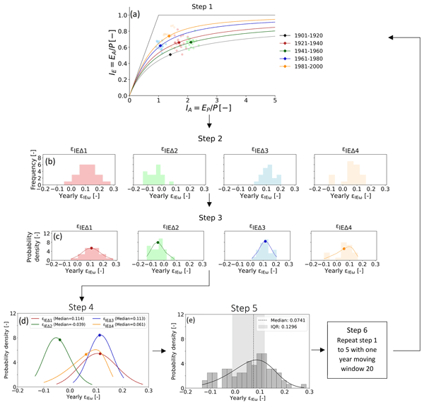
The quantification of precipitation into evaporation and runoff is vital for water resources management. The Budyko framework, based on aridity and evaporative indices of a catchment, can be an ideal tool for that. However, recent research highlights deviations of catchments from the expected evaporative index, casting doubt on its reliability. This study quantifies deviations of 2387 catchments, finding them minor and predictable. Integrating these into predictions upholds the framework's efficacy.
Wouter R. Berghuijs, Ross A. Woods, Bailey J. Anderson, Anna Luisa Hemshorn de Sánchez, and Markus Hrachowitz
Hydrol. Earth Syst. Sci., 29, 1319–1333, https://doi.org/10.5194/hess-29-1319-2025, https://doi.org/10.5194/hess-29-1319-2025, 2025
Short summary
Short summary
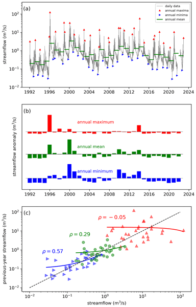
Water balances of catchments will often strongly depend on their state in the recent past, but such memory effects may persist at annual timescales. We use global data sets to show that annual memory is typically absent in precipitation but strong in terrestrial water stores and also present in evaporation and streamflow (including low flows and floods). Our experiments show that hysteretic models provide behaviour that is consistent with these observed memory behaviours.
Masooma Batool, Fanny J. Sarrazin, and Rohini Kumar
Earth Syst. Sci. Data, 17, 881–916, https://doi.org/10.5194/essd-17-881-2025, https://doi.org/10.5194/essd-17-881-2025, 2025
Short summary
Short summary
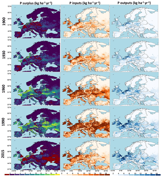
Our paper presents a reconstruction and analysis of the gridded P surplus in European landscapes from 1850 to 2019 at a 5 arcmin resolution. By utilizing 48 different estimates, we account for uncertainties in major components of the P surplus. Our findings highlight substantial historical changes, with the total P surplus in the EU 27 tripling over 170 years. Our dataset enables flexible aggregation at various spatial scales, providing critical insights for land and water management strategies.
Jordy Salmon-Monviola, Ophélie Fovet, and Markus Hrachowitz
Hydrol. Earth Syst. Sci., 29, 127–158, https://doi.org/10.5194/hess-29-127-2025, https://doi.org/10.5194/hess-29-127-2025, 2025
Short summary
Short summary
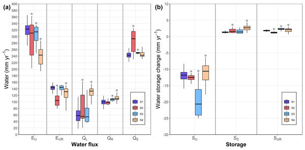
To increase the predictive power of hydrological models, it is necessary to improve their consistency, i.e. their physical realism, which is measured by the ability of the model to reproduce observed system dynamics. Using a model to represent the dynamics of water and nitrate and dissolved organic carbon concentrations in an agricultural catchment, we showed that using solute-concentration data for calibration is useful to improve the hydrological consistency of the model.
Eshrat Fatima, Rohini Kumar, Sabine Attinger, Maren Kaluza, Oldrich Rakovec, Corinna Rebmann, Rafael Rosolem, Sascha E. Oswald, Luis Samaniego, Steffen Zacharias, and Martin Schrön
Hydrol. Earth Syst. Sci., 28, 5419–5441, https://doi.org/10.5194/hess-28-5419-2024, https://doi.org/10.5194/hess-28-5419-2024, 2024
Short summary
Short summary
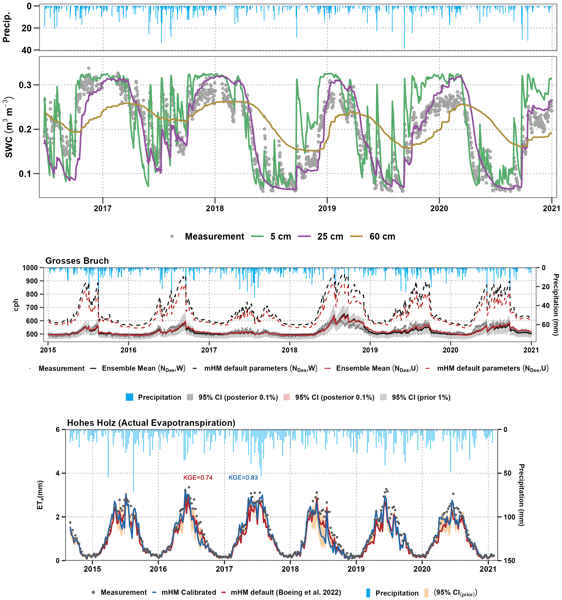
This study establishes a framework to incorporate cosmic-ray neutron measurements into the mesoscale Hydrological Model (mHM). We evaluate different approaches to estimate neutron counts within the mHM using the Desilets equation, with uniformly and non-uniformly weighted average soil moisture, and the physically based code COSMIC. The data improved not only soil moisture simulations but also the parameterisation of evapotranspiration in the model.
Alberto Bassi, Marvin Höge, Antonietta Mira, Fabrizio Fenicia, and Carlo Albert
Hydrol. Earth Syst. Sci., 28, 4971–4988, https://doi.org/10.5194/hess-28-4971-2024, https://doi.org/10.5194/hess-28-4971-2024, 2024
Short summary
Short summary
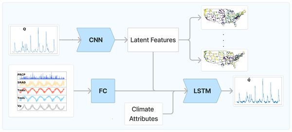
The goal is to remove the impact of meteorological drivers in order to uncover the unique landscape fingerprints of a catchment from streamflow data. Our results reveal an optimal two-feature summary for most catchments, with a third feature associated with aridity and intermittent flow that is needed for challenging cases. Baseflow index, aridity, and soil or vegetation attributes strongly correlate with learnt features, indicating their importance for streamflow prediction.
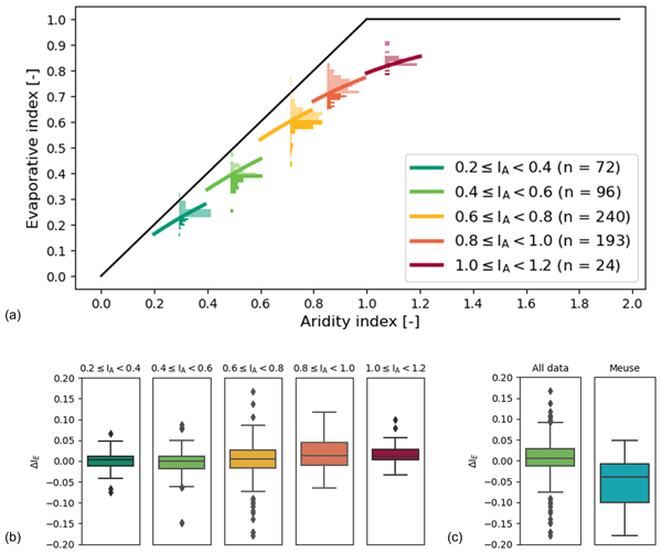
Nienke Tempel, Laurène Bouaziz, Riccardo Taormina, Ellis van Noppen, Jasper Stam, Eric Sprokkereef, and Markus Hrachowitz
Hydrol. Earth Syst. Sci., 28, 4577–4597, https://doi.org/10.5194/hess-28-4577-2024, https://doi.org/10.5194/hess-28-4577-2024, 2024
Short summary
Short summary
This study explores the impact of climatic variability on root zone water storage capacities and, thus, on hydrological predictions. Analysing data from 286 areas in Europe and the US, we found that, despite some variations in root zone storage capacity due to changing climatic conditions over multiple decades, these changes are generally minor and have a limited effect on water storage and river flow predictions.
Fanny J. Sarrazin, Sabine Attinger, and Rohini Kumar
Earth Syst. Sci. Data, 16, 4673–4708, https://doi.org/10.5194/essd-16-4673-2024, https://doi.org/10.5194/essd-16-4673-2024, 2024
Short summary
Short summary
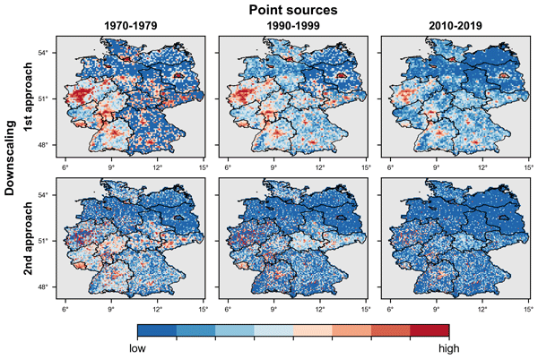
Nitrogen (N) and phosphorus (P) contamination of water bodies is a long-term issue due to the long history of N and P inputs to the environment and their persistence. Here, we introduce a long-term and high-resolution dataset of N and P inputs from wastewater (point sources) for Germany, combining data from different sources and conceptual understanding. We also account for uncertainties in modelling choices, thus facilitating robust long-term and large-scale water quality studies.
Hongkai Gao, Markus Hrachowitz, Lan Wang-Erlandsson, Fabrizio Fenicia, Qiaojuan Xi, Jianyang Xia, Wei Shao, Ge Sun, and Hubert H. G. Savenije
Hydrol. Earth Syst. Sci., 28, 4477–4499, https://doi.org/10.5194/hess-28-4477-2024, https://doi.org/10.5194/hess-28-4477-2024, 2024
Short summary
Short summary
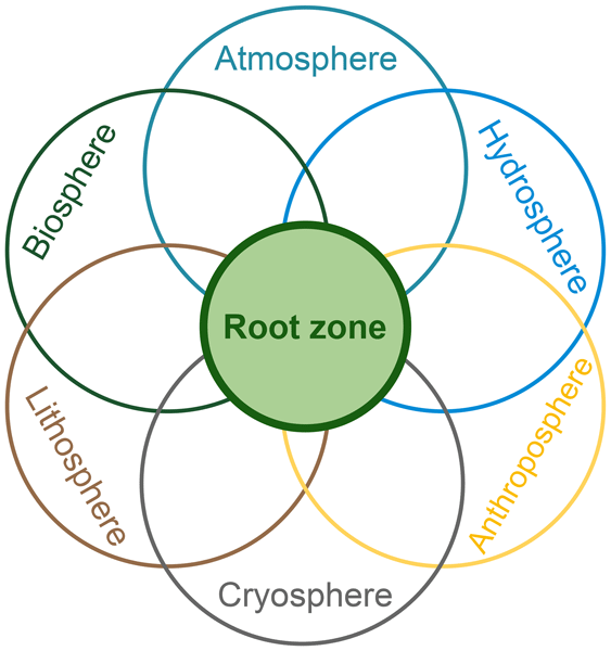
The concept of the root zone is widely used but lacks a precise definition. Its importance in Earth system science is not well elaborated upon. Here, we clarified its definition with several similar terms to bridge the multi-disciplinary gap. We underscore the key role of the root zone in the Earth system, which links the biosphere, hydrosphere, lithosphere, atmosphere, and anthroposphere. To better represent the root zone, we advocate for a paradigm shift towards ecosystem-centred modelling.
Shervan Gharari, Paul H. Whitfield, Alain Pietroniro, Jim Freer, Hongli Liu, and Martyn P. Clark
Hydrol. Earth Syst. Sci., 28, 4383–4405, https://doi.org/10.5194/hess-28-4383-2024, https://doi.org/10.5194/hess-28-4383-2024, 2024
Short summary
Short summary
This study provides insight into the practices that are incorporated into discharge estimation across the national Canadian hydrometric network operated by the Water Survey of Canada (WSC). The procedures used to estimate and correct discharge values are not always understood by end-users. Factors such as ice cover and sedimentation limit accurate discharge estimation. Highlighting these challenges sheds light on difficulties in discharge estimation and the associated uncertainty.
Siyuan Wang, Markus Hrachowitz, and Gerrit Schoups
Hydrol. Earth Syst. Sci., 28, 4011–4033, https://doi.org/10.5194/hess-28-4011-2024, https://doi.org/10.5194/hess-28-4011-2024, 2024
Short summary
Short summary
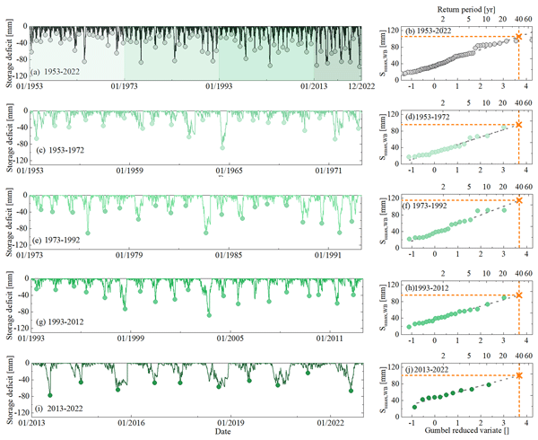
Root zone storage capacity (Sumax) changes significantly over multiple decades, reflecting vegetation adaptation to climatic variability. However, this temporal evolution of Sumax cannot explain long-term fluctuations in the partitioning of water fluxes as expressed by deviations ΔIE from the parametric Budyko curve over time with different climatic conditions, and it does not have any significant effects on shorter-term hydrological response characteristics of the upper Neckar catchment.
Henry M. Zimba, Miriam Coenders-Gerrits, Kawawa E. Banda, Petra Hulsman, Nick van de Giesen, Imasiku A. Nyambe, and Hubert H. G. Savenije
Hydrol. Earth Syst. Sci., 28, 3633–3663, https://doi.org/10.5194/hess-28-3633-2024, https://doi.org/10.5194/hess-28-3633-2024, 2024
Short summary
Short summary
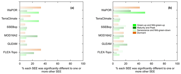
The fall and flushing of new leaves in the miombo woodlands co-occur in the dry season before the commencement of seasonal rainfall. The miombo species are also said to have access to soil moisture in deep soils, including groundwater in the dry season. Satellite-based evaporation estimates, temporal trends, and magnitudes differ the most in the dry season, most likely due to inadequate understanding and representation of the highlighted miombo species attributes in simulations.
Peter Reichert, Kai Ma, Marvin Höge, Fabrizio Fenicia, Marco Baity-Jesi, Dapeng Feng, and Chaopeng Shen
Hydrol. Earth Syst. Sci., 28, 2505–2529, https://doi.org/10.5194/hess-28-2505-2024, https://doi.org/10.5194/hess-28-2505-2024, 2024
Short summary
Short summary
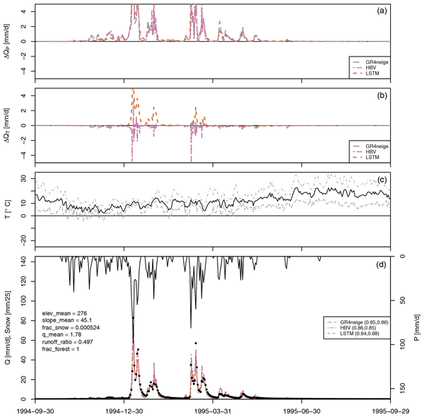
We compared the predicted change in catchment outlet discharge to precipitation and temperature change for conceptual and machine learning hydrological models. We found that machine learning models, despite providing excellent fit and prediction capabilities, can be unreliable regarding the prediction of the effect of temperature change for low-elevation catchments. This indicates the need for caution when applying them for the prediction of the effect of climate change.
Fransje van Oorschot, Ruud J. van der Ent, Andrea Alessandri, and Markus Hrachowitz
Hydrol. Earth Syst. Sci., 28, 2313–2328, https://doi.org/10.5194/hess-28-2313-2024, https://doi.org/10.5194/hess-28-2313-2024, 2024
Short summary
Short summary
Vegetation plays a crucial role in regulating the water cycle by transporting water from the subsurface to the atmosphere via roots; this transport depends on the extent of the root system. In this study, we quantified the effect of irrigation on roots at a global scale. Our results emphasize the importance of accounting for irrigation in estimating the vegetation root extent, which is essential to adequately represent the water cycle in hydrological and climate models.
Hubert H. G. Savenije
Proc. IAHS, 385, 1–4, https://doi.org/10.5194/piahs-385-1-2024, https://doi.org/10.5194/piahs-385-1-2024, 2024
Short summary
Short summary
Hydrology is the bloodstream of the Earth, acting as a living organism, with the ecosystem as its active agent. The ecosystem optimises its survival within the constraints of energy, water, climate and nutrients. It is capable of adjusting the hydrological system and, through evolution, adjust its efficiency of carbon sequestration and moisture uptake. In trying to understand future functioning of hydrology, we have to take into account the adaptability of the ecosystem.
Jiaxing Liang, Hongkai Gao, Fabrizio Fenicia, Qiaojuan Xi, Yahui Wang, and Hubert H. G. Savenije
EGUsphere, https://doi.org/10.5194/egusphere-2024-550, https://doi.org/10.5194/egusphere-2024-550, 2024
Preprint archived
Short summary
Short summary
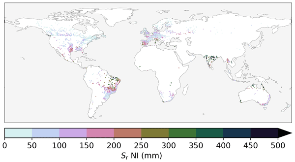
The root zone storage capacity (Sumax) is a key element in hydrology and land-atmospheric interaction. In this study, we utilized a hydrological model and a dynamic parameter identification method, to quantify the temporal trends of Sumax for 497 catchments in the USA. We found that 423 catchments (85 %) showed increasing Sumax, which averagely increased from 178 to 235 mm between 1980 and 2014. The increasing trend was also validated by multi-sources data and independent methods.
Luis Andres De la Fuente, Mohammad Reza Ehsani, Hoshin Vijai Gupta, and Laura Elizabeth Condon
Hydrol. Earth Syst. Sci., 28, 945–971, https://doi.org/10.5194/hess-28-945-2024, https://doi.org/10.5194/hess-28-945-2024, 2024
Short summary
Short summary
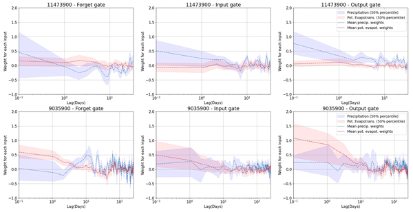
Long short-term memory (LSTM) is a widely used machine-learning model in hydrology, but it is difficult to extract knowledge from it. We propose HydroLSTM, which represents processes like a hydrological reservoir. Models based on HydroLSTM perform similarly to LSTM while requiring fewer cell states. The learned parameters are informative about the dominant hydrology of a catchment. Our results show how parsimony and hydrological knowledge extraction can be achieved by using the new structure.
Marvin Höge, Martina Kauzlaric, Rosi Siber, Ursula Schönenberger, Pascal Horton, Jan Schwanbeck, Marius Günter Floriancic, Daniel Viviroli, Sibylle Wilhelm, Anna E. Sikorska-Senoner, Nans Addor, Manuela Brunner, Sandra Pool, Massimiliano Zappa, and Fabrizio Fenicia
Earth Syst. Sci. Data, 15, 5755–5784, https://doi.org/10.5194/essd-15-5755-2023, https://doi.org/10.5194/essd-15-5755-2023, 2023
Short summary
Short summary
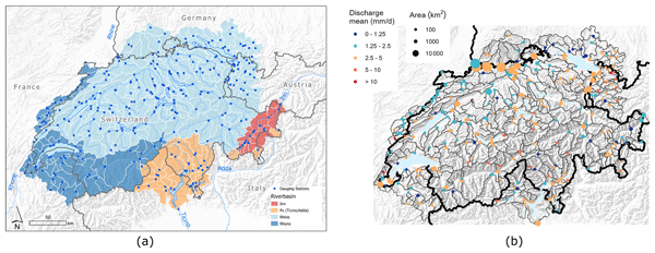
CAMELS-CH is an open large-sample hydro-meteorological data set that covers 331 catchments in hydrologic Switzerland from 1 January 1981 to 31 December 2020. It comprises (a) daily data of river discharge and water level as well as meteorologic variables like precipitation and temperature; (b) yearly glacier and land cover data; (c) static attributes of, e.g, topography or human impact; and (d) catchment delineations. CAMELS-CH enables water and climate research and modeling at catchment level.
Fransje van Oorschot, Ruud J. van der Ent, Markus Hrachowitz, Emanuele Di Carlo, Franco Catalano, Souhail Boussetta, Gianpaolo Balsamo, and Andrea Alessandri
Earth Syst. Dynam., 14, 1239–1259, https://doi.org/10.5194/esd-14-1239-2023, https://doi.org/10.5194/esd-14-1239-2023, 2023
Short summary
Short summary
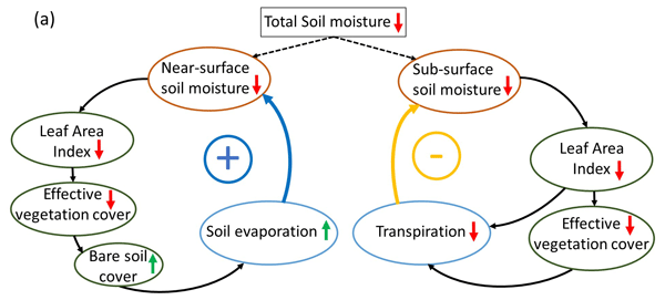
Vegetation largely controls land hydrology by transporting water from the subsurface to the atmosphere through roots and is highly variable in space and time. However, current land surface models have limitations in capturing this variability at a global scale, limiting accurate modeling of land hydrology. We found that satellite-based vegetation variability considerably improved modeled land hydrology and therefore has potential to improve climate predictions of, for example, droughts.
Siyuan Wang, Markus Hrachowitz, Gerrit Schoups, and Christine Stumpp
Hydrol. Earth Syst. Sci., 27, 3083–3114, https://doi.org/10.5194/hess-27-3083-2023, https://doi.org/10.5194/hess-27-3083-2023, 2023
Short summary
Short summary
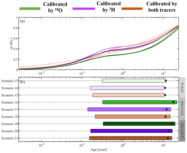
This study shows that previously reported underestimations of water ages are most likely not due to the use of seasonally variable tracers. Rather, these underestimations can be largely attributed to the choices of model approaches which rely on assumptions not frequently met in catchment hydrology. We therefore strongly advocate avoiding the use of this model type in combination with seasonally variable tracers and instead adopting StorAge Selection (SAS)-based or comparable model formulations.
Hubert T. Samboko, Sten Schurer, Hubert H. G. Savenije, Hodson Makurira, Kawawa Banda, and Hessel Winsemius
Geosci. Instrum. Method. Data Syst., 12, 155–169, https://doi.org/10.5194/gi-12-155-2023, https://doi.org/10.5194/gi-12-155-2023, 2023
Short summary
Short summary
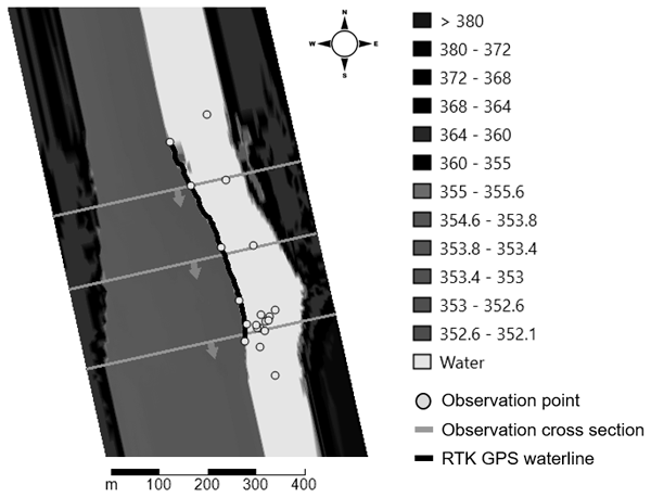
The study investigates how low-cost technology can be applied in data-scarce catchments to improve water resource management. More specifically, we investigate how drone technology can be combined with low-cost real-time kinematic positioning (RTK) global navigation satellite system (GNSS) equipment and subsequently applied to a 3D hydraulic model so as to generate more physically based rating curves.
Arianna Borriero, Rohini Kumar, Tam V. Nguyen, Jan H. Fleckenstein, and Stefanie R. Lutz
Hydrol. Earth Syst. Sci., 27, 2989–3004, https://doi.org/10.5194/hess-27-2989-2023, https://doi.org/10.5194/hess-27-2989-2023, 2023
Short summary
Short summary
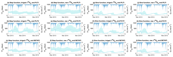
We analyzed the uncertainty of the water transit time distribution (TTD) arising from model input (interpolated tracer data) and structure (StorAge Selection, SAS, functions). We found that uncertainty was mainly associated with temporal interpolation, choice of SAS function, nonspatial interpolation, and low-flow conditions. It is important to characterize the specific uncertainty sources and their combined effects on TTD, as this has relevant implications for both water quantity and quality.
Hongkai Gao, Fabrizio Fenicia, and Hubert H. G. Savenije
Hydrol. Earth Syst. Sci., 27, 2607–2620, https://doi.org/10.5194/hess-27-2607-2023, https://doi.org/10.5194/hess-27-2607-2023, 2023
Short summary
Short summary
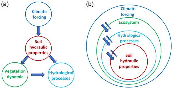
It is a deeply rooted perception that soil is key in hydrology. In this paper, we argue that it is the ecosystem, not the soil, that is in control of hydrology. Firstly, in nature, the dominant flow mechanism is preferential, which is not particularly related to soil properties. Secondly, the ecosystem, not the soil, determines the land–surface water balance and hydrological processes. Moving from a soil- to ecosystem-centred perspective allows more realistic and simpler hydrological models.
Nutchanart Sriwongsitanon, Wasana Jandang, James Williams, Thienchart Suwawong, Ekkarin Maekan, and Hubert H. G. Savenije
Hydrol. Earth Syst. Sci., 27, 2149–2171, https://doi.org/10.5194/hess-27-2149-2023, https://doi.org/10.5194/hess-27-2149-2023, 2023
Short summary
Short summary
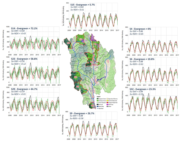
We developed predictive semi-distributed rainfall–runoff models for nested sub-catchments in the upper Ping basin, which yielded better or similar performance compared to calibrated lumped models. The normalised difference infrared index proves to be an effective proxy for distributed root zone moisture capacity over sub-catchments and is well correlated with the percentage of evergreen forest. In validation, soil moisture simulations appeared to be highly correlated with the soil wetness index.
Henry Zimba, Miriam Coenders-Gerrits, Kawawa Banda, Bart Schilperoort, Nick van de Giesen, Imasiku Nyambe, and Hubert H. G. Savenije
Hydrol. Earth Syst. Sci., 27, 1695–1722, https://doi.org/10.5194/hess-27-1695-2023, https://doi.org/10.5194/hess-27-1695-2023, 2023
Short summary
Short summary
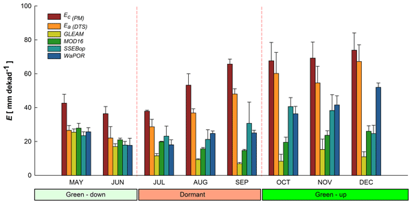
Miombo woodland plants continue to lose water even during the driest part of the year. This appears to be facilitated by the adapted features such as deep rooting (beyond 5 m) with access to deep soil moisture, potentially even ground water. It appears the trend and amount of water that the plants lose is correlated more to the available energy. This loss of water in the dry season by miombo woodland plants appears to be incorrectly captured by satellite-based evaporation estimates.
Luis Andres De la Fuente, Mohammad Reza Ehsani, Hoshin Vijai Gupta, and Laura E. Condon
EGUsphere, https://doi.org/10.5194/egusphere-2023-666, https://doi.org/10.5194/egusphere-2023-666, 2023
Preprint archived
Short summary
Short summary
Long Short-Term Memory (LSTM) is a widely-used machine learning (ML) model in hydrology. However, it is difficult to extract knowledge from it. We propose HydroLSTM which represents processes analogous to a hydrological reservoir. Models using HydroLSTM perform similarly to LSTM but require fewer cell states. The learned parameters are informative about the dominant hydroclimatic characteristics of a catchment. Our results demonstrate how hydrological knowledge is encoded in the new structure.
Carolin Winter, Tam V. Nguyen, Andreas Musolff, Stefanie R. Lutz, Michael Rode, Rohini Kumar, and Jan H. Fleckenstein
Hydrol. Earth Syst. Sci., 27, 303–318, https://doi.org/10.5194/hess-27-303-2023, https://doi.org/10.5194/hess-27-303-2023, 2023
Short summary
Short summary
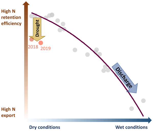
The increasing frequency of severe and prolonged droughts threatens our freshwater resources. While we understand drought impacts on water quantity, its effects on water quality remain largely unknown. Here, we studied the impact of the unprecedented 2018–2019 drought in Central Europe on nitrate export in a heterogeneous mesoscale catchment in Germany. We show that severe drought can reduce a catchment's capacity to retain nitrogen, intensifying the internal pollution and export of nitrate.

Pau Wiersma, Jerom Aerts, Harry Zekollari, Markus Hrachowitz, Niels Drost, Matthias Huss, Edwin H. Sutanudjaja, and Rolf Hut
Hydrol. Earth Syst. Sci., 26, 5971–5986, https://doi.org/10.5194/hess-26-5971-2022, https://doi.org/10.5194/hess-26-5971-2022, 2022
Short summary
Short summary
We test whether coupling a global glacier model (GloGEM) with a global hydrological model (PCR-GLOBWB 2) leads to a more realistic glacier representation and to improved basin runoff simulations across 25 large-scale basins. The coupling does lead to improved glacier representation, mainly by accounting for glacier flow and net glacier mass loss, and to improved basin runoff simulations, mostly in strongly glacier-influenced basins, which is where the coupling has the most impact.
Judith Uwihirwe, Alessia Riveros, Hellen Wanjala, Jaap Schellekens, Frederiek Sperna Weiland, Markus Hrachowitz, and Thom A. Bogaard
Nat. Hazards Earth Syst. Sci., 22, 3641–3661, https://doi.org/10.5194/nhess-22-3641-2022, https://doi.org/10.5194/nhess-22-3641-2022, 2022
Short summary
Short summary
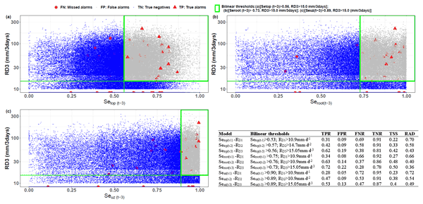
This study compared gauge-based and satellite-based precipitation products. Similarly, satellite- and hydrological model-derived soil moisture was compared to in situ soil moisture and used in landslide hazard assessment and warning. The results reveal the cumulative 3 d rainfall from the NASA-GPM to be the most effective landslide trigger. The modelled antecedent soil moisture in the root zone was the most informative hydrological variable for landslide hazard assessment and warning in Rwanda.
Friedrich Boeing, Oldrich Rakovec, Rohini Kumar, Luis Samaniego, Martin Schrön, Anke Hildebrandt, Corinna Rebmann, Stephan Thober, Sebastian Müller, Steffen Zacharias, Heye Bogena, Katrin Schneider, Ralf Kiese, Sabine Attinger, and Andreas Marx
Hydrol. Earth Syst. Sci., 26, 5137–5161, https://doi.org/10.5194/hess-26-5137-2022, https://doi.org/10.5194/hess-26-5137-2022, 2022
Short summary
Short summary
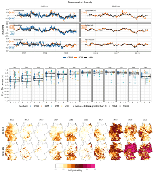
In this paper, we deliver an evaluation of the second generation operational German drought monitor (https://www.ufz.de/duerremonitor) with a state-of-the-art compilation of observed soil moisture data from 40 locations and four different measurement methods in Germany. We show that the expressed stakeholder needs for higher resolution drought information at the one-kilometer scale can be met and that the agreement of simulated and observed soil moisture dynamics can be moderately improved.
Marvin Höge, Andreas Scheidegger, Marco Baity-Jesi, Carlo Albert, and Fabrizio Fenicia
Hydrol. Earth Syst. Sci., 26, 5085–5102, https://doi.org/10.5194/hess-26-5085-2022, https://doi.org/10.5194/hess-26-5085-2022, 2022
Short summary
Short summary
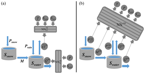
Neural ODEs fuse physics-based models with deep learning: neural networks substitute terms in differential equations that represent the mechanistic structure of the system. The approach combines the flexibility of machine learning with physical constraints for inter- and extrapolation. We demonstrate that neural ODE models achieve state-of-the-art predictive performance while keeping full interpretability of model states and processes in hydrologic modelling over multiple catchments.
Bahar Bahrami, Anke Hildebrandt, Stephan Thober, Corinna Rebmann, Rico Fischer, Luis Samaniego, Oldrich Rakovec, and Rohini Kumar
Geosci. Model Dev., 15, 6957–6984, https://doi.org/10.5194/gmd-15-6957-2022, https://doi.org/10.5194/gmd-15-6957-2022, 2022
Short summary
Short summary
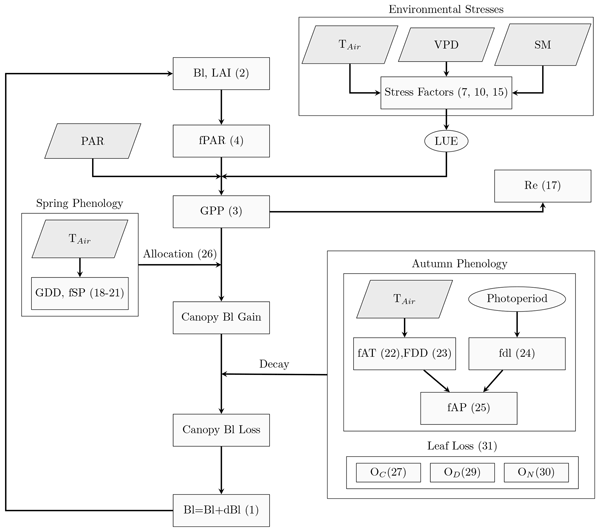
Leaf area index (LAI) and gross primary productivity (GPP) are crucial components to carbon cycle, and are closely linked to water cycle in many ways. We develop a Parsimonious Canopy Model (PCM) to simulate GPP and LAI at stand scale, and show its applicability over a diverse range of deciduous broad-leaved forest biomes. With its modular structure, the PCM is able to adapt with existing data requirements, and run in either a stand-alone mode or as an interface linked to hydrologic models.
Sadaf Nasreen, Markéta Součková, Mijael Rodrigo Vargas Godoy, Ujjwal Singh, Yannis Markonis, Rohini Kumar, Oldrich Rakovec, and Martin Hanel
Earth Syst. Sci. Data, 14, 4035–4056, https://doi.org/10.5194/essd-14-4035-2022, https://doi.org/10.5194/essd-14-4035-2022, 2022
Short summary
Short summary
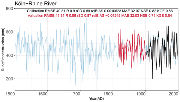
This article presents a 500-year reconstructed annual runoff dataset for several European catchments. Several data-driven and hydrological models were used to derive the runoff series using reconstructed precipitation and temperature and a set of proxy data. The simulated runoff was validated using independent observed runoff data and documentary evidence. The validation revealed a good fit between the observed and reconstructed series for 14 catchments, which are available for further analysis.
Pia Ebeling, Rohini Kumar, Stefanie R. Lutz, Tam Nguyen, Fanny Sarrazin, Michael Weber, Olaf Büttner, Sabine Attinger, and Andreas Musolff
Earth Syst. Sci. Data, 14, 3715–3741, https://doi.org/10.5194/essd-14-3715-2022, https://doi.org/10.5194/essd-14-3715-2022, 2022
Short summary
Short summary
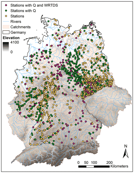
Environmental data are critical for understanding and managing ecosystems, including the mitigation of water quality degradation. To increase data availability, we present the first large-sample water quality data set (QUADICA) of riverine macronutrient concentrations combined with water quantity, meteorological, and nutrient forcing data as well as catchment attributes. QUADICA covers 1386 German catchments to facilitate large-sample data-driven and modeling water quality assessments.
Hongkai Gao, Chuntan Han, Rensheng Chen, Zijing Feng, Kang Wang, Fabrizio Fenicia, and Hubert Savenije
Hydrol. Earth Syst. Sci., 26, 4187–4208, https://doi.org/10.5194/hess-26-4187-2022, https://doi.org/10.5194/hess-26-4187-2022, 2022
Short summary
Short summary
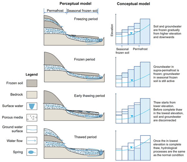
Frozen soil hydrology is one of the 23 unsolved problems in hydrology (UPH). In this study, we developed a novel conceptual frozen soil hydrological model, FLEX-Topo-FS. The model successfully reproduced the soil freeze–thaw process, and its impacts on hydrologic connectivity, runoff generation, and groundwater. We believe this study is a breakthrough for the 23 UPH, giving us new insights on frozen soil hydrology, with broad implications for predicting cold region hydrology in future.

Jonathan M. Frame, Frederik Kratzert, Daniel Klotz, Martin Gauch, Guy Shalev, Oren Gilon, Logan M. Qualls, Hoshin V. Gupta, and Grey S. Nearing
Hydrol. Earth Syst. Sci., 26, 3377–3392, https://doi.org/10.5194/hess-26-3377-2022, https://doi.org/10.5194/hess-26-3377-2022, 2022
Short summary
Short summary
The most accurate rainfall–runoff predictions are currently based on deep learning. There is a concern among hydrologists that deep learning models may not be reliable in extrapolation or for predicting extreme events. This study tests that hypothesis. The deep learning models remained relatively accurate in predicting extreme events compared with traditional models, even when extreme events were not included in the training set.
Inne Vanderkelen, Shervan Gharari, Naoki Mizukami, Martyn P. Clark, David M. Lawrence, Sean Swenson, Yadu Pokhrel, Naota Hanasaki, Ann van Griensven, and Wim Thiery
Geosci. Model Dev., 15, 4163–4192, https://doi.org/10.5194/gmd-15-4163-2022, https://doi.org/10.5194/gmd-15-4163-2022, 2022
Short summary
Short summary
Human-controlled reservoirs have a large influence on the global water cycle. However, dam operations are rarely represented in Earth system models. We implement and evaluate a widely used reservoir parametrization in a global river-routing model. Using observations of individual reservoirs, the reservoir scheme outperforms the natural lake scheme. However, both schemes show a similar performance due to biases in runoff timing and magnitude when using simulated runoff.
Judith Uwihirwe, Markus Hrachowitz, and Thom Bogaard
Nat. Hazards Earth Syst. Sci., 22, 1723–1742, https://doi.org/10.5194/nhess-22-1723-2022, https://doi.org/10.5194/nhess-22-1723-2022, 2022
Short summary
Short summary
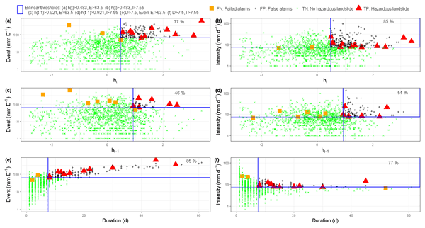
This research tested the value of regional groundwater level information to improve landslide predictions with empirical models based on the concept of threshold levels. In contrast to precipitation-based thresholds, the results indicated that relying on threshold models exclusively defined using hydrological variables such as groundwater levels can lead to improved landslide predictions due to their implicit consideration of long-term antecedent conditions until the day of landslide occurrence.
Henry Zimba, Miriam Coenders-Gerrits, Kawawa Banda, Petra Hulsman, Nick van de Giesen, Imasiku Nyambe, and Hubert Savenije
Hydrol. Earth Syst. Sci. Discuss., https://doi.org/10.5194/hess-2022-114, https://doi.org/10.5194/hess-2022-114, 2022
Manuscript not accepted for further review
Short summary
Short summary
We compare performance of evaporation models in the Luangwa Basin located in a semi-arid and complex Miombo ecosystem in Africa. Miombo plants changes colour, drop off leaves and acquire new leaves during the dry season. In addition, the plant roots go deep in the soil and appear to access groundwater. Results show that evaporation models with structure and process that do not capture this unique plant structure and behaviour appears to have difficulties to correctly estimating evaporation.
Elisa Ragno, Markus Hrachowitz, and Oswaldo Morales-Nápoles
Hydrol. Earth Syst. Sci., 26, 1695–1711, https://doi.org/10.5194/hess-26-1695-2022, https://doi.org/10.5194/hess-26-1695-2022, 2022
Short summary
Short summary
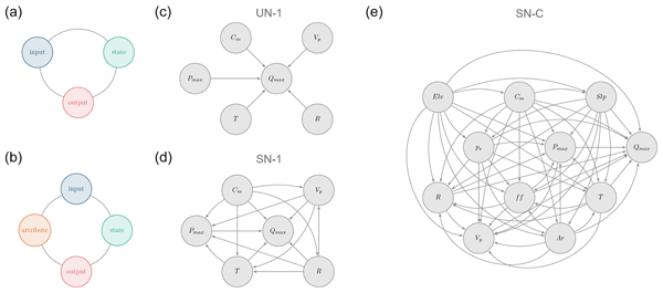
We explore the ability of non-parametric Bayesian networks to reproduce maximum daily discharge in a given month in a catchment when the remaining hydro-meteorological and catchment attributes are known. We show that a saturated network evaluated in an individual catchment can reproduce statistical characteristics of discharge in about ~ 40 % of the cases, while challenges remain when a saturated network considering all the catchments together is evaluated.
Laurène J. E. Bouaziz, Emma E. Aalbers, Albrecht H. Weerts, Mark Hegnauer, Hendrik Buiteveld, Rita Lammersen, Jasper Stam, Eric Sprokkereef, Hubert H. G. Savenije, and Markus Hrachowitz
Hydrol. Earth Syst. Sci., 26, 1295–1318, https://doi.org/10.5194/hess-26-1295-2022, https://doi.org/10.5194/hess-26-1295-2022, 2022
Short summary
Short summary
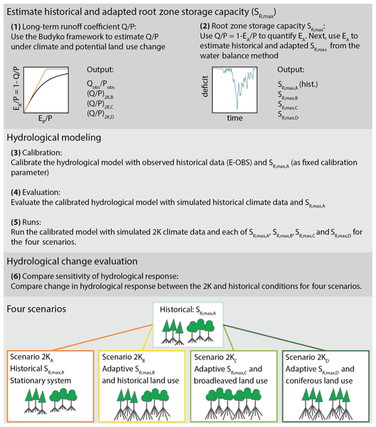
Assuming stationarity of hydrological systems is no longer appropriate when considering land use and climate change. We tested the sensitivity of hydrological predictions to changes in model parameters that reflect ecosystem adaptation to climate and potential land use change. We estimated a 34 % increase in the root zone storage parameter under +2 K global warming, resulting in up to 15 % less streamflow in autumn, due to 14 % higher summer evaporation, compared to a stationary system.
Robert Schweppe, Stephan Thober, Sebastian Müller, Matthias Kelbling, Rohini Kumar, Sabine Attinger, and Luis Samaniego
Geosci. Model Dev., 15, 859–882, https://doi.org/10.5194/gmd-15-859-2022, https://doi.org/10.5194/gmd-15-859-2022, 2022
Short summary
Short summary
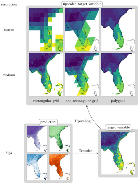
The recently released multiscale parameter regionalization (MPR) tool enables
environmental modelers to efficiently use extensive datasets for model setups.
It flexibly ingests the datasets using user-defined data–parameter relationships
and rescales parameter fields to given model resolutions. Modern
land surface models especially benefit from MPR through increased transparency and
flexibility in modeling decisions. Thus, MPR empowers more sound and robust
simulations of the Earth system.
Hubert T. Samboko, Sten Schurer, Hubert H. G. Savenije, Hodson Makurira, Kawawa Banda, and Hessel Winsemius
Geosci. Instrum. Method. Data Syst., 11, 1–23, https://doi.org/10.5194/gi-11-1-2022, https://doi.org/10.5194/gi-11-1-2022, 2022
Short summary
Short summary
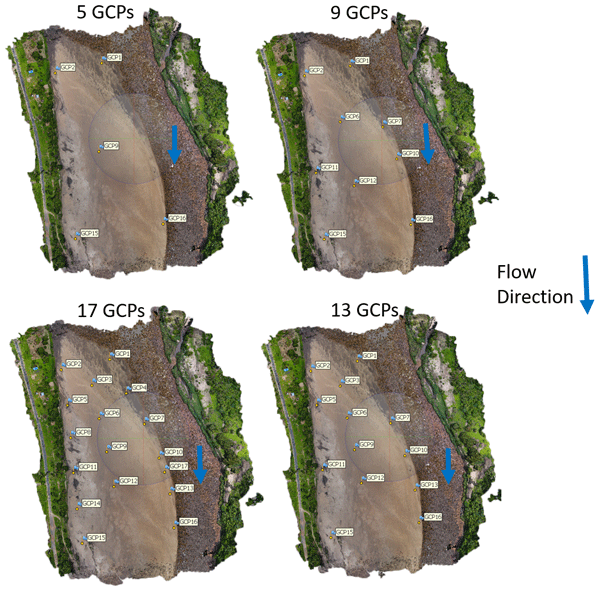
The study was conducted along the Luangwa River in Zambia. It combines low-cost instruments such as UAVs and GPS kits to collect data for the purposes of water management. A novel technique which seamlessly merges the dry and wet bathymetry before application in a hydraulic model was applied. Successful implementation resulted in water authorities with small budgets being able to monitor flows safely and efficiently without significant compromise on accuracy.
Joni Dehaspe, Fanny Sarrazin, Rohini Kumar, Jan H. Fleckenstein, and Andreas Musolff
Hydrol. Earth Syst. Sci., 25, 6437–6463, https://doi.org/10.5194/hess-25-6437-2021, https://doi.org/10.5194/hess-25-6437-2021, 2021
Short summary
Short summary
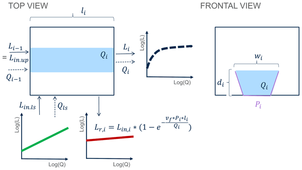
Increased nitrate concentrations in surface waters can compromise river ecosystem health. As riverine nitrate uptake is hard to measure, we explore how low-frequency nitrate concentration and discharge observations (that are widely available) can help to identify (in)efficient uptake in river networks. We find that channel geometry and water velocity rather than the biological uptake capacity dominate the nitrate-discharge pattern at the outlet. The former can be used to predict uptake.

Marco Dal Molin, Dmitri Kavetski, and Fabrizio Fenicia
Geosci. Model Dev., 14, 7047–7072, https://doi.org/10.5194/gmd-14-7047-2021, https://doi.org/10.5194/gmd-14-7047-2021, 2021
Short summary
Short summary
This paper introduces SuperflexPy, an open-source Python framework for building flexible conceptual hydrological models. SuperflexPy is available as open-source code and can be used by the hydrological community to investigate improved process representations, for model comparison, and for operational work.
Cited articles
Anderson, R. M., Koren, V. I., and Reed, S. M.: Using SSURGO data to improve Sacramento Model a priori parameter estimates, J. Hydrol., 320, 103–116, https://doi.org/10.1016/j.jhydrol.2005.07.020, 2006.
Bastidas, L. A., Gupta, H. V., Sorooshian, S., Shuttleworth, W. J., and Yang, Z. L.: Sensitivity analysis of a land surface scheme using multicriteria methods, J. Geophys. Res.-Atmos., 104, 19481–19490, https://doi.org/10.1029/1999JD900155, 1999.
Beven, K.: Rainfall-Runoff Modelling, The Primer, John Wiley and Sons, 2001.
Birkel, C., D., T., Dunn, S., and Soulsby, C.: Using time domain and geographic source tracers to conceptualize streamflow generation processes in lumped rainfall-runoff models, Water Resour. Res., 47, W02515, https://doi.org/10.1029/2010WR009547, 2011.
Boyle, D. P., Gupta, H. V., and Sorooshian, S.: Toward improved calibration of hydrologic models: Combining the strengths of manual and automatic methods, Water Resour. Res., 36, 3663–3674, https://doi.org/10.1029/2000WR900207, 2000.
Boyle, D. P., Gupta, H. V., Sorooshian, S., Koren, V., Zhang, Z., and Smith, M.: Toward improved streamflow forecasts: value of semidistributed modeling, Water Resour. Res., 37, 2749–2759, https://doi.org/10.1029/2000WR000207, 2001.
Bulygina, N. and Gupta, H.: Estimating the uncertain mathematical structure of a water balance model via Bayesian data assimilation, Water Resour. Res., 45, W00B13, https://doi.org/10.1029/2007WR006749, 2009.
Bulygina, N. and Gupta, H.: How Bayesian data assimilation can be used to estimate the mathematical structure of a model, Stoch. Environ. Res. Risk A., 24, 925–937, https://doi.org/10.1007/s00477-010-0387-y, 2010.
Bulygina, N. and Gupta, H.: Correcting the mathematical structure of a hydrological model via Bayesian data assimilation, Water Resour. Res., 47, W05514, https://doi.org/10.1029/2010WR009614, 2011.
Efstratiadis, A. and Koutsoyiannis, D.: One decade of multi-objective calibration approaches in hydrological modelling: a review, Hydrolog. Sci. J., 55, 58–78, https://doi.org/10.1080/02626660903526292, 2010.
Fenicia, F., Savenije, H. H. G., Matgen, P., and Pfister, L.: Understanding catchment behavior through stepwise model concept improvement, Water Resour. Res., 44, W01402, https://doi.org/10.1029/2006WR005563, 2008.
Freer, J., McDonnell, J. J., Beven, K. J., Peters, N. E., Burns, D. A., Hooper, R. P., Aulenbach, B., and Kendall, C.: The role of bedrock topography on subsurface storm flow, Water Resour. Res., 38, 1269, https://doi.org/10.1029/2001WR000872, 2002.
Gao, H., Hrachowitz, M., Fenicia, F., Gharari, S., and Savenije, H. H. G.: Testing the realism of a topography-driven model (FLEX-Topo) in the nested catchments of the Upper Heihe, China, Hydrol. Earth Syst. Sci., 18, 1895–1915, https://doi.org/10.5194/hess-18-1895-2014, 2014.
Gharari, S., Hrachowitz, M., Fenicia, F., and Savenije, H. H. G.: Hydrological landscape classification: investigating the performance of HAND based landscape classifications in a central European meso-scale catchment, Hydrol. Earth Syst. Sci., 15, 3275–3291, https://doi.org/10.5194/hess-15-3275-2011, 2011.
Gharari, S., Hrachowitz, M., Fenicia, F., Gao, H., and Savenije, H. H. G.: Using expert knowledge to increase realism in environmental system models can dramatically reduce the need for calibration, Hydrol. Earth Syst. Sci., 18, 4839–4859, https://doi.org/10.5194/hess-18-4839-2014, 2014.
Götzinger, J. and Bárdossy, A.: Comparison of four regionalisation methods for a distributed hydrological model, J. Hydrol., 333, 374–384, https://doi.org/10.1016/j.jhydrol.2006.09.008, 2007.
Gupta, H. V., Sorooshian, S., and Yapo, P. O.: Toward improved calibration of hydrologic models: Multiple and noncommensurable measures of information, Water Resour. Res., 34, 751–763, https://doi.org/10.1029/97WR03495, 1998.
Gupta, H. V., Bastidas, L. A., Sorooshian, S., Shuttleworth, W. J., and Yang, Z. L.: Parameter estimation of a land surface scheme using multicriteria methods, J. Geophys. Res.-Atmos., 104, 19491–19503, https://doi.org/10.1029/1999JD900154, 1999.
Hrachowitz, M., Savenije, H., Bogaard, T. A., Tetzlaff, D., and Soulsby, C.: What can flux tracking teach us about water age distribution patterns and their temporal dynamics?, Hydrol. Earth Syst. Sci., 17, 533–564, https://doi.org/10.5194/hess-17-533-2013, 2013.
Hrachowitz, M., Fovet, O., Ruiz, L., Euser, T., Gharari, S., Nijzink, R., Freer, J., Savenije, H. H. G., and Gascuel-Odoux, C.: Process consistency in models: The importance of system signatures, expert knowledge, and process complexity, Water Resour. Res., 50, 7445–7469, https://doi.org/10.1002/2014WR015484, 2014.
Hughes, D. A., Andersson, L., Wilk, J., and Savenije, H. H.: Regional calibration of the Pitman model for the Okavango River, J. Hydrol., 331, 30–42, https://doi.org/10.1016/j.jhydrol.2006.04.047, 2006.
Kapangaziwiri, E., Hughes, D., and Wagener, T.: Incorporating uncertainty in hydrological predictions for gauged and ungauged basins in southern Africa, Hydrolog. Sci. J., 57, 1000–1019, https://doi.org/10.1080/02626667.2012.690881, 2012.
Khu, S. T. and Madsen, H.: Multiobjective calibration with Pareto preference ordering: An application to rainfall-runoff model calibration, Water Resour. Res., 41, W03004, https://doi.org/10.1029/2004WR003041, 2005.
Kling, H. and Gupta, H.: On the development of regionalization relationships for lumped watershed models: The impact of ignoring sub-basin scale variability, J. Hydrol., 373, 337–351, https://doi.org/10.1016/j.jhydrol.2009.04.031, 2009.
Koren, V., Smith, M., Wang, D., and Zhang, Z.: Use of soil property data in the derivation of conceptual rainfall-runoff model parameters, in: 15th Conference on Hydrology, Long Beach, California, American Meteorological Society, 2000.
Koren, V., Smith, M., and Duan, Q.: Use of a priori parameter estimates in the derivation of spatially consistent parameter sets of rainfall-runoff models, Water Science and Application, 6, 239–254, 2003.
Kumar, R., Samaniego, L., and Attinger, S.: The effects of spatial discretization and model parameterization on the prediction of extreme runoff characteristics, J. Hydrol., 392, 54–69, https://doi.org/10.1016/j.jhydrol.2010.07.047, 2010.
Kumar, R., Samaniego, L., and Attinger, S.: Implications of distributed hydrologic model parameterization on water fluxes at multiple scales and locations, Water Resour. Res., 491, 360–379, https://doi.org/10.1029/2012WR012195, 2013.
Martinez, G. F. and Gupta, H. V.: Hydrologic consistency as a basis for assessing complexity of monthly water balance models for the continental United States, Water Resour. Res., 47, W12540, https://doi.org/10.1029/2011WR011229, 2011.
Merz, R. and Blöschl, G.: Regionalisation of catchment model parameters, J. Hydrol., 287, 95–123, 2004.
Nash, J. E. and Sutcliffe, J. V.: River flow forecasting through conceptual models part I – A discussion of principles, J. Hydrol., 10, 282–290, https://doi.org/10.1016/0022-1694(70)90255-6, 1970.
Perrin, C., Andréassian, V., Serna, C. R., Mathevet, T., and Moine, N. L.: Discrete parameterization of hydrological models: Evaluating the use of parameter sets libraries over 900 catchments, Water Resour. Res., 44, W08447, https://doi.org/10.1029/2007WR006579, 2008.
Pokhrel, P., Gupta, H. V., and Wagener, T.: A spatial regularization approach to parameter estimation for a distributed watershed model, Water Resour. Res., 44, W12419, https://doi.org/10.1029/2007WR006615, 2008.
Pokhrel, P., Yilmaz, K. K., and Gupta, H. V.: Multiple-criteria calibration of a distributed watershed model using spatial regularization and response signatures, J. Hydrol., 418–419, 49–60, https://doi.org/10.1016/j.jhydrol.2008.12.004, 2012.
Samaniego, L., Bárdossy, A., and Kumar, R.: Streamflow prediction in ungauged catchments using copula-based dissimilarity measures, Water Resour. Rese., 46, W02506, https://doi.org/10.1029/2008WR007695, 2010.
Seibert, J. and McDonnell, J. J.: On the dialog between experimentalist and modeler in catchment hydrology: Use of soft data for multicriteria model calibration, Water Resour. Res., 38, 1241, https://doi.org/10.1029/2001WR000978, 2002.
Seibert, J. and McDonnell, J. J.: Gauging the Ungauged Basin: Relative Value of Soft and Hard Data, J. Hydrol. Eng., 0, A4014004, https://doi.org/10.1061/(ASCE)HE.1943-5584.0000861, 2013.
Wheater, H. S., Jakeman, A. J., and Beven, K. J.: Progress and directions in rainfall-runoff modeling, John Wiley & Sons, Chichester, 1993.
Winsemius, H. C., Savenije, H. H. G., and Bastiaanssen, W. G. M.: Constraining model parameters on remotely sensed evaporation: justification for distribution in ungauged basins?, Hydrol. Earth Syst. Sci., 12, 1403–1413, https://doi.org/10.5194/hess-12-1403-2008, 2008.
Yadav, M., Wagener, T., and Gupta, H.: Regionalization of constraints on expected watershed response behavior for improved predictions in ungauged basins, Adv. Water Resour., 30, 1756–1774, https://doi.org/10.1016/j.advwatres.2007.01.005, 2007.
Zhang, Z., Wagener, T., Reed, P., and Bhushan, R.: Reducing uncertainty in predictions in ungauged basins by combining hydrologic indices regionalization and multiobjective optimization, Water Resour. Res., 44, W00B04, https://doi.org/10.1029/2008WR006833, 2008.


