Articles | Volume 25, issue 11
https://doi.org/10.5194/hess-25-6001-2021
© Author(s) 2021. This work is distributed under
the Creative Commons Attribution 4.0 License.
https://doi.org/10.5194/hess-25-6001-2021
© Author(s) 2021. This work is distributed under
the Creative Commons Attribution 4.0 License.
Gravity as a tool to improve the hydrologic mass budget in karstic areas
Tommaso Pivetta
CORRESPONDING AUTHOR
Department of Mathematics and Geosciences, University of Trieste,
Trieste, 34128, Italy
Carla Braitenberg
Department of Mathematics and Geosciences, University of Trieste,
Trieste, 34128, Italy
Franci Gabrovšek
Karst Research Institute, ZRC SAZU, Postojna, 6230, Slovenia
Gerald Gabriel
Leibniz Institute for Applied Geophysics, Hannover, 30655, Germany
Institute of Geology, Leibniz University Hannover, Hannover, 30167,
Germany
Bruno Meurers
Department of Meteorology and Geophysics, University of Vienna, Vienna, 1090, Austria
Related authors
No articles found.
Julia Pfeffer, Benoît Meyssignac, Rory Bingham, Alejandro Blazquez, Marie Bouih, Carla Braitenberg, Luca Brocca, Henryk Dobslaw, Ramiro Ferrari, Ehsan Forootan, Helena Gerdener, Muhammad Tahir Javed, Laura Jensen, Volker Klemann, Anna Kremer, Jürgen Kusche, Gilles Larnicol, Muhammad Usman Liaqat, Francesco Leopardi, Elisavet-Maria Mamagiannou, Gerardo Maurizio, Roland Pail, Isabelle Panet, Thomas Papanikolaou, Peyman Saemian, Ingo Sasgen, Maike Schumacher, Marius Schlaak, Linus Shihora, Alireza Sobouti, Nico Sneeuw, Mohammad Javad Tourian, Dimitrios Tsoulis, Georgios Vergos, Bert Wouters, Fan Yang, and Ilias Daras
EGUsphere, https://doi.org/10.5194/egusphere-2026-4642, https://doi.org/10.5194/egusphere-2026-4642, 2026
This preprint is open for discussion and under review for Earth Observation (EO).
Short summary
Short summary
The ESA SING project demonstrates how the future satellite gravity missions NGGM and MAGIC will improve observations of continental water storage, oceans, glaciers, sea level, earthquakes, and climate change. Their more accurate, higher-resolution gravity measurements will enhance Earth system monitoring, improve climate and hazard assessments, and strengthen operational services for water management, disaster preparedness, and environmental decision-making.
Thomas Burschil, Daniel Köhn, Matthias Körbe, Gerald Gabriel, Johannes Großmann, Gustav Firla, and Markus Fiebig
Solid Earth, 16, 1493–1507, https://doi.org/10.5194/se-16-1493-2025, https://doi.org/10.5194/se-16-1493-2025, 2025
Short summary
Short summary
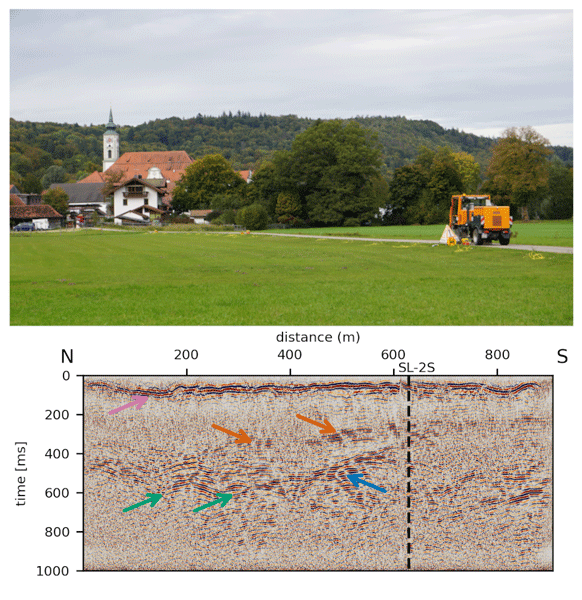
The study investigates a glacially overdeepened basin near the town of Schäftlarn, Germany, to provide the datasets for the methodological developmonet of combining high-resolution seismic reflection (HRSR) and full-waveform inversion (FWI). Seismic data with different source and receiver configurations reveal detailed basin structures, including previously unknown internal reflectors. HRSR with S-waves show more details than P-waves. First FWI delivers consistent velocity models.
Youjun Jiao, Qingchun Yu, Xusheng Wang, and Franci Gabrovšek
Hydrol. Earth Syst. Sci., 29, 6685–6702, https://doi.org/10.5194/hess-29-6685-2025, https://doi.org/10.5194/hess-29-6685-2025, 2025
Short summary
Short summary
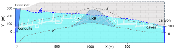
Dams and reservoirs in karst areas often struggle with significant leakage, making construction both challenging and costly. This study uses a numerical model to show how karst aquifers in water divide regions evolve to form low-karstified rock-blocks (LKB). It also explores how and when these LKBs can significantly reduce leakage across the water divides if a reservoir is built on one side.
Sarah Beraus, Thomas Burschil, Hermann Buness, Daniel Köhn, Thomas Bohlen, and Gerald Gabriel
Sci. Dril., 33, 237–248, https://doi.org/10.5194/sd-33-237-2024, https://doi.org/10.5194/sd-33-237-2024, 2024
Short summary
Short summary
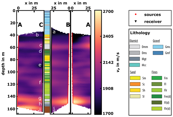
We conducted seismic crosshole experiments with a sparker source in order to obtain a high-resolution subsurface velocity model in the glacially overdeepened Tannwald Basin (ICDP site 5068_1). The data show complex wave fields that contain a lot of information but also present challenges. Nevertheless, isotropic first-arrival travel-time tomography provides the first high-resolution subsurface models that correlate well with the sonic logs and the core recovered from one of the three boreholes.
Sonja H. Wadas, Hermann Buness, Raphael Rochlitz, Peter Skiba, Thomas Günther, Michael Grinat, David C. Tanner, Ulrich Polom, Gerald Gabriel, and Charlotte M. Krawczyk
Solid Earth, 13, 1673–1696, https://doi.org/10.5194/se-13-1673-2022, https://doi.org/10.5194/se-13-1673-2022, 2022
Short summary
Short summary
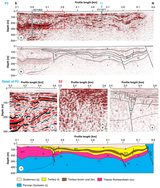
The dissolution of rocks poses a severe hazard because it can cause subsidence and sinkhole formation. Based on results from our study area in Thuringia, Germany, using P- and SH-wave reflection seismics, electrical resistivity and electromagnetic methods, and gravimetry, we develop a geophysical investigation workflow. This workflow enables identifying the initial triggers of subsurface dissolution and its control factors, such as structural constraints, fluid pathways, and mass movement.
Flavio S. Anselmetti, Milos Bavec, Christian Crouzet, Markus Fiebig, Gerald Gabriel, Frank Preusser, Cesare Ravazzi, and DOVE scientific team
Sci. Dril., 31, 51–70, https://doi.org/10.5194/sd-31-51-2022, https://doi.org/10.5194/sd-31-51-2022, 2022
Short summary
Short summary
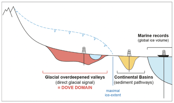
Previous glaciations eroded below the ice deep valleys in the Alpine foreland, which, with their sedimentary fillings, witness the timing and extent of these glacial advance–retreat cycles. Drilling such sedimentary sequences will thus provide well-needed evidence in order to reconstruct the (a)synchronicity of past ice advances in a trans-Alpine perspective. Eventually these data will document how the Alpine foreland was shaped and how the paleoclimate patterns varied along and across the Alps.
Andreas Eberts, Hamed Fazlikhani, Wolfgang Bauer, Harald Stollhofen, Helga de Wall, and Gerald Gabriel
Solid Earth, 12, 2277–2301, https://doi.org/10.5194/se-12-2277-2021, https://doi.org/10.5194/se-12-2277-2021, 2021
Short summary
Short summary
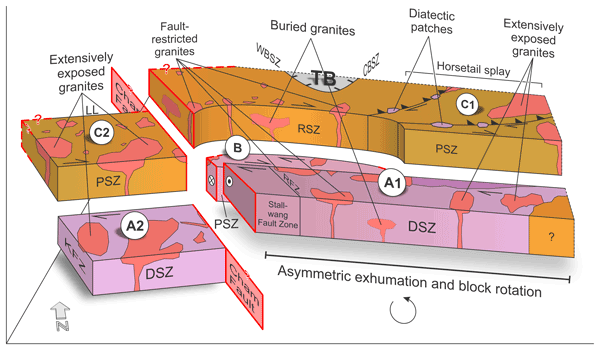
We combine gravity anomaly and topographic data with observations from thermochronology, metamorphic grades, and the granite inventory to detect patterns of basement block segmentation and differential exhumation along the southwestern Bohemian Massif. Based on our analyses, we introduce a previously unknown tectonic structure termed Cham Fault, which, together with the Pfahl and Danube shear zones, is responsible for the exposure of different crustal levels during late to post-Variscan times.
Florence Colleoni, Laura De Santis, Enrico Pochini, Edy Forlin, Riccardo Geletti, Giuseppe Brancatelli, Magdala Tesauro, Martina Busetti, and Carla Braitenberg
Geosci. Model Dev., 14, 5285–5305, https://doi.org/10.5194/gmd-14-5285-2021, https://doi.org/10.5194/gmd-14-5285-2021, 2021
Short summary
Short summary
PALEOSTRIP has been developed in the framework of past Antarctic ice sheet reconstructions for periods when bathymetry around Antarctica differed substantially from today. It has been designed for users with no knowledge of numerical modelling and allows users to switch on and off the processes involved in backtracking and backstripping. Applications are broad, and it can be used to restore any continental margin bathymetry or sediment thickness and to perform basin analysis.
Cited articles
Blatnik, M., Culver, D. C., Gabrovšek, F., Knez, M., Kogovšek, B.,
Kogovšek, J., Liu, H., Mayaud, C., Mihevc, A., Mulec, J.,
Năpăruş-Aljančič, M., Otoničar, B., Petrič, M.,
Pipan, T., Prelovšek, M., Ravbar, N., Shaw, T., Slabe, T., Šebela,
S., and Zupan Hajna, N.: Deciphering Epiphreatic Conduit Geometry from Head
and Flow Data, in: Karstology in the Classical Karst, edited by: Knez, M.,
Otoničar, B., Petrič, M., Pipan, T., and Slabe, T., Springer
International Publishing, Cham, 149–168,
https://doi.org/10.1007/978-3-030-26827-5_8, 2020.
Braitenberg, C., Sampietro, D., Pivetta, T., Zuliani, D., Barbagallo, A.,
Fabris, P., Rossi, L., Fabbri, J., and Mansi, A. H.: Gravity for Detecting
Caves: Airborne and Terrestrial Simulations Based on a Comprehensive Karstic
Cave Benchmark, Pure Appl. Geophys., 173, 1243–1264,
https://doi.org/10.1007/s00024-015-1182-y, 2016.
Braitenberg, C., Pivetta, T., Barbolla, D. F., Gabrovšek, F., Devoti,
R., and Nagy, I.: Terrain uplift due to natural hydrologic overpressure in
karstic conduits, Sci. Rep., 9, 3934, https://doi.org/10.1038/s41598-019-38814-1,
2019.
Chalikakis, K., Plagnes, V., Guerin, R., Valois, R., and Bosch, F. P.:
Contribution of geophysical methods to karst-system exploration: An
overview, Hydrogeol. J., 19, 1169–1180,
https://doi.org/10.1007/s10040-011-0746-x, 2011.
Dehant, V., Defraigne, P., and Wahr, J. M.: Tides for a convective Earth, J.
Geophys. Res.-Sol Ea., 104, 1035–1058,
https://doi.org/10.1029/1998JB900051, 1999.
Deville, S., Jacob, T., Chéry, J., and Champollion, C.: On the impact of topography and building mask on time varying gravity due to local hydrology, Geophys. J. Int., 192, 82–93, https://doi.org/10.1093/gji/ggs007, 2013.
Farr, T. G., Rosen, P. A., Caro, E., Crippen, R., Duren, R., Hensley, S.,
Kobrick, M., Paller, M., Rodriguez, E., Roth, L., Seal, D., Shaffer, S.,
Shimada, J., Umland, J., Werner, M., Oskin, M., Burbank, D., and Alsdorf,
D.: The Shuttle Radar Topography Mission, Rev. Geophys., 45, RG2004,
https://doi.org/10.1029/2005RG000183, 2007.
Ford, D. and Williams, P.: Karst Hydrogeology and Geomorphology, John Wiley
and Sons, Chichester, England, 562 pp., 2007.
Fores, B., Champollion, C., Le Moigne, N., Bayer, R., and Chéry, J.:
Assessing the precision of the iGrav superconducting gravimeter for
hydrological models and karstic hydrological process identification,
Geophys. J. Int., 208, 269–280, https://doi.org/10.1093/gji/ggw396, 2017.
Fores, B., Champollion, C., Mainsant, G., Albaric, J., and Fort, A.:
Monitoring Saturation Changes with Ambient Seismic Noise and Gravimetry in a
Karst Environment, Vadose Zone J., 17, 170163,
https://doi.org/10.2136/vzj2017.09.0163, 2018.
Gabrovšek, F., Häuselmann, P., and Audra, P.: “Looping caves”
versus “water table caves”: The role of base-level changes and recharge
variations in cave development, Geomorphology, 204, 683–691,
https://doi.org/10.1016/j.geomorph.2013.09.016, 2014.
Gabrovšek, F., Peric, B., and Kaufmann, G.: Hydraulics of epiphreatic
flow of a karst aquifer, J. Hydrol., 560, 56–74,
https://doi.org/10.1016/j.jhydrol.2018.03.019, 2018.
Goldscheider, N. and Drew D.: Methods in Karst Hydrogeology. International Contributions to Hydrogeology 26, International Association of Hydrogeologists, Taylor & Francis, London, 280 pp., 2007.
Güntner, A., Reich, M., Mikolaj, M., Creutzfeldt, B., Schroeder, S., and Wziontek, H.: Landscape-scale water balance monitoring with an iGrav superconducting gravimeter in a field enclosure, Hydrol. Earth Syst. Sci., 21, 3167–3182, https://doi.org/10.5194/hess-21-3167-2017, 2017.
Hinderer, J., Crossley, D., and Warburton, R. J.: Gravimetric
Methods – Superconducting Gravity Meters, Treatsie Geophys. Geod., 3, 65–122, 2007.
Jacob, T., Bayer, R., Chery, J., Jourde, H., Moigne, N. L., Boy, J.-P., Hinderer, J., Luck, B., and Brunet, P.: Absolute gravity monitoring of water storage variation in a karst aquifer on the larzac plateau (Southern France), J. Hydrol., 359, 105–117, https://doi.org/10.1016/j.jhydrol.2008.06.020, 2008.
Jacob, T., Bayer, R., Chery, J., and Moigne, N. L.: Time-lapse microgravity
surveys reveal water storage heterogeneity of a karst aquifer, J. Geophys.
Res.-Sol. Ea., 115, B06402, https://doi.org/10.1029/2009JB006616, 2011.
Jurkovšek, B., Biolchi, S., Furlani, S., Kolar-Jurkovšek, T., Zini,
L., Jež, J., Tunis, G., Bavec, M., and Cucchi, F.: Geology of the
Classical Karst Region (SW Slovenia–NE Italy), J. Maps, 12, 352–362,
https://doi.org/10.1080/17445647.2016.1215941, 2016.
Karbon, M., Böhm, J., Meurers, B., and Schuh, H.: Atmospheric Corrections for Superconducting Gravimeters Using Operational Weather Models, in: Earth on the Edge: Science for a Sustainable Planet, vol. 139, edited by: Rizos, C. and Willis, P., Springer Berlin Heidelberg, Berlin, Heidelberg, 421–427, https://doi.org/10.1007/978-3-642-37222-3_56, 2014.
Kaufmann, G., Gabrovšek, F., and Turk, J.: Modelling flow of
subterranean Pivka river in Postojnska jama, Slovenia, Acta Carsologica, 45, 57–70,
https://doi.org/10.3986/ac.v45i1.3059, 2016.
Klügel, T. and Wziontek, H.: Correcting gravimeters and tiltmeters for
atmospheric mass attraction using operational weather models, J. Geodyn.,
48, 204–210, https://doi.org/10.1016/j.jog.2009.09.010, 2009.
Kobe, M., Gabriel, G., Weise, A., and Vogel, D.: Time-lapse gravity and levelling surveys reveal mass loss and ongoing subsidence in the urban subrosion-prone area of Bad Frankenhausen, Germany, Solid Earth, 10, 599–619, https://doi.org/10.5194/se-10-599-2019, 2019.
Mayaud, C., Gabrovšek, F., Blatnik, M., Kogovšek, B., Petrič,
M., and Ravbar, N.: Understanding flooding in poljes: A modelling
perspective, J. Hydrol., 575, 874–889,
https://doi.org/10.1016/j.jhydrol.2019.04.092, 2019.
Meurers, B., Van Camp, M., and Petermans, T.: Correcting superconducting
gravity time-series using rainfall modelling at the Vienna and Membach
stations and application to Earth tide analysis, J. Geod., 81, 703–712,
https://doi.org/10.1007/s00190-007-0137-1, 2007.
Meurers, B., Van Camp, M., Francis, O., and Pálinkáš, V.:
Temporal variation of tidal parameters in superconducting gravimeter
time-series, Geophys. J. Int., 205, 284–300,
https://doi.org/10.1093/gji/ggw017, 2016.
Meurers, B., Papp, G., Ruotsalainen, H., Benedek, J., and Leonhardt, R.: Hydrological signals in tilt and gravity residuals at Conrad Observatory (Austria), Hydrol. Earth Syst. Sci., 25, 217–236, https://doi.org/10.5194/hess-25-217-2021, 2021.
Mikolaj, M., Meurers, B., and Güntner, A.: Modelling of global mass
effects in hydrology, atmosphere and oceans on surface gravity, Comput.
Geosci., 93, 12–20, https://doi.org/10.1016/j.cageo.2016.04.014, 2016.
Moulin, A., Benedetti, L., Rizza, M., Jamšek Rupnik, P., Gosar, A.,
Bourlès, D., Keddadouche, K., Aumaître, G., Arnold, M., Guillou,
V., and Ritz, J.-F.: The Dinaric fault system: Large-scale structure, rates
of slip, and Plio-Pleistocene evolution of the transpressive northeastern
boundary of the Adria microplate: the dinaric faults system (NE Adria),
Tectonics, 35, 2258–2292, https://doi.org/10.1002/2016TC004188, 2016.
Mouyen, M., Longuevergne, L., Chalikakis, K., Mazzilli, N., Ollivier, C.,
Rosat, S., Hinderer, J., and Champollion, C.: Monitoring of groundwater
redistribution in a karst aquifer using a superconducting gravimeter, E3S
Web Conf., Geosciences, 88, 03001, https://doi.org/10.1051/e3sconf/20198803001, 2019.
Mouyen, M., Steer, P., Chang, K.-J., Le Moigne, N., Hwang, C., Hsieh, W.-C., Jeandet, L., Longuevergne, L., Cheng, C.-C., Boy, J.-P., and Masson, F.: Quantifying sediment mass redistribution from joint time-lapse gravimetry and photogrammetry surveys, Earth Surf. Dynam., 8, 555–577, https://doi.org/10.5194/esurf-8-555-2020, 2020.
Petersen, J.: Observations and modelling of background seismic noise,
Open-file report 93-322, U. S. Geological Survey, Albuquerque, New Mexico,
42 pp., 1993.
Petkovšek, G. and Mikoš, M.: Measurements of erosion processes in
the experimental catchment of the Dragonja river, SW Slovenia, Acta
Hydrotech., 21, 37–57, 2003.
Petrič, M. and Kogovšek, J.: Identifying the characteristics of
groundwater flow in the Classical Karst area (Slovenia/Italy) by means of
tracer tests, Environ. Earth Sci., 75, 1446,
https://doi.org/10.1007/s12665-016-6255-4, 2016.
Pivetta, T. and Braitenberg, C.: Laser-scan and gravity joint investigation
for subsurface cavity exploration–The Grotta Gigante benchmark,
Geophysics, 80, B83–B94, https://doi.org/10.1190/geo2014-0601.1, 2015.
Portier, N., Hinderer, J., Riccardi, U., Ferhat, G., Calvo, M., Abdelfettah,
Y., Heimlich, C., and Bernard, J.-D.: Hybrid gravimetry monitoring of
Soultz-sous-Forêts and Rittershoffen geothermal sites (Alsace, France),
Geothermics, 76, 201–219,
https://doi.org/10.1016/j.geothermics.2018.07.008, 2018.
Riccardi, U., Rosat, S., and Hinderer, J.: Comparison of the Micro-g LaCoste
gPhone-054 spring gravimeter and the GWR-C026 superconducting gravimeter in
Strasbourg (France) using a 300-day time series, Metrologia, 48, 28–39,
https://doi.org/10.1088/0026-1394/48/1/003, 2011.
Rodell, M., Houser, P. R., Jambor, U., Gottschalck, J., Mitchell, K., Meng,
C.-J., Arsenault, K., Cosgrove, B., Radakovich, J., Bosilovich, M., Entin,
J. K., Walker, J. P., Lohmann, D., and Toll, D.: The Global Land Data
Assimilation System, B. Am. Meteorol. Soc., 85, 381–394,
https://doi.org/10.1175/BAMS-85-3-381, 2004.
Rosat, S., Escot, B., Hinderer, J., and Boy, J.-P.: Analyses of a 426-Day
Record of Seafloor Gravity and Pressure Time Series in the North Sea, Pure
Appl. Geophys., 175, 1793–1804, https://doi.org/10.1007/s00024-017-1554-6, 2017.
Rossman, L. A.: Storm Water Management Model Reference Manual, Vol. II – Hydraulics, National Risk Management Laboratory, Cincinatti, Ohio, 190 pp., 2017.
Schüller, K.: ET34-X-V73: Program System for Earth Tide Analysis and
Prediction, available at: http://ggp.bkg.bund.de/eterna (last access: 5 Novmeber 2021), 2015.
Tenze, D., Braitenberg, C., and Nagy, I.: Karst Deformations Due To
Environmental Factors: evidences from the horizontal pendulums of Grotta
Gigante, Italy, Boll. Geofis. Teor. Appl., 53, 331–345, 2012.
Van Camp, M., Meus, P., Quinif, Y., Kaufmann, O., van Ruymbeke, M.,
Vandiepenbeck, M., and Camelbeeck, T.: Karst aquifer investigation using
absolute gravity, Eos Trans. Am. Geophys. Union, 87, 298,
https://doi.org/10.1029/2006EO300005, 2006.
Van Camp, M., de Viron, O., Watlet, A., Meurers, B., Francis, O., and
Caudron, C.: Geophysics From Terrestrial Time-Variable Gravity Measurements:
Time-Variable Gravity Measurements, Rev. Geophys., 55, 938–992,
https://doi.org/10.1002/2017RG000566, 2017.
Watlet, A., Kaufmann, O., Triantafyllou, A., Poulain, A., Chambers, J. E., Meldrum, P. I., Wilkinson, P. B., Hallet, V., Quinif, Y., Van Ruymbeke, M., and Van Camp, M.: Imaging groundwater infiltration dynamics in the karst vadose zone with long-term ERT monitoring, Hydrol. Earth Syst. Sci., 22, 1563–1592, https://doi.org/10.5194/hess-22-1563-2018, 2018.
Watlet, A., Van Camp, M., Francis, O., Poulain, A., Rochez, G., Hallet, V.,
Quinif, Y., and Kaufmann, O.: Gravity Monitoring of Underground Flash Flood
Events to Study Their Impact on Groundwater Recharge and the Distribution of
Karst Voids, Water Resour. Res., 56, e2019WR026673, https://doi.org/10.1029/2019WR026673, 2020.
Weise, A. and Jahr, T.: The Improved Hydrological Gravity Model for Moxa
Observatory, Germany, Pure Appl. Geophys., 175, 1755–1763,
https://doi.org/10.1007/s00024-017-1546-6, 2017.
Wenzel, H.-G.: The nanogal software: earth tide data preprocessing package,
B. Inf. Marées Terr., 124, 9425–9439, 1996.
Zini, L., Calligaris, C., and Zavagno, E.: Classical Karst hydrodynamics: a shared aquifer within Italy and Slovenia, Proc. IAHS, 364, 499–504, https://doi.org/10.5194/piahs-364-499-2014, 2014.
Short summary
Gravimetry offers a valid complement to classical hydrologic measurements in order to characterize karstic systems in which the recharge process causes fast accumulation of large water volumes in the voids of the epi-phreatic system. In this contribution we show an innovative integration of gravimetric and hydrologic observations to constrain a hydrodynamic model of the Škocjan Caves (Slovenia). We demonstrate how the inclusion of gravity observations improves the water mass budget estimates.
Gravimetry offers a valid complement to classical hydrologic measurements in order to...