
Articles | Volume 21, issue 5
https://doi.org/10.5194/hess-21-2389-2017
© Author(s) 2017. This work is distributed under
the Creative Commons Attribution 3.0 License.
the Creative Commons Attribution 3.0 License.
https://doi.org/10.5194/hess-21-2389-2017
© Author(s) 2017. This work is distributed under
the Creative Commons Attribution 3.0 License.
the Creative Commons Attribution 3.0 License.
Research article
| 
09 May 2017
Research article |
| 09 May 2017
Intensity–duration–frequency curves from remote sensing rainfall estimates: comparing satellite and weather radar over the eastern Mediterranean
Francesco Marra
CORRESPONDING AUTHOR
Institute of Earth Sciences, Hebrew University of Jerusalem, 91904, Jerusalem, Israel
Efrat Morin
Institute of Earth Sciences, Hebrew University of Jerusalem, 91904, Jerusalem, Israel
Nadav Peleg
Institute of Environmental Engineering, Hydrology and Water Resources Management, ETH Zurich, Zurich, Switzerland
Yiwen Mei
Department of Civil and Environmental Engineering, University of Connecticut, Storrs, CT, USA
Emmanouil N. Anagnostou
Department of Civil and Environmental Engineering, University of Connecticut, Storrs, CT, USA
Related authors
Nathalia Correa-Sánchez, Xiaoli Guo Larsén, Eleonora Dallan, Marco Borga, and Francesco Marra
Wind Energ. Sci., 11, 2961–2985, https://doi.org/10.5194/wes-11-2961-2026, https://doi.org/10.5194/wes-11-2961-2026, 2026
Short summary
Short summary
This research presents the first use of the simplified metastatistical extreme value approach for wind extremes, extending it to wind energy applications. We use a categorical framework that combines climate, roughness, and topography to evaluate convection-permitted models. We find that model formulation drives inter-model uncertainties, rather than surface conditions. Convection-permitted models' uncertainty analysis improves the reliability of extreme wind estimates for design parameters.

Ella Thomas, Petr Vohnicky, Marco Borga, Nadav Peleg, and Francesco Marra
Hydrol. Earth Syst. Sci., 30, 4957–4967, https://doi.org/10.5194/hess-30-4957-2026, https://doi.org/10.5194/hess-30-4957-2026, 2026
Short summary
Short summary
Extreme rainfall is expected to grow in magnitude with increasing temperature. We assess whether very rare extremes increase with temperature faster than moderate extremes, and we test methods to include this effect into a model to predict future extremes called TENAX. We find that this dependence on temperature is typically observed but including it in the model without prior information on its magnitude may lead to disproportionately large uncertainty.
Rashid Akbary, Eleonora Dallan, Paul C. Astagneau, Raul R. Wood, Francesco Marra, Manuela I. Brunner, and Marco Borga
Hydrol. Earth Syst. Sci., 30, 4117–4139, https://doi.org/10.5194/hess-30-4117-2026, https://doi.org/10.5194/hess-30-4117-2026, 2026
Short summary
Short summary
Heavy short rain can trigger flash floods and debris flows. In this study we evaluated how well climate models reproduce these events in Switzerland. We compared finer and coarser resolution models with high-quality hourly precipitation observations across small to large areas. The finer models better captured where short, intense precipitation occurs, but their errors changed with area size. Flood risk studies should therefore account for these scale-related errors.
Talia Rosin, Francesco Marra, Marco Gabella, Urs Germann, Daniel Wolfensberger, and Efrat Morin
EGUsphere, https://doi.org/10.5194/egusphere-2026-1800, https://doi.org/10.5194/egusphere-2026-1800, 2026
Short summary
Short summary
Extreme rainfall in mountainous regions is difficult to assess as it varies strongly across space and time, and rain gauges are often too sparse to capture it. Using 9 years of radar data, we analyse summer rainfall extremes across Switzerland for different durations and areas. We show that rainfall intensity depends strongly on scale and topography, and that radar better captures local extremes, improving flood hazard assessment, as demonstrated for three recent major flood-producing storms.
Francesco Marra, Eleonora Dallan, Marco Borga, Roberto Greco, and Thom Bogaard
Nat. Hazards Earth Syst. Sci., 25, 5055–5061, https://doi.org/10.5194/nhess-25-5055-2025, https://doi.org/10.5194/nhess-25-5055-2025, 2025
Short summary
Short summary
We highlight an important conceptual difference between the duration used in intensity-duration thresholds and the duration used in the intensity-duration-frequency curves that has been overlooked by the landslide literature so far.
Nathalia Correa-Sánchez, Xiaoli Guo Larsén, Giorgia Fosser, Eleonora Dallan, Marco Borga, and Francesco Marra
Wind Energ. Sci., 10, 2551–2561, https://doi.org/10.5194/wes-10-2551-2025, https://doi.org/10.5194/wes-10-2551-2025, 2025
Short summary
Short summary
We examined the power spectra of wind speed in three convection-permitting models in central Europe and found that these models have a better representation of wind variability characteristics than standard wind datasets like the New European Wind Atlas, due to different simulation approaches, providing more reliable extreme wind predictions.
Rajani Kumar Pradhan, Yannis Markonis, Francesco Marra, Efthymios I. Nikolopoulos, Simon Michael Papalexiou, and Vincenzo Levizzani
Hydrol. Earth Syst. Sci., 29, 4929–4949, https://doi.org/10.5194/hess-29-4929-2025, https://doi.org/10.5194/hess-29-4929-2025, 2025
Short summary
Short summary
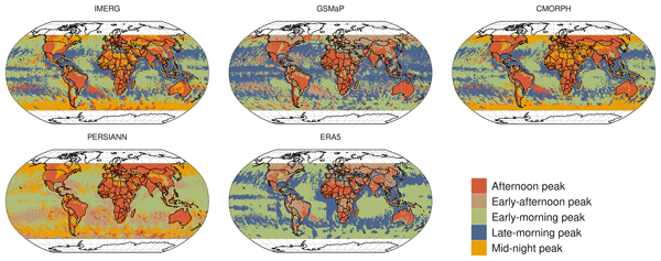
This study compared global satellite and reanalysis precipitation datasets to assess diurnal variability. We found that all datasets capture key diurnal precipitation patterns, with maximum precipitation in the afternoon over land and early morning over the ocean. However, there are differences in the exact timing and amount of precipitation. This suggests that it is better to use a combination of datasets for potential applications rather than relying on a single dataset.
Francesco Marra, Nadav Peleg, Elena Cristiano, Efthymios I. Nikolopoulos, Federica Remondi, and Paolo Tarolli
Nat. Hazards Earth Syst. Sci., 25, 2565–2570, https://doi.org/10.5194/nhess-25-2565-2025, https://doi.org/10.5194/nhess-25-2565-2025, 2025
Short summary
Short summary
Climate change is escalating the risks related to hydro-meteorological extremes. This preface introduces a special issue originating from a European Geosciences Union (EGU) session. It highlights the challenges posed by these extremes, ranging from hazard assessment to mitigation strategies, and covers both water excess events like floods, landslides, and coastal hazards and water deficit events such as droughts and fire weather. The collection aims to advance understanding, improve resilience, and inform policy-making.
Kevin Kenfack, Francesco Marra, Zéphirin Yepdo Djomou, Lucie Angennes Djiotang Tchotchou, Alain Tchio Tamoffo, and Derbetini Appolinaire Vondou
Weather Clim. Dynam., 5, 1457–1472, https://doi.org/10.5194/wcd-5-1457-2024, https://doi.org/10.5194/wcd-5-1457-2024, 2024
Short summary
Short summary
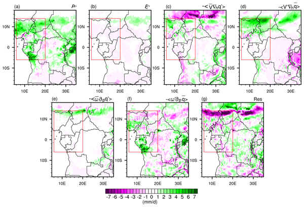
The results of this study show that moisture advection induced by horizontal wind anomalies and vertical moisture advection induced by vertical velocity anomalies were crucial mechanisms behind the anomalous October 2019 exceptional rainfall increase over western central Africa. The information we derive can be used to support risk assessment and management in the region and to improve our resilience to ongoing climate change.
Talia Rosin, Francesco Marra, and Efrat Morin
Hydrol. Earth Syst. Sci., 28, 3549–3566, https://doi.org/10.5194/hess-28-3549-2024, https://doi.org/10.5194/hess-28-3549-2024, 2024
Short summary
Short summary
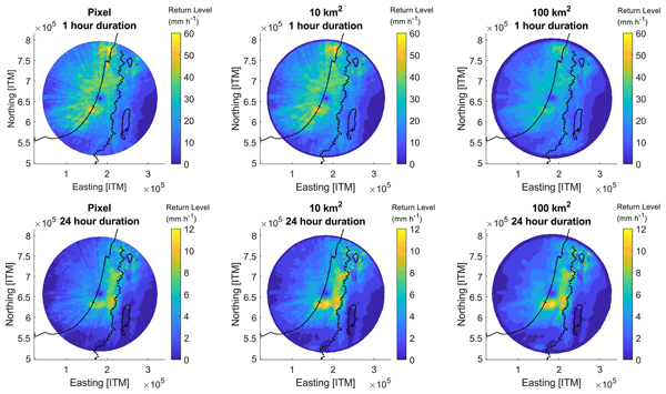
Knowledge of extreme precipitation probability at various spatial–temporal scales is crucial. We estimate extreme precipitation return levels at multiple scales (10 min–24 h, 0.25–500 km2) in the eastern Mediterranean using radar data. We show our estimates are comparable to those derived from averaged daily rain gauges. We then explore multi-scale extreme precipitation across coastal, mountainous, and desert regions.
Francesco Marra, Marika Koukoula, Antonio Canale, and Nadav Peleg
Hydrol. Earth Syst. Sci., 28, 375–389, https://doi.org/10.5194/hess-28-375-2024, https://doi.org/10.5194/hess-28-375-2024, 2024
Short summary
Short summary
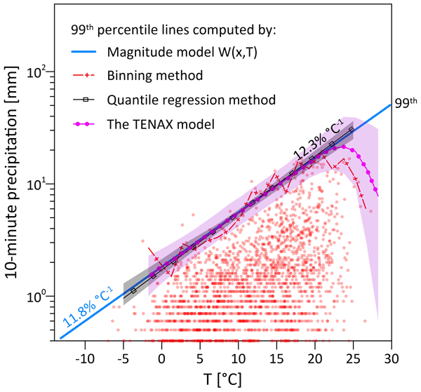
We present a new physical-based method for estimating extreme sub-hourly precipitation return levels (i.e., intensity–duration–frequency, IDF, curves), which are critical for the estimation of future floods. The proposed model, named TENAX, incorporates temperature as a covariate in a physically consistent manner. It has only a few parameters and can be easily set for any climate station given sub-hourly precipitation and temperature data are available.
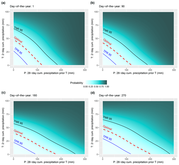
Stefan Steger, Mateo Moreno, Alice Crespi, Peter James Zellner, Stefano Luigi Gariano, Maria Teresa Brunetti, Massimo Melillo, Silvia Peruccacci, Francesco Marra, Robin Kohrs, Jason Goetz, Volkmar Mair, and Massimiliano Pittore
Nat. Hazards Earth Syst. Sci., 23, 1483–1506, https://doi.org/10.5194/nhess-23-1483-2023, https://doi.org/10.5194/nhess-23-1483-2023, 2023
Short summary
Short summary
We present a novel data-driven modelling approach to determine season-specific critical precipitation conditions for landslide occurrence. It is shown that the amount of precipitation required to trigger a landslide in South Tyrol varies from season to season. In summer, a higher amount of preparatory precipitation is required to trigger a landslide, probably due to denser vegetation and higher temperatures. We derive dynamic thresholds that directly relate to hit rates and false-alarm rates.

Nadav Peleg, Herminia Torelló-Sentelles, Grégoire Mariéthoz, Lionel Benoit, João P. Leitão, and Francesco Marra
Nat. Hazards Earth Syst. Sci., 23, 1233–1240, https://doi.org/10.5194/nhess-23-1233-2023, https://doi.org/10.5194/nhess-23-1233-2023, 2023
Short summary
Short summary
Floods in urban areas are one of the most common natural hazards. Due to climate change enhancing extreme rainfall and cities becoming larger and denser, the impacts of these events are expected to increase. A fast and reliable flood warning system should thus be implemented in flood-prone cities to warn the public of upcoming floods. The purpose of this brief communication is to discuss the potential implementation of low-cost acoustic rainfall sensors in short-term flood warning systems.
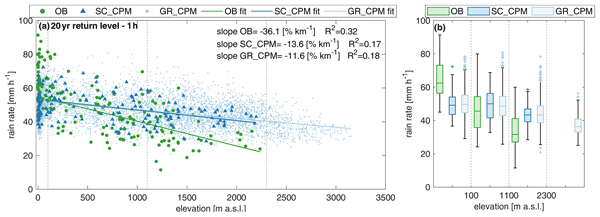
Eleonora Dallan, Francesco Marra, Giorgia Fosser, Marco Marani, Giuseppe Formetta, Christoph Schär, and Marco Borga
Hydrol. Earth Syst. Sci., 27, 1133–1149, https://doi.org/10.5194/hess-27-1133-2023, https://doi.org/10.5194/hess-27-1133-2023, 2023
Short summary
Short summary
Convection-permitting climate models could represent future changes in extreme short-duration precipitation, which is critical for risk management. We use a non-asymptotic statistical method to estimate extremes from 10 years of simulations in an orographically complex area. Despite overall good agreement with rain gauges, the observed decrease of hourly extremes with elevation is not fully represented by the model. Climate model adjustment methods should consider the role of orography.
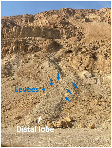
Shalev Siman-Tov and Francesco Marra
Nat. Hazards Earth Syst. Sci., 23, 1079–1093, https://doi.org/10.5194/nhess-23-1079-2023, https://doi.org/10.5194/nhess-23-1079-2023, 2023
Short summary
Short summary
Debris flows represent a threat to infrastructure and the population. In arid areas, they are observed when heavy rainfall hits steep slopes with sediments. Here, we use digital surface models and radar rainfall data to detect and characterize the triggering and non-triggering rainfall conditions. We find that rainfall intensity alone is insufficient to explain the triggering. We suggest that antecedent rainfall could represent a critical factor for debris flow triggering in arid regions.
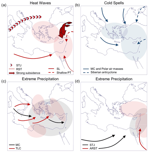
Assaf Hochman, Francesco Marra, Gabriele Messori, Joaquim G. Pinto, Shira Raveh-Rubin, Yizhak Yosef, and Georgios Zittis
Earth Syst. Dynam., 13, 749–777, https://doi.org/10.5194/esd-13-749-2022, https://doi.org/10.5194/esd-13-749-2022, 2022
Short summary
Short summary
Gaining a complete understanding of extreme weather, from its physical drivers to its impacts on society, is important in supporting future risk reduction and adaptation measures. Here, we provide a review of the available scientific literature, knowledge gaps and key open questions in the study of extreme weather events over the vulnerable eastern Mediterranean region.
Francesco Marra, Moshe Armon, and Efrat Morin
Hydrol. Earth Syst. Sci., 26, 1439–1458, https://doi.org/10.5194/hess-26-1439-2022, https://doi.org/10.5194/hess-26-1439-2022, 2022
Short summary
Short summary
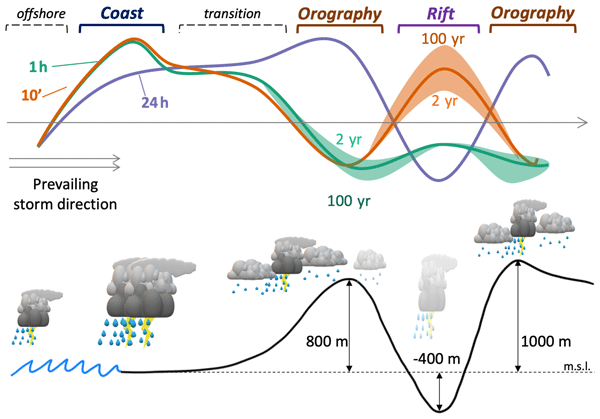
We present a new method for quantifying the probability of occurrence of extreme rainfall using radar data, and we use it to examine coastal and orographic effects on extremes. We identify three regimes, directly related to precipitation physical processes, which respond differently to these forcings. The methods and results are of interest for researchers and practitioners using radar for the analysis of extremes, risk managers, water resources managers, and climate change impact studies.
Yoav Ben Dor, Francesco Marra, Moshe Armon, Yehouda Enzel, Achim Brauer, Markus Julius Schwab, and Efrat Morin
Clim. Past, 17, 2653–2677, https://doi.org/10.5194/cp-17-2653-2021, https://doi.org/10.5194/cp-17-2653-2021, 2021
Short summary
Short summary
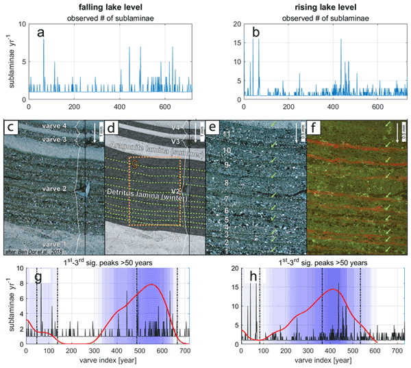
Laminated sediments from the deepest part of the Dead Sea unravel the hydrological response of the eastern Mediterranean to past climate changes. This study demonstrates the importance of geological archives in complementing modern hydrological measurements that do not fully capture natural hydroclimatic variability, which is crucial to configure for understanding the impact of climate change on the hydrological cycle in subtropical regions.
Nathalia Correa-Sánchez, Xiaoli Guo Larsén, Eleonora Dallan, Marco Borga, and Francesco Marra
Wind Energ. Sci., 11, 2961–2985, https://doi.org/10.5194/wes-11-2961-2026, https://doi.org/10.5194/wes-11-2961-2026, 2026
Short summary
Short summary
This research presents the first use of the simplified metastatistical extreme value approach for wind extremes, extending it to wind energy applications. We use a categorical framework that combines climate, roughness, and topography to evaluate convection-permitted models. We find that model formulation drives inter-model uncertainties, rather than surface conditions. Convection-permitted models' uncertainty analysis improves the reliability of extreme wind estimates for design parameters.
Wenyue Zou, Ruidong Li, Daniel B. Wright, Jovan Blagojevic, Peter Molnar, Mohammad A. Hussain, Yue Zhu, Yongkun Li, Guangheng Ni, and Nadav Peleg
Hydrol. Earth Syst. Sci., 30, 5097–5116, https://doi.org/10.5194/hess-30-5097-2026, https://doi.org/10.5194/hess-30-5097-2026, 2026
Short summary
Short summary
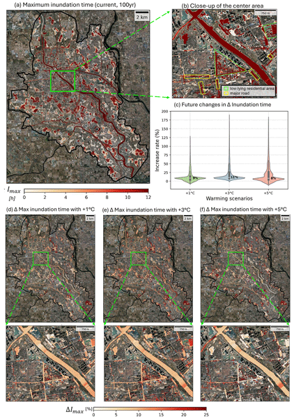
We present a framework using observed rainfall and temperature to generate realistic storms and simulate street-scale flooding for present and future climates. It integrates temperature-based rainfall scaling, storm-frequency estimation, and urban flood modeling, demonstrated in Beijing to assess changes in regional storm and flood depth, timing, and flow velocity. The workflow is data-light, physically grounded, and transferable worldwide.

Ying Hu, Huan Wu, Yiwen Mei, Zhijun Huang, Aihui Wang, Chaoqun Li, and Bing Sui
Nat. Hazards Earth Syst. Sci., 26, 3667–3682, https://doi.org/10.5194/nhess-26-3667-2026, https://doi.org/10.5194/nhess-26-3667-2026, 2026
Short summary
Short summary
Our analysis of United States river data explains why more heavy rain has not led to more flash floods. Only 17.3 % of basins see more frequent events, and 6.5 % see sharper, more intense flash floods. A key finding is that the warming climate counteracts rainfall's impact, reducing potential increases in flood frequency by 3.6 % and intensity by 8.0 % since the 1980s. While national land cover has remained stable, local urbanization remains a crucial factor driving flood risk.
Ella Thomas, Petr Vohnicky, Marco Borga, Nadav Peleg, and Francesco Marra
Hydrol. Earth Syst. Sci., 30, 4957–4967, https://doi.org/10.5194/hess-30-4957-2026, https://doi.org/10.5194/hess-30-4957-2026, 2026
Short summary
Short summary
Extreme rainfall is expected to grow in magnitude with increasing temperature. We assess whether very rare extremes increase with temperature faster than moderate extremes, and we test methods to include this effect into a model to predict future extremes called TENAX. We find that this dependence on temperature is typically observed but including it in the model without prior information on its magnitude may lead to disproportionately large uncertainty.
Yair Rinat, Moshe Armon, and Efrat Morin
Hydrol. Earth Syst. Sci., 30, 4565–4585, https://doi.org/10.5194/hess-30-4565-2026, https://doi.org/10.5194/hess-30-4565-2026, 2026
Short summary
Short summary
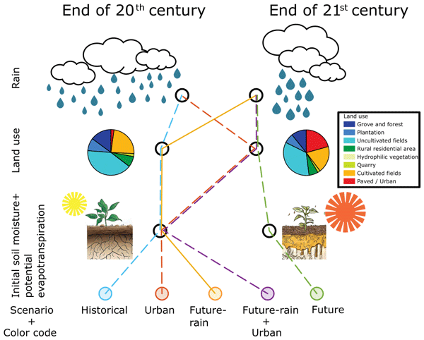
In the coming decades Mediterranean floods are expected to change due to increased urbanization and climate change. We simulate floods under different conditions and show that future rainfall will likely reduce flood magnitudes, but increased urbanization will make them higher. Flood intensification is more pronounced at upstream sections and when soil moisture is high. As future flood trends may change between different regions further research is needed to cope with upcoming challenges.
Rashid Akbary, Eleonora Dallan, Paul C. Astagneau, Raul R. Wood, Francesco Marra, Manuela I. Brunner, and Marco Borga
Hydrol. Earth Syst. Sci., 30, 4117–4139, https://doi.org/10.5194/hess-30-4117-2026, https://doi.org/10.5194/hess-30-4117-2026, 2026
Short summary
Short summary
Heavy short rain can trigger flash floods and debris flows. In this study we evaluated how well climate models reproduce these events in Switzerland. We compared finer and coarser resolution models with high-quality hourly precipitation observations across small to large areas. The finer models better captured where short, intense precipitation occurs, but their errors changed with area size. Flood risk studies should therefore account for these scale-related errors.
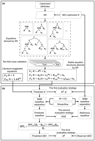
Yongen Lin, Dagang Wang, Yiwen Mei, Jinxin Zhu, Huan Wu, Shuo Wang, Zhonghou Xu, Asaad Y. Shamseldin, and Emmanouil N. Anagnostou
Hydrol. Earth Syst. Sci., 30, 3425–3438, https://doi.org/10.5194/hess-30-3425-2026, https://doi.org/10.5194/hess-30-3425-2026, 2026
Short summary
Short summary
Understanding how baseflow contributes to river flow is essential for managing water resources. We studied a widely used method for separating baseflow and found that a key parameter was often estimated too simply. Using symbolic regression and data from 855 catchments, we uncovered new formulas that greatly improve accuracy and reveal how soil, snow, and catchment size jointly influence baseflow estimation.
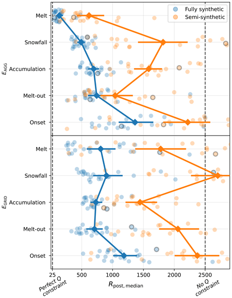
Pau Wiersma, Jan Magnusson, Nadav Peleg, Bettina Schaefli, and Gregoire Mariethoz
Hydrol. Earth Syst. Sci., 30, 3331–3350, https://doi.org/10.5194/hess-30-3331-2026, https://doi.org/10.5194/hess-30-3331-2026, 2026
Short summary
Short summary
Streamflow observations contain information about snow, but their potential to constrain seasonal snow mass reconstructions remains underexplored. Using inverse hydrological modeling, we show that streamflow is particularly effective at constraining catchment-aggregated melt rates, but that non-uniqueness in the snow–streamflow relationship and uncertainties in the inverse modeling chain can easily limit inversion performance.
Talia Rosin, Francesco Marra, Marco Gabella, Urs Germann, Daniel Wolfensberger, and Efrat Morin
EGUsphere, https://doi.org/10.5194/egusphere-2026-1800, https://doi.org/10.5194/egusphere-2026-1800, 2026
Short summary
Short summary
Extreme rainfall in mountainous regions is difficult to assess as it varies strongly across space and time, and rain gauges are often too sparse to capture it. Using 9 years of radar data, we analyse summer rainfall extremes across Switzerland for different durations and areas. We show that rainfall intensity depends strongly on scale and topography, and that radar better captures local extremes, improving flood hazard assessment, as demonstrated for three recent major flood-producing storms.
Saran Aadhar, Efrat Morin, and Utkarsh Gupta
EGUsphere, https://doi.org/10.5194/egusphere-2026-339, https://doi.org/10.5194/egusphere-2026-339, 2026
Short summary
Short summary
River basins in India are often affected by flooding during the summer monsoon, putting millions of people and livelihoods at risk. Understanding the processes that cause floods is critical to minimizing flood risk. Our investigations show how rainfall (short and long-duration), surface water flow, and the specific location of the drainage area contribute to flood events in the Godavari River basin using observations and hydrological model data.
Francesco Marra, Eleonora Dallan, Marco Borga, Roberto Greco, and Thom Bogaard
Nat. Hazards Earth Syst. Sci., 25, 5055–5061, https://doi.org/10.5194/nhess-25-5055-2025, https://doi.org/10.5194/nhess-25-5055-2025, 2025
Short summary
Short summary
We highlight an important conceptual difference between the duration used in intensity-duration thresholds and the duration used in the intensity-duration-frequency curves that has been overlooked by the landslide literature so far.
Nathalia Correa-Sánchez, Xiaoli Guo Larsén, Giorgia Fosser, Eleonora Dallan, Marco Borga, and Francesco Marra
Wind Energ. Sci., 10, 2551–2561, https://doi.org/10.5194/wes-10-2551-2025, https://doi.org/10.5194/wes-10-2551-2025, 2025
Short summary
Short summary
We examined the power spectra of wind speed in three convection-permitting models in central Europe and found that these models have a better representation of wind variability characteristics than standard wind datasets like the New European Wind Atlas, due to different simulation approaches, providing more reliable extreme wind predictions.
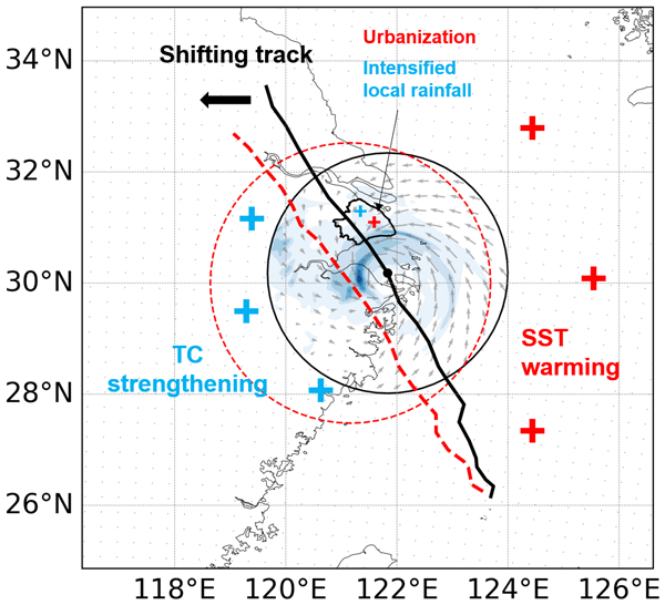
Qi Zhuang, Marika Koukoula, Shuguang Liu, Zhengzheng Zhou, and Nadav Peleg
Weather Clim. Dynam., 6, 1267–1281, https://doi.org/10.5194/wcd-6-1267-2025, https://doi.org/10.5194/wcd-6-1267-2025, 2025
Short summary
Short summary
Understanding how projected urbanization and climate change affect typhoons, which may cause the most destructive natural catastrophes, is crucial. Based on numerical simulations of five landfalling typhoons in Shanghai, China, our results highlight that warming sea surface temperatures significantly shift typhoon tracks with intensified structures (increased size, intensity, and affected time) on the big scale. Meanwhile, urbanization further amplifies local rainfall intensity.
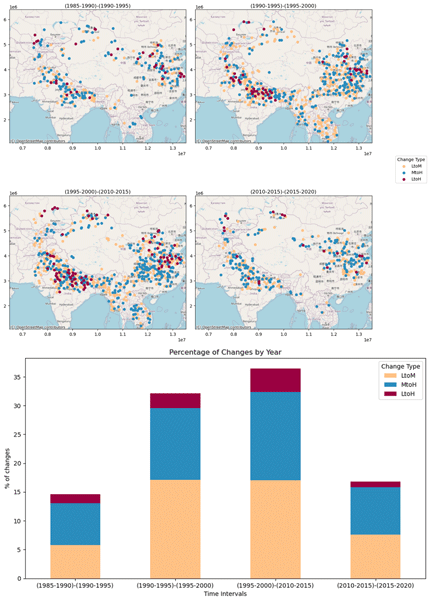
Mariam Khanam, Giulia Sofia, Wilmalis Rodriguez, Efthymios I. Nikolopoulos, Binghao Lu, Dongjin Song, and Emmanouil N. Anagnostou
Nat. Hazards Earth Syst. Sci., 25, 3759–3778, https://doi.org/10.5194/nhess-25-3759-2025, https://doi.org/10.5194/nhess-25-3759-2025, 2025
Short summary
Short summary
This study comprehends and predicts the socioeconomic effects of floods in the High Mountain Asia (HMA) region. We proposed a machine learning strategy for mapping socioeconomic flood damage. We predicted the life year index (LYI), which quantifies the financial cost and loss of life caused by floods, using variables including climate, geomorphology, and population. The study's overall goal is to offer useful information on flood susceptibility and subsequent risk mapping in the HMA region.
Rajani Kumar Pradhan, Yannis Markonis, Francesco Marra, Efthymios I. Nikolopoulos, Simon Michael Papalexiou, and Vincenzo Levizzani
Hydrol. Earth Syst. Sci., 29, 4929–4949, https://doi.org/10.5194/hess-29-4929-2025, https://doi.org/10.5194/hess-29-4929-2025, 2025
Short summary
Short summary
This study compared global satellite and reanalysis precipitation datasets to assess diurnal variability. We found that all datasets capture key diurnal precipitation patterns, with maximum precipitation in the afternoon over land and early morning over the ocean. However, there are differences in the exact timing and amount of precipitation. This suggests that it is better to use a combination of datasets for potential applications rather than relying on a single dataset.
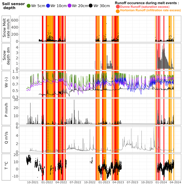
Judith Eeckman, Brian De Grenus, Floreana Marie Miesen, James Thornton, Philip Brunner, and Nadav Peleg
Hydrol. Earth Syst. Sci., 29, 4093–4107, https://doi.org/10.5194/hess-29-4093-2025, https://doi.org/10.5194/hess-29-4093-2025, 2025
Short summary
Short summary
The fate of liquid water from melting snow in winter and spring is difficult to understand in the mountains. This work uses a multi-instrumental network to accurately monitor the dynamics of snowmelt and infiltration at different depths in the ground and at different altitudes. The results show that melting snow quickly infiltrates into the upper layers of the soil but is also quickly transferred through the soil along the slopes towards the river.
Francesco Marra, Nadav Peleg, Elena Cristiano, Efthymios I. Nikolopoulos, Federica Remondi, and Paolo Tarolli
Nat. Hazards Earth Syst. Sci., 25, 2565–2570, https://doi.org/10.5194/nhess-25-2565-2025, https://doi.org/10.5194/nhess-25-2565-2025, 2025
Short summary
Short summary
Climate change is escalating the risks related to hydro-meteorological extremes. This preface introduces a special issue originating from a European Geosciences Union (EGU) session. It highlights the challenges posed by these extremes, ranging from hazard assessment to mitigation strategies, and covers both water excess events like floods, landslides, and coastal hazards and water deficit events such as droughts and fire weather. The collection aims to advance understanding, improve resilience, and inform policy-making.
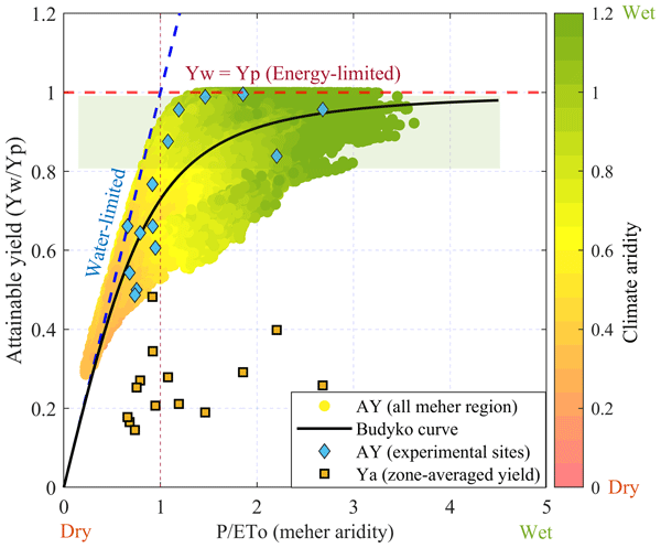
Mosisa Tujuba Wakjira, Nadav Peleg, Johan Six, and Peter Molnar
Hydrol. Earth Syst. Sci., 29, 863–886, https://doi.org/10.5194/hess-29-863-2025, https://doi.org/10.5194/hess-29-863-2025, 2025
Short summary
Short summary
In this study, we implement a climate, water, and crop interaction model to evaluate current conditions and project future changes in rainwater availability and its yield potential, with the goal of informing adaptation policies and strategies in Ethiopia. Although climate change is likely to increase rainfall in Ethiopia, our findings suggest that water-scarce croplands in Ethiopia are expected to face reduced crop yields during the main growing season due to increases in temperature.
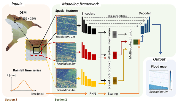
Tabea Cache, Milton Salvador Gomez, Tom Beucler, Jovan Blagojevic, João Paulo Leitao, and Nadav Peleg
Hydrol. Earth Syst. Sci., 28, 5443–5458, https://doi.org/10.5194/hess-28-5443-2024, https://doi.org/10.5194/hess-28-5443-2024, 2024
Short summary
Short summary
We introduce a new deep-learning model that addresses the limitations of existing urban flood models in handling varied terrains and rainfall events. Our model subdivides a city into small patches and presents a novel approach to incorporate broader terrain information. It accurately predicts high-resolution flood maps across diverse rainfall events and cities (on minute and meter scales) that haven’t been seen by the model, which offers valuable insights for urban flood mitigation strategies.
Kevin Kenfack, Francesco Marra, Zéphirin Yepdo Djomou, Lucie Angennes Djiotang Tchotchou, Alain Tchio Tamoffo, and Derbetini Appolinaire Vondou
Weather Clim. Dynam., 5, 1457–1472, https://doi.org/10.5194/wcd-5-1457-2024, https://doi.org/10.5194/wcd-5-1457-2024, 2024
Short summary
Short summary
The results of this study show that moisture advection induced by horizontal wind anomalies and vertical moisture advection induced by vertical velocity anomalies were crucial mechanisms behind the anomalous October 2019 exceptional rainfall increase over western central Africa. The information we derive can be used to support risk assessment and management in the region and to improve our resilience to ongoing climate change.
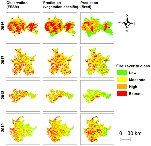
Kang He, Xinyi Shen, Cory Merow, Efthymios Nikolopoulos, Rachael V. Gallagher, Feifei Yang, and Emmanouil N. Anagnostou
Nat. Hazards Earth Syst. Sci., 24, 3337–3355, https://doi.org/10.5194/nhess-24-3337-2024, https://doi.org/10.5194/nhess-24-3337-2024, 2024
Short summary
Short summary
A framework combining a fire severity classification with a regression model to predict an indicator of fire severity derived from Landsat imagery (difference normalized burning ratio, dNBR) is proposed. The results show that the proposed predictive technique is capable of providing robust fire severity prediction information, which can be used for forecasting seasonal fire severity and, subsequently, impacts on biodiversity and ecosystems under projected future climate conditions.
Talia Rosin, Francesco Marra, and Efrat Morin
Hydrol. Earth Syst. Sci., 28, 3549–3566, https://doi.org/10.5194/hess-28-3549-2024, https://doi.org/10.5194/hess-28-3549-2024, 2024
Short summary
Short summary
Knowledge of extreme precipitation probability at various spatial–temporal scales is crucial. We estimate extreme precipitation return levels at multiple scales (10 min–24 h, 0.25–500 km2) in the eastern Mediterranean using radar data. We show our estimates are comparable to those derived from averaged daily rain gauges. We then explore multi-scale extreme precipitation across coastal, mountainous, and desert regions.
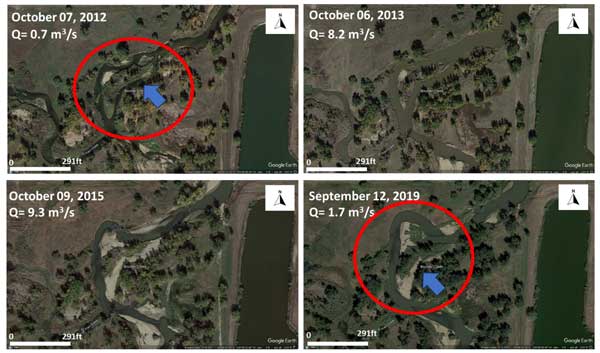
Mariam Khanam, Giulia Sofia, and Emmanouil N. Anagnostou
Hydrol. Earth Syst. Sci., 28, 3161–3190, https://doi.org/10.5194/hess-28-3161-2024, https://doi.org/10.5194/hess-28-3161-2024, 2024
Short summary
Short summary
Flooding worsens due to climate change, with river dynamics being a key in local flood control. Predicting post-storm geomorphic changes is challenging. Using self-organizing maps and machine learning, this study forecasts post-storm alterations in stage–discharge relationships across 3101 US stream gages. The provided framework can aid in updating hazard assessments by identifying rivers prone to change, integrating channel adjustments into flood hazard assessment.
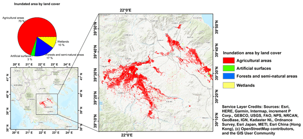
Kang He, Qing Yang, Xinyi Shen, Elias Dimitriou, Angeliki Mentzafou, Christina Papadaki, Maria Stoumboudi, and Emmanouil N. Anagnostou
Nat. Hazards Earth Syst. Sci., 24, 2375–2382, https://doi.org/10.5194/nhess-24-2375-2024, https://doi.org/10.5194/nhess-24-2375-2024, 2024
Short summary
Short summary
About 820 km2 of agricultural land was inundated in central Greece due to Storm Daniel. A detailed analysis revealed that the crop most affected by the flooding was cotton; the inundated area of more than 282 km2 comprised ~ 30 % of the total area planted with cotton in central Greece. In terms of livestock, we estimate that more than 14 000 ornithoids and 21 500 sheep and goats were affected. Consequences for agriculture and animal husbandry in Greece are expected to be severe.
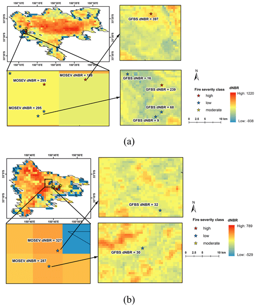
Kang He, Xinyi Shen, and Emmanouil N. Anagnostou
Earth Syst. Sci. Data, 16, 3061–3081, https://doi.org/10.5194/essd-16-3061-2024, https://doi.org/10.5194/essd-16-3061-2024, 2024
Short summary
Short summary
Forest fire risk is expected to increase as fire weather and drought conditions intensify. To improve quantification of the intensity and extent of forest fire damage, we have developed a global forest burn severity (GFBS) database that provides burn severity spectral indices (dNBR and RdNBR) at a 30 m spatial resolution. This database could be more reliable than prior sources of information for future studies of forest burn severity on the global scale in a computationally cost-effective way.
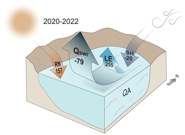
Shai Abir, Hamish A. McGowan, Yonatan Shaked, Hezi Gildor, Efrat Morin, and Nadav G. Lensky
Atmos. Chem. Phys., 24, 6177–6195, https://doi.org/10.5194/acp-24-6177-2024, https://doi.org/10.5194/acp-24-6177-2024, 2024
Short summary
Short summary
Understanding air–sea heat exchange is vital for studying ocean dynamics. Eddy covariance measurements over the Gulf of Eilat revealed a 3.22 m yr-1 evaporation rate, which is inconsistent with bulk formulae estimations in stable atmospheric conditions, requiring bulk formulae to be revisited in these environments. The surface fluxes have a net cooling effect on the gulf water on an annual mean (-79 W m-2), balanced by a strong exchange flux between the Red Sea and the Gulf of Eilat.
Francesco Marra, Marika Koukoula, Antonio Canale, and Nadav Peleg
Hydrol. Earth Syst. Sci., 28, 375–389, https://doi.org/10.5194/hess-28-375-2024, https://doi.org/10.5194/hess-28-375-2024, 2024
Short summary
Short summary
We present a new physical-based method for estimating extreme sub-hourly precipitation return levels (i.e., intensity–duration–frequency, IDF, curves), which are critical for the estimation of future floods. The proposed model, named TENAX, incorporates temperature as a covariate in a physically consistent manner. It has only a few parameters and can be easily set for any climate station given sub-hourly precipitation and temperature data are available.
Stefan Steger, Mateo Moreno, Alice Crespi, Peter James Zellner, Stefano Luigi Gariano, Maria Teresa Brunetti, Massimo Melillo, Silvia Peruccacci, Francesco Marra, Robin Kohrs, Jason Goetz, Volkmar Mair, and Massimiliano Pittore
Nat. Hazards Earth Syst. Sci., 23, 1483–1506, https://doi.org/10.5194/nhess-23-1483-2023, https://doi.org/10.5194/nhess-23-1483-2023, 2023
Short summary
Short summary
We present a novel data-driven modelling approach to determine season-specific critical precipitation conditions for landslide occurrence. It is shown that the amount of precipitation required to trigger a landslide in South Tyrol varies from season to season. In summer, a higher amount of preparatory precipitation is required to trigger a landslide, probably due to denser vegetation and higher temperatures. We derive dynamic thresholds that directly relate to hit rates and false-alarm rates.
Nadav Peleg, Herminia Torelló-Sentelles, Grégoire Mariéthoz, Lionel Benoit, João P. Leitão, and Francesco Marra
Nat. Hazards Earth Syst. Sci., 23, 1233–1240, https://doi.org/10.5194/nhess-23-1233-2023, https://doi.org/10.5194/nhess-23-1233-2023, 2023
Short summary
Short summary
Floods in urban areas are one of the most common natural hazards. Due to climate change enhancing extreme rainfall and cities becoming larger and denser, the impacts of these events are expected to increase. A fast and reliable flood warning system should thus be implemented in flood-prone cities to warn the public of upcoming floods. The purpose of this brief communication is to discuss the potential implementation of low-cost acoustic rainfall sensors in short-term flood warning systems.
Eleonora Dallan, Francesco Marra, Giorgia Fosser, Marco Marani, Giuseppe Formetta, Christoph Schär, and Marco Borga
Hydrol. Earth Syst. Sci., 27, 1133–1149, https://doi.org/10.5194/hess-27-1133-2023, https://doi.org/10.5194/hess-27-1133-2023, 2023
Short summary
Short summary
Convection-permitting climate models could represent future changes in extreme short-duration precipitation, which is critical for risk management. We use a non-asymptotic statistical method to estimate extremes from 10 years of simulations in an orographically complex area. Despite overall good agreement with rain gauges, the observed decrease of hourly extremes with elevation is not fully represented by the model. Climate model adjustment methods should consider the role of orography.
Shalev Siman-Tov and Francesco Marra
Nat. Hazards Earth Syst. Sci., 23, 1079–1093, https://doi.org/10.5194/nhess-23-1079-2023, https://doi.org/10.5194/nhess-23-1079-2023, 2023
Short summary
Short summary
Debris flows represent a threat to infrastructure and the population. In arid areas, they are observed when heavy rainfall hits steep slopes with sediments. Here, we use digital surface models and radar rainfall data to detect and characterize the triggering and non-triggering rainfall conditions. We find that rainfall intensity alone is insufficient to explain the triggering. We suggest that antecedent rainfall could represent a critical factor for debris flow triggering in arid regions.

Kang He, Qing Yang, Xinyi Shen, and Emmanouil N. Anagnostou
Nat. Hazards Earth Syst. Sci., 22, 2921–2927, https://doi.org/10.5194/nhess-22-2921-2022, https://doi.org/10.5194/nhess-22-2921-2022, 2022
Short summary
Short summary
This study depicts the flood-affected areas in western Europe in July 2021 and particularly the agriculture land that was under flood inundation. The results indicate that the total inundated area over western Europe is about 1920 km2, of which 1320 km2 is in France. Around 64 % of the inundated area is agricultural land. We expect that the agricultural productivity in western Europe will have been severely impacted.
Michael Schirmer, Adam Winstral, Tobias Jonas, Paolo Burlando, and Nadav Peleg
The Cryosphere, 16, 3469–3488, https://doi.org/10.5194/tc-16-3469-2022, https://doi.org/10.5194/tc-16-3469-2022, 2022
Short summary
Short summary
Rain is highly variable in time at a given location so that there can be both wet and dry climate periods. In this study, we quantify the effects of this natural climate variability and other sources of uncertainty on changes in flooding events due to rain on snow (ROS) caused by climate change. For ROS events with a significant contribution of snowmelt to runoff, the change due to climate was too small to draw firm conclusions about whether there are more ROS events of this important type.
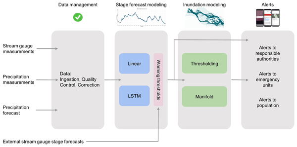
Sella Nevo, Efrat Morin, Adi Gerzi Rosenthal, Asher Metzger, Chen Barshai, Dana Weitzner, Dafi Voloshin, Frederik Kratzert, Gal Elidan, Gideon Dror, Gregory Begelman, Grey Nearing, Guy Shalev, Hila Noga, Ira Shavitt, Liora Yuklea, Moriah Royz, Niv Giladi, Nofar Peled Levi, Ofir Reich, Oren Gilon, Ronnie Maor, Shahar Timnat, Tal Shechter, Vladimir Anisimov, Yotam Gigi, Yuval Levin, Zach Moshe, Zvika Ben-Haim, Avinatan Hassidim, and Yossi Matias
Hydrol. Earth Syst. Sci., 26, 4013–4032, https://doi.org/10.5194/hess-26-4013-2022, https://doi.org/10.5194/hess-26-4013-2022, 2022
Short summary
Short summary
Early flood warnings are one of the most effective tools to save lives and goods. Machine learning (ML) models can improve flood prediction accuracy but their use in operational frameworks is limited. The paper presents a flood warning system, operational in India and Bangladesh, that uses ML models for forecasting river stage and flood inundation maps and discusses the models' performances. In 2021, more than 100 million flood alerts were sent to people near rivers over an area of 470 000 km2.
Assaf Hochman, Francesco Marra, Gabriele Messori, Joaquim G. Pinto, Shira Raveh-Rubin, Yizhak Yosef, and Georgios Zittis
Earth Syst. Dynam., 13, 749–777, https://doi.org/10.5194/esd-13-749-2022, https://doi.org/10.5194/esd-13-749-2022, 2022
Short summary
Short summary
Gaining a complete understanding of extreme weather, from its physical drivers to its impacts on society, is important in supporting future risk reduction and adaptation measures. Here, we provide a review of the available scientific literature, knowledge gaps and key open questions in the study of extreme weather events over the vulnerable eastern Mediterranean region.
Francesco Marra, Moshe Armon, and Efrat Morin
Hydrol. Earth Syst. Sci., 26, 1439–1458, https://doi.org/10.5194/hess-26-1439-2022, https://doi.org/10.5194/hess-26-1439-2022, 2022
Short summary
Short summary
We present a new method for quantifying the probability of occurrence of extreme rainfall using radar data, and we use it to examine coastal and orographic effects on extremes. We identify three regimes, directly related to precipitation physical processes, which respond differently to these forcings. The methods and results are of interest for researchers and practitioners using radar for the analysis of extremes, risk managers, water resources managers, and climate change impact studies.
Yoav Ben Dor, Francesco Marra, Moshe Armon, Yehouda Enzel, Achim Brauer, Markus Julius Schwab, and Efrat Morin
Clim. Past, 17, 2653–2677, https://doi.org/10.5194/cp-17-2653-2021, https://doi.org/10.5194/cp-17-2653-2021, 2021
Short summary
Short summary
Laminated sediments from the deepest part of the Dead Sea unravel the hydrological response of the eastern Mediterranean to past climate changes. This study demonstrates the importance of geological archives in complementing modern hydrological measurements that do not fully capture natural hydroclimatic variability, which is crucial to configure for understanding the impact of climate change on the hydrological cycle in subtropical regions.
Cited articles
Alila, Y.: A hierarchical approach for the regionalization of precipitation annual maxima in Canada, J. Geophys. Res., 104, 31645–31655, https://doi.org/10.1029/1999JD900764, 1999.
Allen, R. J. and DeGaetano, A. T.: Considerations for the use of radar-derived precipitation estimates in determining return intervals for extreme areal precipitation amounts, J. Hydrol., 315, 203–219, https://doi.org/10.1016/j.jhydrol.2005.03.028, 2005.
Alpert, P. and Shafir, H.: Meso c-scale distribution of orographic precipitation: numerical study and comparison with precipitation derived from radar measurements, J. Appl. Meteorol., 28, 1105–1117, https://doi.org/10.1175/1520-0450(1989)028<1105:MSDOOP>2.0.CO;2, 1989.
Amitai, E., Petersen, W. A., Llort, X., and Vasilof, S.: Multi-platform comparisons of rain intensity for extreme precipitation events, IEEE T. Geosci. Remote, 99, 1–12, https://doi.org/10.1109/TGRS.2011.2162737, 2011.
Awadallah, A., ElGamal, M., ElMostafa, A., and ElBadry, H.: Developing intensity–duration–frequency curves in scarce data region: an approach using regional analysis and satellite data, Engineering, 3, 215–226, https://doi.org/10.4236/eng.2011.33025, 2011.
Bacchi, B. and Ranzi, R.: On the Derivation of the Areal Reduction Factor of Storms, Atmos. Res., 42, 123–35, 1996.
Ben-Zvi, A.: Rainfall Intensity–Duration–Frequency Relationships Derived from Large Partial Duration Series, J. Hydrol., 367, 104–114, https://doi.org/10.1016/j.jhydrol.2009.01.007, 2009.
Berne, A. and Krajewski, W. F.: Radar for hydrology: unfulfilled promise or unrecognized potential?, Adv. Water Resour., 51, 357–366, https://doi.org/10.1016/j.advwatres.2012.05.005, 2013.
Borga, M., Anagnostou, E. N., Blöschl, G., and Creutin, J. D.: Flash Flood Forecasting, Warning and Risk Management: The HYDRATE Project, Environ. Sci. Policy, 14, 834–44, 2011.
Borga M., Stoffel, M., Marchi, L., Marra, F., and Jacob, M.: Hydrogeomorphic response to extreme rainfall in headwater systems: flash floods and debris flows, J. Hydrol., 518, 194–205, https://doi.org/10.1016/j.jhydrol.2014.05.022, 2014.
Ceresetti, D., Ursu, E., Carreau, J., Anquetin, S., Creutin, J. D., Gardes, L., Girard, S., and Molinié, G.: Evaluation of classical spatial-analysis schemes of extreme rainfall, Nat. Hazards Earth Syst. Sci., 12, 3229–3240, https://doi.org/10.5194/nhess-12-3229-2012, 2012.
Chen, M., Shi, W., Xie, P., Silva, V. B. S., Kousky, V. E., Wayne Higgins, R., and Janowiak, J. E.: Assessing objective techniques for gauge-based analyses of global daily precipitation, J. Geophys. Res., 113, D04110, https://doi.org/10.1029/2007JD009132, 2008.
Chen, S., Hong, Y., Cao, Q., Kirstetter, P. E., Gourley, J. J., Qi, Y., Zhang, J., Howard, K., Hu, J., and Wang, J.: Performance evaluation of radar and satellite rainfalls for Typhoon Morakot over Taiwan: are remote-sensing products ready for gauge denial scenario of extreme events, J. Hydrol., 506, 4–13, https://doi.org/10.1016/j.jhydrol.2012.12.026, 2013.
Chow, V. T., Maidment, D. R., and Mays, L. W.: Applied Hydrology, McGraw-Hill Inc., New York, 572 pp., 1988
Coles, S.: An Introduction to Statistical Modeling of Extreme Values, Springer-Verlag, London, 2001.
Dayan, U. and Morin, E.: Flash flood-producing rainstorms over the Dead Sea: a review, Geol. S. Am. S., 401, 53–62, https://doi.org/10.1130/2006.2401(04), 2006.
Dayan, U., Ziv, B., Margalit, A., Morin, E., and Sharon, D.: A severe autumn storm over the middle-east: synoptic and mesoscale convection analysis, Theor. Appl. Climatol., 69, 103–122, https://doi.org/10.1007/s007040170038, 2001.
Dayan, U., Nissen, K., and Ulbrich, U.: Review Article: Atmospheric conditions inducing extreme precipitation over the eastern and western Mediterranean, Nat. Hazards Earth Syst. Sci., 15, 2525–2544, https://doi.org/10.5194/nhess-15-2525-2015, 2015.
de Vries, A. J., Tyrlis, E., Edry, D., Krichak, S. O., Steil, B., and Lelieveld, J.: Extreme precipitation events in the Middle East: dynamics of the Active Red Sea Trough, J. Geophys. Res.-Atmos., 118, 7087–7108, https://doi.org/10.1002/jgrd.50569, 2013.
Durrans, S. R., Julian, L. T., and Yekta, M.: Estimation of Depth-Area Relationships Using Radar-Rainfall Data, J. Hydrol. Eng., 7, 356–367, 2002.
Eagleson, P. S.: Dynamic Hydrology, McGraw-Hill, New York, 462 pp., 1970.
Eldardiry, H., Habib, E., and Zhang, Y.: On the use of radar-based quantitative precipitation estimates for precipitation frequency analysis, J. Hydrol., 531, 441–453, https://doi.org/10.1016/j.jhydrol.2015.05.016, 2015.
Endreny, T. A. and Imbeah, N.: Generating robust rainfall intensity–duration–frequency estimates with short-record satellite data, J. Hydrol., 371, 182–191, https://doi.org/10.1016/j.jhydrol.2009.03.027, 2009.
Ferraro, R. R.: SSM/I derived global rainfall estimates for climatological applications, J. Geophys. Res., 102, 16715–16735, 1997.
Ferraro, R. R., Weng, F., Grody, N. C., and Zhao, L.: Precipitation characteristics over land from the NOAA-15 AMSU sensor, Geophys. Res. Lett., 27, 2669–2672, 2000.
Fowler, H. J. and Kilsby, C. G.: A regional frequency analysis of United Kingdom extreme rainfall from 1961 to 2000, Int. J. Climatol., 23, 1313–1334, https://doi.org/10.1002/joc.943, 2003.
Gellens, D.: Combining regional approach and data extension procedure for assessing GEV distribution of extreme precipitation in Belgium, J. Hydrol., 268, 113–126, https://doi.org/10.1016/S0022-1694(02)00160-9, 2002.
Gires, A., Tchiguirinskaia, I., Schertzer, D., Schellart, A., Berne, A., and Lovejoy, S.: Influence of small scale rainfall variability on standard comparison tools between radar and rain gauge data, Atmos. Res., 138, 125–138, 2014.
Goldreich, Y.: The spatial distribution of annual rainfall in Israel – a review, Theor. Appl. Climatol., 50, 45–59, https://doi.org/10.1007/BF00864902, 1994.
Goldreich, Y.: The Climate of Israel, Observations, Research and Applications, Springer, New York, 2003.
Guo, H., Chen, S., Bao, A., Hu, J., Gebregiorgis, A. S., Xue, X., and Zhang, X.: Inter-Comparison of High-Resolution Satellite Precipitation Products over Central Asia, Remote Sens., 7, 7181–7211, https://doi.org/10.3390/rs70607181, 2015.
Joyce, R. J., Janowiak, J. E., Arkin, P. A., and Xie, P.: CMORPH: A Method that Produces Global Precipitation Estimates from Passive Microwave and Infrared Data at High Spatial and Temporal Resolution, J. Hydrometeorol., 5, 487–503, https://doi.org/10.1175/1525-7541(2004)005<0487:CAMTPG>2.0.CO;2, 2004.
Kahana, R., Ziv, B., Enzel, Y., and Dayan, U.: Synoptic climatology of major floods in the Negev Desert, Israel, Int. J. Climatol., 22, 867–882, https://doi.org/10.1002/joc.766, 2002.
Karklinsky, M. and Morin, E.: Spatial characteristics of radar-derived convective rain cells over southern Israel, Meteorol. Z., 15, 513–520, https://doi.org/10.1127/0941-2948/2006/0153, 2006.
Katz, R. W., Parlange, M. B., and Naveau, P.: Statistics of extremes in hydrology, Adv. Water Resour., 25, 1287–1304, 2002.
Kidd, C. and Levizzani, V.: Status of satellite precipitation retrievals, Hydrol. Earth Syst. Sci., 15, 1109–1116, https://doi.org/10.5194/hess-15-1109-2011, 2011.
Kidd, C., Becker, A., Huffman, G., Mullaer, C., Joe, P., Skofronick-Jackson, G., and Kirshbaum, D.: So, How Much of the Earth's Surface Is Covered by Rain Gauges?, B. Am. Meteorol. Soc., 98, 69–78, https://doi.org/10.1175/BAMS-D-14-00283.1, 2017.
Koutsoyiannis, D.: Statistics of extremes and estimation of extreme rainfall: II. Empirical investigation of long rainfall records, Hydrolog. Sci. J., 49, 591–610, https://doi.org/10.1623/hysj.49.4.575.54430, 2004.
Kummerow, C., Hong, Y., Olson, W. S., Yang, S., Adler, R. F., McCollum, J., Ferraro, R., Petty, G., Shin, D. B., and Wilheit, T. T.: Evolution of the Goddard profiling algorithm (GPROF) for rainfall estimation from passive microwave sensors, J. Appl. Meteorol., 40, 1801–1820, 2001.
Kysely, J. and Picek, J.: Regional growth curves and improved design value estimates of extreme precipitation events in the Czech Republic, Clim. Res., 33, 243–255, 2007.
Lombardo, F., Napolitano, F., and Russo, F.: On the use of radar reflectivity for estimation of the areal reduction factor, Nat. Hazards Earth Syst. Sci., 6, 377–386, https://doi.org/10.5194/nhess-6-377-2006, 2006.
Marra, F. and Morin, E.: Use of radar QPE for the derivation of Intensity–Duration–Frequency curves in a range of climatic regimes, J. Hydrol., 531, 427–440, https://doi.org/10.1016/j.jhydrol.2015.08.064, 2015.
Marra, F., Nikolopoulos, E. I., Creutin, J. D., and Borga, M.: Radar rainfall estimation for the identification of debris-flow occurrence thresholds, J. Hydrol. 519, 1607–1619, https://doi.org/10.1016/j.jhydrol.2014.09.039, 2014.
Marra, F., Nikolopoulos, E. I., Creutin, J. D., and Borga, M.: Space-time organization of debris flows-triggering rainfall and its effect on the identification of the rainfall threshold relationship, J. Hydrol., 541, 246–255, https://doi.org/10.1016/j.jhydrol.2015.10.010, 2016.
Mei, Y., Nikolopoulos, E. I., Anagnostou, E. N., Zoccatelli, D., and Borga, M.: Error analysis of satellite precipitation-driven modeling of flood events in complex alpine terrain, Remote Sens., 8, 293, https://doi.org/10.3390/rs8040293, 2016.
Morin, E. and Gabella, M.: Radar-based quantitative precipitation estimation over Mediterranean and dry climate regimes, J. Geophys. Res., 112, D20108, https://doi.org/10.1029/2006JD008206, 2007.
Morin, E., Enzel, Y., Shamir, U., and Garti, R.: The characteristic time scale for basin hydrological response using radar data, J. Hydrol., 252, 85–99, https://doi.org/10.1016/S0022-1694(01)00451-6, 2001.
Morin, E., Jacoby, Y., Navon, S., and Ben-Halachmi, E.: Towards flash-flood prediction in the dry Dead Sea region utilizing radar rainfall information, Adv. Water Resour., 32, 1066–1076, https://doi.org/10.1016/j.advwatres.2008.11.011, 2009.
Morin, J., Rosenfeld, D., and Amitai, E.: Radar rain field evaluation and possible use of its high temporal and spatial resolution for hydrological purposes, J. Hydrol., 172, 275–292, https://doi.org/10.1016/0022-1694(95)02700-Y, 1995.
Morin, J., Sharon, D., Rubin, S.: Rainfall Intensity in Israel, Selected Stations, Report 1/94, IMS, Bet Dagan, Israel, 1998.
Nastos, P. T., Kapsomenakis, J., Douvis, K. C.: Analysis of precipitation extremes based on satellite and high-resolution gridded data set over Mediterranean basin, Atmos. Res., 131, 46–59, 2013.
Overeem, A., Buishand, T. A., and Holleman, I.: Rainfall Depth–Duration–Frequency Curves and Their Uncertainties, J. Hydrol., 348, 124–134, https://doi.org/10.1016/j.jhydrol.2007.09.044, 2008.
Overeem, A., Buishand, T. A., and Holleman, I.: Extreme rainfall analysis and estimation of depth–duration–frequency curves using weather radar, Water Resour. Res., 45, W10424, https://doi.org/10.1029/2009WR007869, 2009.
Overeem, A., Buishand, T. A., Holleman, I., and Uijlenhoet, R.: Extreme Value Modeling of Areal Rainfall from Weather Radar, Water Resour. Res., 46, W09514, https://doi.org/10.1029/2009WR008517, 2010.
Paixao, E., Mirza, M. M. Q., Shephard, M. W., Auld, H., Klaassen, J., and Smith, G.: An integrated approach for identifying homogeneous regions of extreme rainfall events and estimating IDF curves in Southern Ontario, Canada: incorporating radar observations, J. Hydrol., 528, 734–750, https://doi.org/10.1016/j.jhydrol.2015.06.015, 2015.
Panziera, L., Gabella, M., Zanini, S., Hering, A., Germann, U., and Berne, A.: A radar-based regional extreme rainfall analysis to derive the thresholds for a novel automatic alert system in Switzerland, Hydrol. Earth Syst. Sci., 20, 2317–2332, https://doi.org/10.5194/hess-20-2317-2016, 2016.
Papalexiou, S. M. and Koutsoyiannis, D.: Battle of Extreme Value Distributions: A Global Survey on Extreme Daily Rainfall, Water Resour. Res., 49, 187–201, https://doi.org/10.1029/2012WR012557, 2013.
Peel, M. C., Finlayson, B. L., and McMahon, T. A.: Updated world map of the Köppen–Geiger climate classification, Hydrol. Earth Syst. Sci., 11, 1633–1644, https://doi.org/10.5194/hess-11-1633-2007, 2007.
Peleg, N. and Morin, E.: Convective rain cells: radar-derived spatiotemporal characteristics and synoptic patterns over the eastern Mediterranean, J. Geophys. Res., 117, D15116, https://doi.org/10.1029/2011JD017353, 2012.
Peleg, N., Ben-Asher, M., and Morin, E.: Radar subpixel-scale rainfall variability and uncertainty: lessons learned from observations of a dense rain-gauge network, Hydrol. Earth Syst. Sci., 17, 2195–2208, https://doi.org/10.5194/hess-17-2195-2013, 2013.
Peleg, N., Blumensaat, F., Molnar, P., Fatichi, S., and Burlando, P.: Partitioning the impacts of spatial and climatological rainfall variability in urban drainage modeling, Hydrol. Earth Syst. Sci., 21, 1559–1572, https://doi.org/10.5194/hess-21-1559-2017, 2017a.
Peleg, N., Marra, F., Fatichi, S., Paschalis, A., Molnar, P., and Burlando, P.: Spatial variability of rainfall at radar subpixel scale, J. Hydrol., in press, https://doi.org/10.1016/j.jhydrol.2016.05.033, 2017b.
Perica, S., Martin, D., Pavlovic, S., Roy, I., St. Laurent, M., Trypaluk, C., Unruh, D., Yekta, M., and Bonnin, G.: Precipitation-Frequency Atlas of the United States, NOAA Atlas 14, Volume 9, Version 2.0: Southeastern States (Alabama, Arkansas, Florida, Georgia, Louisiana, Mississippi), U.S. Department of Commerce, National Oceanic and Atmospheric Adminstration, National Weather Service, Silver Spring, Maryland, 2013.
Phillips, P. and Perron, P.: Testing for a Unit Root in Time Series Regression, Biometrika, 75, 335–346, https://doi.org/10.1175/2007MWR1919.1, 1988.
Rubin, S., Ziv, B., and Paldor, N.: Tropical plumes over eastern North Africa as a source of rain in the Middle East, Mon. Weather Rev., 135, 4135–4148, https://doi.org/10.1175/2007MWR1919.1, 2007.
Schaefer, M. G.: Regional analyses of precipitation annual maxima in Washington State, Water Resour. Res., 26, 119–131, https://doi.org/10.1029/WR026i001p00119, 1990.
Segoni, S., Battistini, A., Rossi, G., Rosi, A., Lagomarsino, D., Catani, F., Moretti, S., and Casagli, N.: Technical Note: An operational landslide early warning system at regional scale based on space-time-variable rainfall thresholds, Nat. Hazards Earth Syst. Sci., 15, 853–861, https://doi.org/10.5194/nhess-15-853-2015, 2015.
Sivapalan, M. and Blöschl, G.: Transformation of point rainfall to areal rainfall: intensity–duration–frequency curves, J. Hydrol., 204, 150–167, https://doi.org/10.1016/S0022-1694(97)00117-0, 1998.
Srebro, H. and Soffer, T.: The New Atlas of Israel: The National Atlas, Survey of Israel and The Hebrew University of Jerusalem, Jerusalem, Israel, 2011.
Stampoulis, D., Anagnostou, E. N., and Nikolopoulos, E. I.: Assessment of high-resolution satellite-based rainfall estimates over the Mediterranean during heavy precipitation events, J. Hydrometeorol., 14, 1500–1514, https://doi.org/10.1175/JHM-D-12-0167.1, 2013.
Svensson, C. and Jones, D. A.: Review of Methods for Deriving Areal Reduction Factors, Journal of Flood Risk Management 3, 232–245, https://doi.org/10.1111/j.1753-318X.2010.01075.x, 2010.
Tapiador, F. J., Turk, F. J., Petersen, W., Hou, A. Y., García-Ortega, E., Machado, L. A. T., Angelis, C. F., Salio, P., Kidd, C., Huffman, G. J., and de Castro, M.: Global precipitation measurement: methods, datasets and applications, Atmos. Res., 104–105, 70–97, https://doi.org/10.1016/j.atmosres.2011.10.021, 2012.
Tiranti, D., Cremonini, R., Marco, F., Gaeta, A. R., and Barbero, S.: The DEFENSE (Debris Flows triggEred by Storms – Nowcasting System): An Early Warning System for Torrential Processes by Radar Storm Tracking Using a Geographic Information System (GIS), Comput. Geosci., 70, 96–109, https://doi.org/10.1016/j.cageo.2014.05.004, 2014.
Tubi, A. and Dayan, U.: Tropical Plumes over the Middle East: Climatology and synoptic conditions, Atmos. Res., 145–146, 168–181, https://doi.org/10.1016/j.atmosres.2014.03.028, 2014.
Villarini, G., Krajewski, W., Ntelekos, A. A., Georgakakos, K. P., and Smith, J. A.: Towards Probabilistic Forecasting of Flash Floods: The Combined Effects of Uncertainty in Radar-Rainfall and Flash Flood Guidance, J. Hydrol., 394, 275–84, https://doi.org/10.1016/j.jhydrol.2010.02.014, 2010.
Watt, E. and Marsalek, J.: Critical review of the evolution of the design storm event concept, Can. J. Civil. Eng., 40, 105–113, https://doi.org/10.1139/cjce-2011-0594, 2013:
Wright, D. B., Smith, J. A., Villarini, G., and Baeck, M. L.: Estimating the frequency of extreme rainfall using weather radar and stochastic storm transposition, J. Hydrol., 488, 150–165. https://doi.org/10.1016/j.jhydrol.2013.03.003, 2013.
Wright, D. B., Smith, J. A., and Baeck, M. L.: Flood Frequency Analysis Using Radar Rainfall Fields and Stochastic Storm Transposition, Water Resour. Res., 50, 1592–1615, https://doi.org/10.1002/2013WR014224, 2014.
Xie, P., Yoo, S.-H., Joyce, R. J., and Yarosh, Y.: Bias-corrected CMORPH: A 13-year analysis of high-resolution global precipitation, EGU General Assembly, Vienna, Austria, 4–8 April 2011, EGU2011-1809, 2011.
Yakir, H. and Morin, E.: Hydrologic response of a semi-arid watershed to spatial and temporal characteristics of convective rain cells, Hydrol. Earth Syst. Sci., 15, 393–404, https://doi.org/10.5194/hess-15-393-2011, 2011.
Yang, T.-H., Hwang, G.-D., Tsai, C.-C., and Ho, J.-Y.: Using rainfall thresholds and ensemble precipitation forecasts to issue and improve urban inundation alerts, Hydrol. Earth Syst. Sci., 20, 4731–4745, https://doi.org/10.5194/hess-20-4731-2016, 2016.
Short summary
Rainfall frequency analyses from radar and satellite estimates over the eastern Mediterranean are compared examining different climatic conditions. Correlation between radar and satellite results is high for frequent events and decreases with return period. The uncertainty related to record length is larger for drier climates. The agreement between different sensors instills confidence on their use for rainfall frequency analysis in ungauged areas of the Earth.
Rainfall frequency analyses from radar and satellite estimates over the eastern Mediterranean...


