
Articles | Volume 21, issue 10
https://doi.org/10.5194/hess-21-5201-2017
© Author(s) 2017. This work is distributed under
the Creative Commons Attribution 3.0 License.
the Creative Commons Attribution 3.0 License.
https://doi.org/10.5194/hess-21-5201-2017
© Author(s) 2017. This work is distributed under
the Creative Commons Attribution 3.0 License.
the Creative Commons Attribution 3.0 License.
Research article
| 
17 Oct 2017
Research article |
| 17 Oct 2017
SMOS near-real-time soil moisture product: processor overview and first validation results
Nemesio J. Rodríguez-Fernández
CORRESPONDING AUTHOR
European Centre for Medium-Range Weather Forecasts, Shinfield Road, Reading, RG2 9AX, UK
CESBIO, Université de Toulouse, CNES, CNRS, IRD, 18 av. Edouard Belin, bpi 2801, 31401 Toulouse, France
Joaquin Muñoz Sabater
European Centre for Medium-Range Weather Forecasts, Shinfield Road, Reading, RG2 9AX, UK
Philippe Richaume
CESBIO, Université de Toulouse, CNES, CNRS, IRD, 18 av. Edouard Belin, bpi 2801, 31401 Toulouse, France
Patricia de Rosnay
European Centre for Medium-Range Weather Forecasts, Shinfield Road, Reading, RG2 9AX, UK
Yann H. Kerr
CESBIO, Université de Toulouse, CNES, CNRS, IRD, 18 av. Edouard Belin, bpi 2801, 31401 Toulouse, France
Clement Albergel
European Centre for Medium-Range Weather Forecasts, Shinfield Road, Reading, RG2 9AX, UK
CNRM – UMR3589, Météo-France/CNRS, Toulouse, France
Matthias Drusch
European Space Agency, ESTEC, Noordwijk, the Netherlands
Susanne Mecklenburg
European Space Agency, ESRIN, Frascati, Italy
Related authors
Yann Baehr, Pierre Vanderbecken, Bertrand Bonan, Catherine Robert, Mathieu Regimbeau, François Pimont, Kevyn Raynal, Xiangzhuo Liu, Remi Savazzi, Moncef Garouani, Josiane Mothe, Nemesio Rodriguez-Fernandez, Lionel Jarlan, and Jean-Christophe Calvet
EGUsphere, https://doi.org/10.5194/egusphere-2026-1247, https://doi.org/10.5194/egusphere-2026-1247, 2026
This preprint is open for discussion and under review for Natural Hazards and Earth System Sciences (NHESS).
Short summary
Short summary
This study produced vegetation water content maps to help manage the risk of forest fires in France. Artificial intelligence was used alongside land surface model outputs, satellite data and in situ observations to monitor vegetation stress in real time. The methodology tested has been shown to be robust and spatially consistent.
Simon Boitard, Arnaud Mialon, Stéphane Mermoz, Nemesio J. Rodríguez-Fernández, Philippe Richaume, Julio César Salazar-Neira, Stéphane Tarot, and Yann H. Kerr
Earth Syst. Sci. Data, 17, 1101–1119, https://doi.org/10.5194/essd-17-1101-2025, https://doi.org/10.5194/essd-17-1101-2025, 2025
Short summary
Short summary
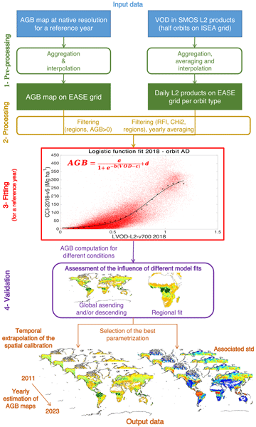
Aboveground biomass (AGB) is a critical component of the Earth's carbon cycle. The presented dataset aims to help monitor this essential climate variable with AGB time series from 2011 onward, derived with a carefully calibrated spatial relationship between the measurements of the Soil Moisture and Ocean Salinity (SMOS) mission and pre-existing AGB maps. The produced dataset has been extensively compared with other available AGB time series and can be used in AGB studies.
Remi Madelon, Nemesio J. Rodríguez-Fernández, Hassan Bazzi, Nicolas Baghdadi, Clement Albergel, Wouter Dorigo, and Mehrez Zribi
Hydrol. Earth Syst. Sci., 27, 1221–1242, https://doi.org/10.5194/hess-27-1221-2023, https://doi.org/10.5194/hess-27-1221-2023, 2023
Short summary
Short summary
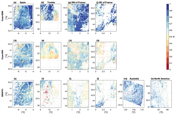
We present an approach to estimate soil moisture (SM) at 1 km resolution using Sentinel-1 and Sentinel-3 satellites. The estimates were compared to other high-resolution (HR) datasets over Europe, northern Africa, Australia, and North America, showing good agreement. However, the discrepancies between the different HR datasets and their lower performances compared with in situ measurements and coarse-resolution datasets show the remaining challenges for large-scale HR SM mapping.
Emma Bousquet, Arnaud Mialon, Nemesio Rodriguez-Fernandez, Stéphane Mermoz, and Yann Kerr
Biogeosciences, 19, 3317–3336, https://doi.org/10.5194/bg-19-3317-2022, https://doi.org/10.5194/bg-19-3317-2022, 2022
Short summary
Short summary
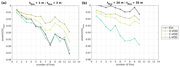
Pre- and post-fire values of four climate variables and four vegetation variables were analysed at the global scale, in order to observe (i) the general fire likelihood factors and (ii) the vegetation recovery trends over various biomes. The main result of this study is that L-band vegetation optical depth (L-VOD) is the most impacted vegetation variable and takes the longest to recover over dense forests. L-VOD could then be useful for post-fire vegetation recovery studies.
Ekaterina Vorobeva, Yvan Orsolini, Patricia de Rosnay, Jonathan Day, Retish Senan, Damien Decremer, and Frederic Vitart
The Cryosphere, 20, 4605–4618, https://doi.org/10.5194/tc-20-4605-2026, https://doi.org/10.5194/tc-20-4605-2026, 2026
Short summary
Short summary
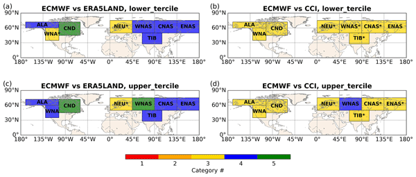
How reliable are probabilistic seasonal snow forecasts in winter? Although they are routinely issued by operational prediction centres, their reliability has never been evaluated. We close this gap by analyzing 30 years of seasonal snow re-forecasts and evaluating them against two snow datasets. Our results provide comprehensive assessment of seasonal snow forecast reliability and offer new insights into their performance in different parts of the Northern Hemisphere.
Manu Holmberg, Mike Schwank, Andreas Colliander, Juliette Ortet, Juha Lemmetyinen, Yiwen Zhou, Philippe Richaume, Cristina Vittucci, Kimmo Rautiainen, Arnaud Mialon, and Yann Kerr
EGUsphere, https://doi.org/10.5194/egusphere-2026-2927, https://doi.org/10.5194/egusphere-2026-2927, 2026
This preprint is open for discussion and under review for Geoscientific Model Development (GMD).
Short summary
Short summary
Satellites measuring long-wavelength microwaves provide essential information on soil moisture, frozen ground, snow, and forests, which matter for climate and weather. Turning these measurements into useful information requires physical models of how the land surface emits microwaves. This paper presents and tests one such model using data from two satellites and three field sites. The results clarify the model's assumptions, show where it works, and identify the main sources of uncertainty.
Nina Raoult, Ewan Pinnington, Mario Santa Cruz, Florian Pinault, Baudouin Raoult, Natalie Zelenka, Gabriele Arduini, Gianpaolo Balsamo, Souhail Boussetta, Matthew Chantry, Patricia de Rosnay, Peter Dueben, and Christoph Rüdiger
EGUsphere, https://doi.org/10.5194/egusphere-2026-3620, https://doi.org/10.5194/egusphere-2026-3620, 2026
Short summary
Short summary
The land surface shapes our weather and climate by controlling how heat and water move between the ground and the air, so the models representing it matter enormously. But they are costly to run and carry built-in errors. We built a faster artificial-intelligence version of one, then used real measurements from sites worldwide to correct some of these errors. The result stays reliable over years and better captures these heat and water exchanges—a quicker, more accurate tool for forecasting.
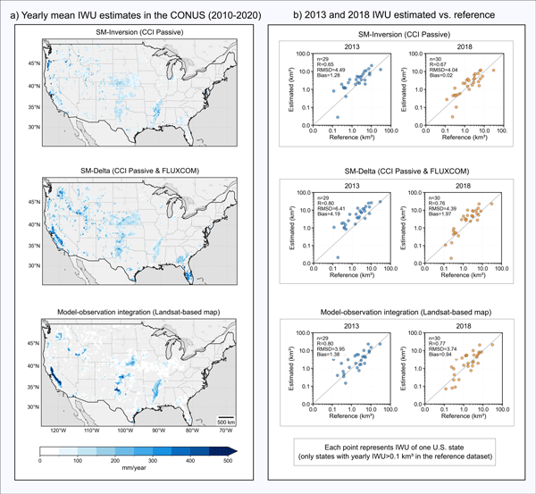
Pierre Laluet, Jacopo Dari, Louise Busschaert, Zdenko Heyvaert, Gabrielle De Lannoy, Pia Langhans, Sara Modanesi, Christian Massari, Luca Brocca, Carla Saltalippi, Renato Morbidelli, Clément Albergel, and Wouter Dorigo
Earth Syst. Sci. Data, 18, 4833–4853, https://doi.org/10.5194/essd-18-4833-2026, https://doi.org/10.5194/essd-18-4833-2026, 2026
Short summary
Short summary
We developed a long-term dataset collection of irrigation water use based on about two decades of satellite observations, three distinct approaches, and many input datasets. The collection provides monthly estimates for major agricultural regions and helps describe how irrigation varies across locations, seasons, and years. It offers a foundation for improving how irrigation is quantified, compared across methods, and integrated into large-scale hydrological and climate studies.
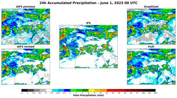
Gabriel Moldovan, Ewan Pinnington, Ana Prieto Nemesio, Simon Lang, Zied Ben Bouallègue, Jesper Dramsch, Mihai Alexe, Mario Santa Cruz, Sara Hahner, Harrison Cook, Helen Theissen, Mariana Clare, Cathal O'Brien, Jan Polster, Linus Magnusson, Gert Mertes, Florian Pinault, Baudouin Raoult, Patricia de Rosnay, Richard Forbes, and Matthew Chantry
Geosci. Model Dev., 19, 4703–4724, https://doi.org/10.5194/gmd-19-4703-2026, https://doi.org/10.5194/gmd-19-4703-2026, 2026
Short summary
Short summary
We present the latest release of the Artificial Intelligence Forecasting System, AIFS 1.1.0, which shows improved headline forecasting skill through an expanded dataset and enhanced training schedule. The model also incorporates hard physical constraints that facilitate training and improve rainfall prediction. Finally, we extend the set of forecasted variables to include soil conditions and energy-related fields, strengthening the operational value of AIFS.
Franklin Robertson, Michael Bosilovich, Matthew Rodell, Richard Allan, Bryant Loomis, Hiroko Beaudoing, Joaquin Munoz-Sabater, and Jason Roberts
EGUsphere, https://doi.org/10.5194/egusphere-2026-2539, https://doi.org/10.5194/egusphere-2026-2539, 2026
Short summary
Short summary
Water availability for societies and ecosystems depends upon Terrestrial Water Storage (TWS). By exploiting Gravity Recovery and Climate Experiment gravimetric measurements and TWS reconstructions from reanalysis, global hydrologic modeling and machine learning approaches, we provide evidence that previously documented TWS decline since 2002 extends back to the 1980s and is explained by coincident decline in regional precipitation combined with a growing influence of human water management.
Yann Baehr, Pierre Vanderbecken, Bertrand Bonan, Catherine Robert, Mathieu Regimbeau, François Pimont, Kevyn Raynal, Xiangzhuo Liu, Remi Savazzi, Moncef Garouani, Josiane Mothe, Nemesio Rodriguez-Fernandez, Lionel Jarlan, and Jean-Christophe Calvet
EGUsphere, https://doi.org/10.5194/egusphere-2026-1247, https://doi.org/10.5194/egusphere-2026-1247, 2026
This preprint is open for discussion and under review for Natural Hazards and Earth System Sciences (NHESS).
Short summary
Short summary
This study produced vegetation water content maps to help manage the risk of forest fires in France. Artificial intelligence was used alongside land surface model outputs, satellite data and in situ observations to monitor vegetation stress in real time. The methodology tested has been shown to be robust and spatially consistent.
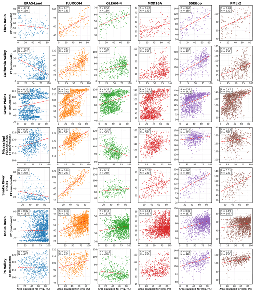
Pierre Laluet, Chiara Corbari, Oscar Baez-Villanueva, Sophia Walther, Yongqiang Zhang, Joaquín Muñoz-Sabater, Clément Albergel, and Wouter Dorigo
Hydrol. Earth Syst. Sci., 30, 1779–1799, https://doi.org/10.5194/hess-30-1779-2026, https://doi.org/10.5194/hess-30-1779-2026, 2026
Short summary
Short summary
We examined how well global datasets estimate evapotranspiration, the water moving from land to the air, in irrigated areas. We compared six widely used products with irrigation maps, satellite estimates, and field measurements across different climate regions. Some datasets better capture irrigation effects, especially those using temperature and vegetation satellite data. This work helps guide dataset selection and supports better inclusion of irrigation in hydrological and climate models.
Pierre Vanderbecken, Jasmin Vural, Oscar Rojas-Munoz, Sébastien Garrigues, Bertrand Bonan, Cédric Bacour, Uwe Rascher, Bastian Siegmann, Patricia de Rosnay, and Jean-Christophe Calvet
EGUsphere, https://doi.org/10.5194/egusphere-2026-941, https://doi.org/10.5194/egusphere-2026-941, 2026
Short summary
Short summary
New satellite observations are used to improve our understanding of regional-scale vegetation. Innovative artificial intelligence methods are employed to combine the available information. The effectiveness of this approach is evaluated using independent observations. The results show that agricultural practices such as irrigation can be modelled more accurately.
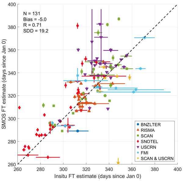
Kimmo Rautiainen, Manu Holmberg, Juval Cohen, Arnaud Mialon, Mike Schwank, Juha Lemmetyinen, Antonio de la Fuente, and Yann Kerr
Earth Syst. Sci. Data, 17, 5337–5353, https://doi.org/10.5194/essd-17-5337-2025, https://doi.org/10.5194/essd-17-5337-2025, 2025
Short summary
Short summary
The SMOS (Soil Moisture and Ocean Salinity) Soil Freeze–Thaw State product uses satellite data to monitor seasonal soil freezing and thawing globally, with a focus on high-latitude regions. This is important for understanding greenhouse gas emissions, as frozen soil is associated with methane release. The product provides accurate data on key events such as the first day of soil freezing in autumn, helping scientists to study climate change, ecosystem dynamics, and its impact on our planet.
Juliette Ortet, Arnaud Mialon, Alain Royer, Mike Schwank, Manu Holmberg, Kimmo Rautiainen, Simone Bircher-Adrot, Andreas Colliander, Yann Kerr, and Alexandre Roy
The Cryosphere, 19, 3571–3598, https://doi.org/10.5194/tc-19-3571-2025, https://doi.org/10.5194/tc-19-3571-2025, 2025
Short summary
Short summary
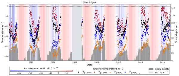
We propose a new method to determine the ground surface temperature under the snowpack in the Arctic area from satellite observations. The obtained ground temperature time series were evaluated over 21 reference sites in Northern Alaska and compared with ground temperatures obtained with global models. The method is extremely promising for monitoring ground temperature below the snowpack and studying the spatio-temporal variability thanks to 15 years of observations over the whole Arctic area.
Wolfgang Knorr, Matthew Williams, Tea Thum, Thomas Kaminski, Michael Voßbeck, Marko Scholze, Tristan Quaife, T. Luke Smallman, Susan C. Steele-Dunne, Mariette Vreugdenhil, Tim Green, Sönke Zaehle, Mika Aurela, Alexandre Bouvet, Emanuel Bueechi, Wouter Dorigo, Tarek S. El-Madany, Mirco Migliavacca, Marika Honkanen, Yann H. Kerr, Anna Kontu, Juha Lemmetyinen, Hannakaisa Lindqvist, Arnaud Mialon, Tuuli Miinalainen, Gaétan Pique, Amanda Ojasalo, Shaun Quegan, Peter J. Rayner, Pablo Reyes-Muñoz, Nemesio Rodríguez-Fernández, Mike Schwank, Jochem Verrelst, Songyan Zhu, Dirk Schüttemeyer, and Matthias Drusch
Geosci. Model Dev., 18, 2137–2159, https://doi.org/10.5194/gmd-18-2137-2025, https://doi.org/10.5194/gmd-18-2137-2025, 2025
Short summary
Short summary
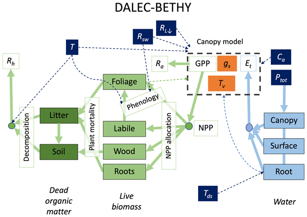
When it comes to climate change, the land surface is where the vast majority of impacts happen. The task of monitoring those impacts across the globe is formidable and must necessarily rely on satellites – at a significant cost: the measurements are only indirect and require comprehensive physical understanding. We have created a comprehensive modelling system that we offer to the research community to explore how satellite data can be better exploited to help us capture the changes that happen on our lands.
Zhu Deng, Philippe Ciais, Liting Hu, Adrien Martinez, Marielle Saunois, Rona L. Thompson, Kushal Tibrewal, Wouter Peters, Brendan Byrne, Giacomo Grassi, Paul I. Palmer, Ingrid T. Luijkx, Zhu Liu, Junjie Liu, Xuekun Fang, Tengjiao Wang, Hanqin Tian, Katsumasa Tanaka, Ana Bastos, Stephen Sitch, Benjamin Poulter, Clément Albergel, Aki Tsuruta, Shamil Maksyutov, Rajesh Janardanan, Yosuke Niwa, Bo Zheng, Joël Thanwerdas, Dmitry Belikov, Arjo Segers, and Frédéric Chevallier
Earth Syst. Sci. Data, 17, 1121–1152, https://doi.org/10.5194/essd-17-1121-2025, https://doi.org/10.5194/essd-17-1121-2025, 2025
Short summary
Short summary
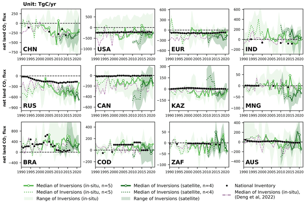
This study reconciles national greenhouse gas (GHG) inventories with updated atmospheric inversion results to evaluate discrepancies for three principal GHG fluxes at the national level. Compared to our previous study, new satellite-based CO2 inversions were included and an updated mask of managed lands was used, improving agreement for Brazil and Canada. The proposed methodology can be regularly applied as a check to assess the gap between top-down inversions and bottom-up inventories.
Simon Boitard, Arnaud Mialon, Stéphane Mermoz, Nemesio J. Rodríguez-Fernández, Philippe Richaume, Julio César Salazar-Neira, Stéphane Tarot, and Yann H. Kerr
Earth Syst. Sci. Data, 17, 1101–1119, https://doi.org/10.5194/essd-17-1101-2025, https://doi.org/10.5194/essd-17-1101-2025, 2025
Short summary
Short summary
Aboveground biomass (AGB) is a critical component of the Earth's carbon cycle. The presented dataset aims to help monitor this essential climate variable with AGB time series from 2011 onward, derived with a carefully calibrated spatial relationship between the measurements of the Soil Moisture and Ocean Salinity (SMOS) mission and pre-existing AGB maps. The produced dataset has been extensively compared with other available AGB time series and can be used in AGB studies.
Gab Abramowitz, Anna Ukkola, Sanaa Hobeichi, Jon Cranko Page, Mathew Lipson, Martin G. De Kauwe, Samuel Green, Claire Brenner, Jonathan Frame, Grey Nearing, Martyn Clark, Martin Best, Peter Anthoni, Gabriele Arduini, Souhail Boussetta, Silvia Caldararu, Kyeungwoo Cho, Matthias Cuntz, David Fairbairn, Craig R. Ferguson, Hyungjun Kim, Yeonjoo Kim, Jürgen Knauer, David Lawrence, Xiangzhong Luo, Sergey Malyshev, Tomoko Nitta, Jerome Ogee, Keith Oleson, Catherine Ottlé, Phillipe Peylin, Patricia de Rosnay, Heather Rumbold, Bob Su, Nicolas Vuichard, Anthony P. Walker, Xiaoni Wang-Faivre, Yunfei Wang, and Yijian Zeng
Biogeosciences, 21, 5517–5538, https://doi.org/10.5194/bg-21-5517-2024, https://doi.org/10.5194/bg-21-5517-2024, 2024
Short summary
Short summary
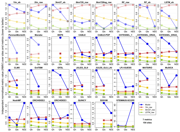
This paper evaluates land models – computer-based models that simulate ecosystem dynamics; land carbon, water, and energy cycles; and the role of land in the climate system. It uses machine learning and AI approaches to show that, despite the complexity of land models, they do not perform nearly as well as they could given the amount of information they are provided with about the prediction problem.
Malak Sadki, Gaëtan Noual, Simon Munier, Vanessa Pedinotti, Kaushlendra Verma, Clément Albergel, Sylvain Biancamaria, and Alice Andral
Hydrol. Earth Syst. Sci. Discuss., https://doi.org/10.5194/hess-2024-328, https://doi.org/10.5194/hess-2024-328, 2024
Revised manuscript accepted for HESS
Short summary
Short summary
This study explores how 20 years of remote-sensed discharge data from the ESA CCI improve large-scale hydrological models, CTRIP and MGB, through data assimilation. Using an EnKF framework across the Niger and Congo basins, it shows how assimilating denser temporal discharge data reduces biases and improves flow variability, enhancing accuracy. These findings underscore the role of long-term discharge data in refining models for climate assessments, water management, and forecasting.
Gregory Duveiller, Mark Pickering, Joaquin Muñoz-Sabater, Luca Caporaso, Souhail Boussetta, Gianpaolo Balsamo, and Alessandro Cescatti
Geosci. Model Dev., 16, 7357–7373, https://doi.org/10.5194/gmd-16-7357-2023, https://doi.org/10.5194/gmd-16-7357-2023, 2023
Short summary
Short summary
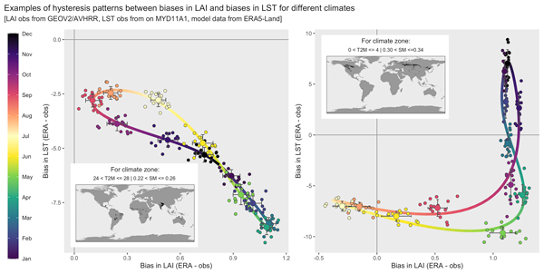
Some of our best tools to describe the state of the land system, including the intensity of heat waves, have a problem. The model currently assumes that the number of leaves in ecosystems always follows the same cycle. By using satellite observations of when leaves are present, we show that capturing the yearly changes in this cycle is important to avoid errors in estimating surface temperature. We show that this has strong implications for our capacity to describe heat waves across Europe.
Samuel Scherrer, Gabriëlle De Lannoy, Zdenko Heyvaert, Michel Bechtold, Clement Albergel, Tarek S. El-Madany, and Wouter Dorigo
Hydrol. Earth Syst. Sci., 27, 4087–4114, https://doi.org/10.5194/hess-27-4087-2023, https://doi.org/10.5194/hess-27-4087-2023, 2023
Short summary
Short summary
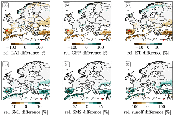
We explored different options for data assimilation (DA) of the remotely sensed leaf area index (LAI). We found strong biases between LAI predicted by Noah-MP and observations. LAI DA that does not take these biases into account can induce unphysical patterns in the resulting LAI and flux estimates and leads to large changes in the climatology of root zone soil moisture. We tested two bias-correction approaches and explored alternative solutions to treating bias in LAI DA.
Remi Madelon, Nemesio J. Rodríguez-Fernández, Hassan Bazzi, Nicolas Baghdadi, Clement Albergel, Wouter Dorigo, and Mehrez Zribi
Hydrol. Earth Syst. Sci., 27, 1221–1242, https://doi.org/10.5194/hess-27-1221-2023, https://doi.org/10.5194/hess-27-1221-2023, 2023
Short summary
Short summary
We present an approach to estimate soil moisture (SM) at 1 km resolution using Sentinel-1 and Sentinel-3 satellites. The estimates were compared to other high-resolution (HR) datasets over Europe, northern Africa, Australia, and North America, showing good agreement. However, the discrepancies between the different HR datasets and their lower performances compared with in situ measurements and coarse-resolution datasets show the remaining challenges for large-scale HR SM mapping.
Wei Li, Jie Chen, Lu Li, Yvan J. Orsolini, Yiheng Xiang, Retish Senan, and Patricia de Rosnay
The Cryosphere, 16, 4985–5000, https://doi.org/10.5194/tc-16-4985-2022, https://doi.org/10.5194/tc-16-4985-2022, 2022
Short summary
Short summary
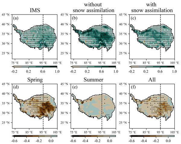
Snow assimilation over the Tibetan Plateau (TP) may influence seasonal forecasts over this region. To investigate the impacts of snow assimilation on the seasonal forecasts of snow, temperature and precipitation, twin ensemble reforecasts are initialized with and without snow assimilation above 1500 m altitude over the TP for spring and summer in 2018. The results show that snow assimilation can improve seasonal forecasts over the TP through the interaction between land and atmosphere.
Arsène Druel, Simon Munier, Anthony Mucia, Clément Albergel, and Jean-Christophe Calvet
Geosci. Model Dev., 15, 8453–8471, https://doi.org/10.5194/gmd-15-8453-2022, https://doi.org/10.5194/gmd-15-8453-2022, 2022
Short summary
Short summary
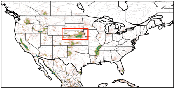
Crop phenology and irrigation is implemented into a land surface model able to work at a global scale. A case study is presented over Nebraska (USA). Simulations with and without the new scheme are compared to different satellite-based observations. The model is able to produce a realistic yearly irrigation water amount. The irrigation scheme improves the simulated leaf area index, gross primary productivity, evapotransipiration, and land surface temperature.
Emma Bousquet, Arnaud Mialon, Nemesio Rodriguez-Fernandez, Stéphane Mermoz, and Yann Kerr
Biogeosciences, 19, 3317–3336, https://doi.org/10.5194/bg-19-3317-2022, https://doi.org/10.5194/bg-19-3317-2022, 2022
Short summary
Short summary
Pre- and post-fire values of four climate variables and four vegetation variables were analysed at the global scale, in order to observe (i) the general fire likelihood factors and (ii) the vegetation recovery trends over various biomes. The main result of this study is that L-band vegetation optical depth (L-VOD) is the most impacted vegetation variable and takes the longest to recover over dense forests. L-VOD could then be useful for post-fire vegetation recovery studies.
Robin van der Schalie, Mendy van der Vliet, Clément Albergel, Wouter Dorigo, Piotr Wolski, and Richard de Jeu
Hydrol. Earth Syst. Sci., 26, 3611–3627, https://doi.org/10.5194/hess-26-3611-2022, https://doi.org/10.5194/hess-26-3611-2022, 2022
Short summary
Short summary
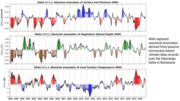
Climate data records of surface soil moisture, vegetation optical depth, and land surface temperature can be derived from passive microwave observations. The ability of these datasets to properly detect anomalies and extremes is very valuable in climate research and can especially help to improve our insight in complex regions where the current climate reanalysis datasets reach their limitations. Here, we present a case study over the Okavango Delta, where we focus on inter-annual variability.
Anthony Mucia, Bertrand Bonan, Clément Albergel, Yongjun Zheng, and Jean-Christophe Calvet
Biogeosciences, 19, 2557–2581, https://doi.org/10.5194/bg-19-2557-2022, https://doi.org/10.5194/bg-19-2557-2022, 2022
Short summary
Short summary
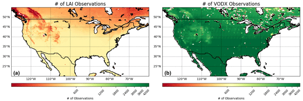
For the first time, microwave vegetation optical depth data are assimilated in a land surface model in order to analyze leaf area index and root zone soil moisture. The advantage of microwave products is the higher observation frequency. A large variety of independent datasets are used to verify the added value of the assimilation. It is shown that the assimilation is able to improve the representation of soil moisture, vegetation conditions, and terrestrial water and carbon fluxes.
Zhu Deng, Philippe Ciais, Zitely A. Tzompa-Sosa, Marielle Saunois, Chunjing Qiu, Chang Tan, Taochun Sun, Piyu Ke, Yanan Cui, Katsumasa Tanaka, Xin Lin, Rona L. Thompson, Hanqin Tian, Yuanzhi Yao, Yuanyuan Huang, Ronny Lauerwald, Atul K. Jain, Xiaoming Xu, Ana Bastos, Stephen Sitch, Paul I. Palmer, Thomas Lauvaux, Alexandre d'Aspremont, Clément Giron, Antoine Benoit, Benjamin Poulter, Jinfeng Chang, Ana Maria Roxana Petrescu, Steven J. Davis, Zhu Liu, Giacomo Grassi, Clément Albergel, Francesco N. Tubiello, Lucia Perugini, Wouter Peters, and Frédéric Chevallier
Earth Syst. Sci. Data, 14, 1639–1675, https://doi.org/10.5194/essd-14-1639-2022, https://doi.org/10.5194/essd-14-1639-2022, 2022
Short summary
Short summary
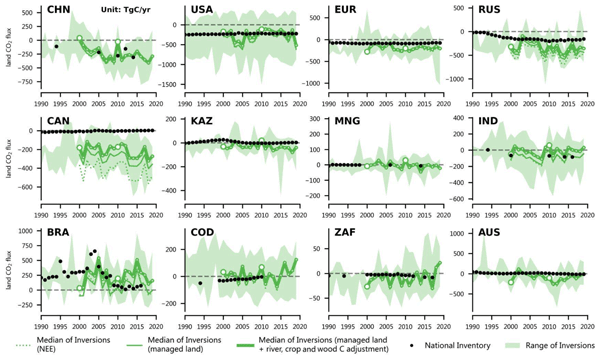
In support of the global stocktake of the Paris Agreement on climate change, we proposed a method for reconciling the results of global atmospheric inversions with data from UNFCCC national greenhouse gas inventories (NGHGIs). Here, based on a new global harmonized database that we compiled from the UNFCCC NGHGIs and a comprehensive framework presented in this study to process the results of inversions, we compared their results of carbon dioxide (CO2), methane (CH4), and nitrous oxide (N2O).
Heye Reemt Bogena, Martin Schrön, Jannis Jakobi, Patrizia Ney, Steffen Zacharias, Mie Andreasen, Roland Baatz, David Boorman, Mustafa Berk Duygu, Miguel Angel Eguibar-Galán, Benjamin Fersch, Till Franke, Josie Geris, María González Sanchis, Yann Kerr, Tobias Korf, Zalalem Mengistu, Arnaud Mialon, Paolo Nasta, Jerzy Nitychoruk, Vassilios Pisinaras, Daniel Rasche, Rafael Rosolem, Hami Said, Paul Schattan, Marek Zreda, Stefan Achleitner, Eduardo Albentosa-Hernández, Zuhal Akyürek, Theresa Blume, Antonio del Campo, Davide Canone, Katya Dimitrova-Petrova, John G. Evans, Stefano Ferraris, Félix Frances, Davide Gisolo, Andreas Güntner, Frank Herrmann, Joost Iwema, Karsten H. Jensen, Harald Kunstmann, Antonio Lidón, Majken Caroline Looms, Sascha Oswald, Andreas Panagopoulos, Amol Patil, Daniel Power, Corinna Rebmann, Nunzio Romano, Lena Scheiffele, Sonia Seneviratne, Georg Weltin, and Harry Vereecken
Earth Syst. Sci. Data, 14, 1125–1151, https://doi.org/10.5194/essd-14-1125-2022, https://doi.org/10.5194/essd-14-1125-2022, 2022
Short summary
Short summary
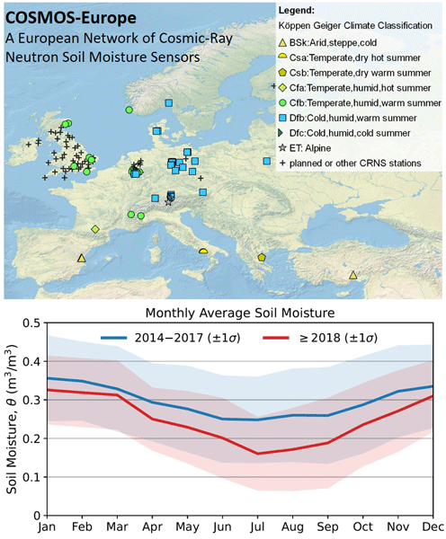
Monitoring of increasingly frequent droughts is a prerequisite for climate adaptation strategies. This data paper presents long-term soil moisture measurements recorded by 66 cosmic-ray neutron sensors (CRNS) operated by 24 institutions and distributed across major climate zones in Europe. Data processing followed harmonized protocols and state-of-the-art methods to generate consistent and comparable soil moisture products and to facilitate continental-scale analysis of hydrological extremes.
Cited articles
Aires, F., Prigent, C., and Rossow, W.: Neural network uncertainty assessment using Bayesian statistics with application to remote sensing: 3. Network Jacobians, J. Geophys. Res.-Atmos., 109, 2156–2202, https://doi.org/10.1029/2003JD004175, 2004.
Albergel, C., Rüdiger, C., Carrer, D., Calvet, J.-C., Fritz, N., Naeimi, V., Bartalis, Z., and Hasenauer, S.: An evaluation of ASCAT surface soil moisture products with in-situ observations in Southwestern France, Hydrol. Earth Syst. Sci., 13, 115–124, https://doi.org/10.5194/hess-13-115-2009, 2009.
Albergel, C., de Rosnay, P., Gruhier, C., Muñoz-Sabater, J., Hasenauer, S., Isaksen, L., Kerr, Y., and Wagner, W.: Evaluation of remotely sensed and modelled soil moisture products using global ground-based in situ observations, Remote Sens. Environ., 118, 215–226, 2012.
Al Bitar, A., Leroux, D., Kerr, Y. H., Merlin, O., Richaume, P., Sahoo, A., and Wood, E.: Evaluation of SMOS Soil Moisture Products Over Continental US Using the SCAN/SNOTEL Network, IEEE T. Geosci. Remote, 50, 1572–1586, https://doi.org/10.1109/TGRS.2012.2186581, 2012.
Al Bitar, A., Mialon, A., Kerr, Y., Cabot, F., Richaume, P., Jacquette, E., Quesney, A., Mahmoodi, A., Tarot, S., Parrens, M., Al-yaari, A., Pellarin, T., Rodriguez-Fernandez, N., and Wigneron, J.-P.: The Global SMOS Level 3 daily soil moisture and brightness temperature maps, Earth Syst. Sci. Data, 9, 293–315, https://doi.org/10.5194/essd-9-293-2017, 2017.
Alvarez-Garreton, C., Ryu, D., Western, A. W., Crow, W. T., Su, C.-H., and Robertson, D. R.: Dual assimilation of satellite soil moisture to improve streamflow prediction in data-scarce catchments, Water Resour. Res., 52, 5357–5375, 2016.
Al-Yaari, A., Wigneron, J.-P., Ducharne, A., Kerr, Y., De Rosnay, P., De Jeu, R., Govind, A., Al Bitar, A., Albergel, C., Munoz-Sabater, J., Richaume, P., and Mialon, A.: Global-scale evaluation of two satellite-based passive microwave soil moisture datasets (SMOS and AMSR-E) with respect to Land Data Assimilation System estimates, Remote Sens. Environ., 149, 181–195, 2014a.
Al-Yaari, A., Wigneron, J.-P., Ducharne, A., Kerr, Y., Wagner, W., De Lannoy, G., Reichle, R., Al Bitar, A., Dorigo, W., Richaume, P., and Mialon, A.: Global-scale comparison of passive (SMOS) and active (ASCAT) satellite based microwave soil moisture retrievals with soil moisture simulations (MERRA-Land), Remote Sens. Environ., 152, 614–626, 2014b.
Anterrieu, E. and Khazaal, A.: Brightness Temperature Map Reconstruction from Dual-Polarimetric Visibilities in Synthetic Aperture Imaging Radiometry, IEEE T. Geosci. Remote, 46, 606–612, https://doi.org/10.1109/TGRS.2007.914799, 2008.
Barbu, A. L., Calvet, J.-C., Mahfouf, J.-F., and Lafont, S.: Integrating ASCAT surface soil moisture and GEOV1 leaf area index into the SURFEX modelling platform: a land data assimilation application over France, Hydrol. Earth Syst. Sci., 18, 173–192, https://doi.org/10.5194/hess-18-173-2014, 2014.
Bartalis, Z., Wagner, W., Naeimi, V., Hasenauer, S., Scipal, K., Bonekamp, H., Figa, J., and Anderson, C.: Initial soil moisture retrievals from the METOP-A Advanced Scatterometer (ASCAT), Geophys. Res. Lett., 34, 20401, https://doi.org/10.1029/2007GL031088, 2007.
Bell, J., Palecki, M., Baker, C., Collins, W., Lawrimore, J., Leeper, R., Hall, M., Kochendorfer, J., Meyers, T., Wilson, T., and Diamond, H.: U.S. Climate Reference Network soil moisture and temperature observations, J. Hydrometeorol., 14, 977–988, 2013.
Bircher, S., Skou, N., and Kerr, Y. H.: Validation of SMOS L1C and L2 Products and Important Parameters of the Retrieval Algorithm in the Skjern River Catchment, Western Denmark, IEEE T. Geoscience Remote, 51, 2969–2985, https://doi.org/10.1109/TGRS.2012.2215041, 2013.
Blankenship, C. B., Case, J. L., Zavodsky, B. T., and Crosson, W. L.: Assimilation of SMOS Retrievals in the Land Information System, IEEE T. Geosci. Remote, 54, 6320–6332, https://doi.org/10.1109/TGRS.2016.2579604, 2016.
Brocca, L., Pellarin, T., Crow, W. T., Ciabatta, L., Massari, C., Ryu, D., Su, C.-H., Rüdiger, C., and Kerr, Y.: Rainfall estimation by inverting SMOS soil moisture estimates: A comparison of different methods over Australia, J. Geophys. Res.-Atmos., 121, 12062–12079, https://doi.org/10.1002/2016JD025382, 2016.
Burgin, M., Colliander, A., Njoku, E. G., Chan, S., Cabot, F., Kerr, Y., Bindlish, R., Jackson, T., Entekhabi, D., and Yueh, S.: A Comparative Study of the SMAP Passive Soil Moisture Product with existing Satellite-Based Soil Moisture Products, IEEE T. Geosci. Remote, 55, 2959–2971, https://doi.org/10.1109/TGRS.2017.2656859, 2017.
Cenci, L., Laiolo, P., Gabellani, S., Campo, L., Silvestro, F., Delogu, F., Boni, G., and Rudari, R.: Assimilation of H-SAF Soil Moisture Products for Flash Flood Early Warning Systems. Case Study: Mediterranean Catchments, IEEE J. Select. Top. Appl. Earth Obs. Rem. Sens., 9, 5634–5646, 2016.
Chen, F., Crow, W. T., Starks, P. J., and Moriasi, D. N.: Improving hydrologic predictions of a catchment model via assimilation of surface soil moisture, Adv. Water Resour., 34, 526–536, 2011.
Choudhury, B. J., Schmugge, T. J., and Mo, T.: A parameterization of effective soil-temperature for microwave emission, J. Geophys. Res.-Oceans, 87, 1301–1304, 1982.
Crow, W. T., Huffman, G. J., Bindlish, R., and Jackson, T. J.: Improving satellite-based rainfall accumulation estimates using spaceborne surface soil moisture retrievals, J. Hydrometeorol., 10, 199–212, 2009.
de Rosnay, P., Dragosavac, M., Drusch, M., Gutiérrez, A., Rodríguez López, M., Wright, N., Muñoz Sabater, J., and Crapolicchio, R.: SMOS NRT BUFR specification, SMOS-NRT-BUFR-ECMWF – v2.0, ECMWF, Reading, UK, 2012.
de Rosnay, P., Drusch, M., Vasiljevic, D., Balsamo, G., Albergel, C., and Isaksen, L.: A simplified Extended Kalman Filter for the global operational soil moisture analysis at ECMWF, Q. J. Royal Meteorol. Soc., 139, 1199–1213, 2013.
Dharssi, I., Bovis, K. J., Macpherson, B., and Jones, C. P.: Operational assimilation of ASCAT surface soil wetness at the Met Office, Hydrol. Earth Syst. Sci., 15, 2729–2746, https://doi.org/10.5194/hess-15-2729-2011, 2011.
Dorigo, W. A., Wagner, W., Hohensinn, R., Hahn, S., Paulik, C., Xaver, A., Gruber, A., Drusch, M., Mecklenburg, S., van Oevelen, P., Robock, A., and Jackson, T.: The International Soil Moisture Network: a data hosting facility for global in situ soil moisture measurements, Hydrol. Earth Syst. Sci., 15, 1675–1698, https://doi.org/10.5194/hess-15-1675-2011, 2011.
Ferrazzoli, P., Guerriero, L., and Wigneron, J.-P.: Simulating L-band emission of forests in view of future satellite applications, IEEE T. Geosci. Remote, 40, 2700–2708, 2002.
Gruber, A., Dorigo, W. A., Zwieback, S., and Wagner, W.: Characterizing Coarse-Scale Representativeness of in situ Soil Moisture Measurements from the International Soil Moisture Network, Vadose Zone J., 12, 2013, https://doi.org/10.2136/vzj2012.0170, 2012.
Gutierrez, A. and Canales Molina, A.: SMOS NRT Product Format Specification, Tech. Rep. SO-ID-DMS-GS-0002, DEIMOS Space, Madrid, Spain, 2010.
Hawke, R. and McConchie, J.: In situ measurement of soil moisture and pore-water pressures in an “incipient” landslide: Lake Tutira, New Zealand, J. Environ. Manage., 92, 266–274, 2011.
Jackson, T. J., Bindlish, R., Cosh, M. H., Zhao, T., Starks, P. J., Bosch, D. D., Seyfried, M., Moran, M. S., Goodrich, D. C., Kerr, Y. H., and Leroux, D.: Validation of Soil Moisture and Ocean Salinity (SMOS) soil moisture over watershed networks in the US, IEEE T. Geosci. Remote, 50, 1530–1543, 2012.
Jackson, T. J., O'Neill, P., Njoku, E., S, C., Bindlish, R., Colliander, A., Chen, F., Burgin, M., Dunbar, S., Piepmeier, J., Cosh, M., Caldwell, T., Walker, J., Wu, X., Berg, A., Rowlandson, T., Pacheco, A., McNairn, H., Thibeault, M., Martínez-Fernández, J., González-Zamora, A., Seyfried, M., Bosch, D., Starks, P., Goodrich, D., Prueger, J., Su, Z., van der Velde, R., Asanuma, J., Palecki, M., Small, E., Zreda, M., Calvet, J., Crow, W., Kerr, Y., Yueh, S., and Entekhabi, D.: Calibration and Validation for the L2/3-SM-P Version 3 Data Products, Tech. rep., SMAP Project, JPL D-93720, Jet Propulsion Laboratory, Pasadena, CA, 2016.
Kerr, Y. H., Waldteufel, P., Wigneron, J.-P., Delwart, S., Cabot, F., Boutin, J., Escorihuela, M.-J., Font, J., Reul, N., Gruhier, C., Juglea, S., Drinkwater, M., Hahne, A., Martin-Neira, M., and Mecklenburg, S.: The SMOS Mission: New Tool for Monitoring Key Elements ofthe Global Water Cycle, Proc. IEEE, 98, 666–687, https://doi.org/10.1109/JPROC.2010.2043032, 2010.
Kerr, Y. H., Waldteufel, P., Richaume, P., Wigneron, J., Ferrazzoli, P., Mahmoodi, A., Al Bitar, A., Cabot, F., Gruhier, C., Juglea, S., Leroux, D., Mialon, A., and Delwart, S.: The SMOS Soil Moisture Retrieval Algorithm, IEEE T. Geosci. Remote, 50, 1384–1403, https://doi.org/10.1109/TGRS.2012.2184548, 2012.
Kerr, Y. H., Al-Yaari, A., Rodriguez-Fernandez, N., Parrens, M., Molero, B., Leroux, D., Bircher, S., Mahmoodi, A., Mialon, A., Richaume, P., Delwart, S., Al Bitar, A., Pellarin, T., Bindlish, R., Jackson, T., Rüdiger C., Waldteufel, P., Mecklenburg, S., and Wigneron, J. P.: Overview of SMOS performance in terms of global soil moisture monitoring after six years in operation, Remote Sens. Environ., 180, 40–63, 2016.
Koster, R. D., Dirmeyer, P. A., Guo, Z., Bonan, G., Chan, E., Cox, P., Gordon, C., Kanae, S., Kowalczyk, E., Lawrence, D., Liu, P., Lu, C.-H., Malyshev, S., McAvaney, B., Mitchell, K., Mocko, D., Oki, T., Oleson, K., Pitman, A., Sud, Y. C., Taylor, C. M., Verseghy, D., Vasic, R., Xue, Y., and Yamada, T.: Regions of strong coupling between soil moisture and precipitation, Science, 305, 1138–1140, 2004.
Lahoz, W. A. and De Lannoy, G. J.: Closing the gaps in our knowledge of the hydrological cycle over land: conceptual problems, Surv. Geophys., 35, 623–660, 2014.
Leroux, D. J.: Analyses statistiques et modèles d'inversion pour la validation des données d'humidité des sols de la mission SMOS, http://tel.archives-ouvertes.fr/tel-00776536/ (last access: 12 October 2017), 2012.
Leroux, D. J., Kerr, Y. H., Al Bitar, A., Bindlish, R., Jackson, T. J., Berthelot, B., and Portet, G.: Comparison between SMOS, VUA, ASCAT, and ECMWF soil moisture products over four watersheds in US, IEEE T. Geosci. Remote, 52, 1562–1571, 2014.
Lievens, H., De Lannoy, G., Al Bitar, A., Drusch, M., Dumedah, G., Franssen, H.-J. H., Kerr, Y., Tomer, S. K., Martens, B., Merlin, O., Pan, M., Roundy, J., Vereecken, H., Walker, J., Wood, E., Verhoest, N., and Pauwels, V.: Assimilation of SMOS soil moisture and brightness temperature products into a land surface model, Remote Sens. Environ., 180, 292–304, 2016.
Louvet, S., Pellarin, T., al Bitar, A., Cappelaere, B., Galle, S., Grippa, M., Gruhier, C., Kerr, Y., Lebel, T., Mialon, A., Mougin, E., Quantin, G., Richaume, P., and de Rosnay, P.: SMOS soil moisture product evaluation over West-Africa from local to regional scale, Remote Sens. Environ., 156, 383–394, 2015.
Martens, B., Miralles, D., Lievens, H., Fernández-Prieto, D., and Verhoest, N.: Improving terrestrial evaporation estimates over continental Australia through assimilation of SMOS soil moisture, Int. J. Appl. Earth Obs. Geoinf., 48, 146–162, 2016.
McColl, K. A., Alemohammad, S. H., Akbar, R., Konings, A. G., Yueh, S., and Entekhabi, D.: The global distribution and dynamics of surface soil moisture, Nat. Geosci., 10, 100–104, 2017.
Mecklenburg, S., Drusch, M., Kerr, Y. H., Font, J., Martin-Neira, M., Delwart, S., Buenadicha, G., Reul, N., Daganzo-Eusebio, E., Oliva, R., and Crapolicchio, R.: ESA's Soil Moisture and Ocean Salinity Mission: Mission Performance and Operations, IEEE T. Geosci. Remote, 50, 1354–1366, https://doi.org/10.1109/TGRS.2012.2187666, 2012.
Montosi, E., Manzoni, S., Porporato, A., and Montanari, A.: An ecohydrological model of malaria outbreaks, Hydrol. Earth Syst. Sci., 16, 2759–2769, https://doi.org/10.5194/hess-16-2759-2012, 2012.
Muñoz-Sabater, J.: Incorporation of passive microwave Brightness Temperatures in the ECMWF soil moisture analysis, Remote Sensing, 7, 5758–5784, 2015.
Muñoz Sabater, J., Jarlan, L., Calvet, J.-C., Bouyssel, F., and De Rosnay, P.: From near-surface to root-zone soil moisture using different assimilation techniques, J. Hydrometeorol., 8, 194–206, 2007.
Muñoz Sabater, J., Fouilloux, A., and de Rosnay, P.: Technical implementation of SMOS data in the ECMWF Integrated Forecasting System, IEEE Geosci. Remote Sens. Lett., 9, 252–256, 2012.
Muñoz-Sabater, J., Rodríguez-Fernández, N. J., Richaume, P., de Rosnay, P., and Kerr, Y. H.: SMOS Near-Real-Time Soil Moisture processor, Tech. Rep. ECMWF ESA report, ECMWF, Reading, UK, 2016.
Norbiato, D., Borga, M., Degli Esposti, S., Gaume, E., and Anquetin, S.: Flash flood warning based on rainfall thresholds and soil moisture conditions: An assessment for gauged and ungauged basins, J. Hydrol., 362, 274–290, 2008.
Pauwels, V. R., Hoeben, R., Verhoest, N. E., De Troch, F. P., and Troch, P. A.: Improvement of TOPLATS-based discharge predictions through assimilation of ERS-based remotely sensed soil moisture values, Hydrol. Process., 16, 995–1013, 2002.
Pellarin, T., Ali, A., Chopin, F., Jobard, I., and Bergès, J.-C.: Using spaceborne surface soil moisture to constrain satellite precipitation estimates over West Africa, Geophys. Res. Lett., 35, L02813, https://doi.org/10.1029/2007GL032243, 2008.
Peters, J., Conte, A., Verhoest, N. E., De Clercq, E., Goffredo, M., De Baets, B., Hendrickx, G., Ducheyne, E.: On the relation between soil moisture dynamics and the geographical distribution of Culicoides imicola, Ecohydrology, 7, 622–632, 2014.
Ponziani, F., Pandolfo, C., Stelluti, M., Berni, N., Brocca, L., and Moramarco, T.: Assessment of rainfall thresholds and soil moisture modeling for operational hydrogeological risk prevention in the Umbria region (central Italy), Landslides, 9, 229–237, 2012.
Ray, R. L., Jacobs, J. M., and Cosh, M. H.: Landslide susceptibility mapping using downscaled AMSR-E soil moisture: A case study from Cleveland Corral, California, US, Remote Sens. Environ., 114, 2624–2636, 2010.
Ridler, M.-E., Madsen, H., Stisen, S., Bircher, S., and Fensholt, R.: Assimilation of SMOS-derived soil moisture in a fully integrated hydrological and soil–vegetation–atmosphere transfer model in Western Denmark, Water Resour. Res., 50, 8962–8981, 2014.
Rodríguez-Fernández, N. J., Richaume, P., Aires, F., Prigent, C., Kerr, Y. H., Kolassa, J., Jiménez, C., Cabot, F., and Mahmoodi, A.: Soil moisture retrieval from SMOS observations using neural networks, Tech. Rep. SMOS Ground Segment SO-TN-CB-GS-038, CESBIO, Toulouse, France, 2013.
Rodríguez-Fernández, N. J., Aires, F., Richaume, P., Kerr, Y. H., Prigent, C., Kolassa, J., Cabot, F., Jiménez, C., Mahmoodi, A., and Drusch, M.: Soil moisture retrieval using neural networks: application to SMOS, IEEE T. Geosci. Remote, 53, 5991–6007, https://doi.org/10.1109/TGRS.2015.2430845, 2015.
Rodríguez-Fernández, N. J., Richaume, P., Muñoz-Sabater, J., de Rosnay, P., and Kerr, Y. H.: SMOS Near-Real-Time Soil Moisture processor. Recommended neural network configuration and algorithm description, Tech. Rep. SMOS Ground Segment SO-TN-CB-GS-049, CESBIO, Toulouse, France, 2016.
Sahr, K., White, D., and Kimerling, A. J.: Geodesic discrete global grid systems cartography, Cartogr. Geogr. Inf. Sci., 30, 121–134, 2003.
Schaefer, G., Cosh, M., and Jackson, T.: The USDA natural resources conservation service soil climate analysis network (SCAN), J. Atmos. Ocean. Tech., 24, 2073–2077, 2007.
Scholze, M., Kaminski, T., Knorr, W., Blessing, S., Vossbeck, M., Grant, J., and Scipal, K.: Simultaneous assimilation of SMOS soil moisture and atmospheric CO2 in-situ observations to constrain the global terrestrial carbon cycle, Remote Sens. Environ., 180, 334–345, 2016.
Seneviratne, S. I., Lüthi, D., Litschi, M., and Schär, C.: Land–atmosphere coupling and climate change in Europe, Nature, 443, 205–209, 2006.
Tuttle, S. and Salvucci, G.: Empirical evidence of contrasting soil moisture–precipitation feedbacks across the United States, Science, 352, 825–828, 2016.
Van der Schalie, R., Kerr, Y., Wigneron, J., Rodríguez-Fernández, N., Al-Yaari, A., and de Jeu, R.: Global SMOS soil moisture retrievals from the land parameter retrieval model, Int. J. Appl. Earth Obs. Geoinf., 45, 125–134, 2016.
Wagner, W., Lemoine, G., and Rott, H.: A Method for Estimating Soil Moisture from ERS Scatterometer and Soil Data, Remote Sens. Environ., 70, 191–207, https://doi.org/10.1016/S0034-4257(99)00036-X, 1999.
Wagner, W., Hahn, S., Kidd, R., Melzer, T., Bartalis, Z., Hasenauer, S., Figa-Saldaña, J., de Rosnay, P., Jann, A., Schneider, S., Komma, J., Kubu, G., Brugger, K., Aubrecht, C., Züger, J., Gangkofner, U., Kienberger, S., Brocca, L., Wang, Y., Blöschl, G., Eitzinger, J., Steinnocher, K., Zeil, P., and Rubel, F.: The ASCAT soil moisture product: A review of its specifications, validation results, and emerging applications, Meteorol. Z., 22, 5–33, 2013.
Wanders, N., Karssenberg, D., Bierkens, M., Parinussa, R., de Jeu, R., van Dam, J., and de Jong, S.: Observation uncertainty of satellite soil moisture products determined with physically-based modeling, Remote Sens. Environ., 127, 341–356, 2012.
Wanders, N., Karssenberg, D., de Roo, A., de Jong, S. M., and Bierkens, M. F. P.: The suitability of remotely sensed soil moisture for improving operational flood forecasting, Hydrol. Earth Syst. Sci., 18, 2343–2357, https://doi.org/10.5194/hess-18-2343-2014, 2014.
Wigneron, J. P., Laguerre, L., and Kerr, Y. H.: A simple parameterization of the L-band microwave emission from rough agricultural soils, IEEE T. Geosci. Remote, 39, 1697–1707, 2001.
Wigneron, J.-P., Kerr, Y., Waldteufel, P., Saleh, K., Escorihuela, M.-J., Richaume, P., Ferrazzoli, P., De Rosnay, P., Gurney, R., Calvet, J.-C., Grant, J., Guglielmetti, M., Hornbuckle, B., Mätzler, C., Pellarin, T., and Schwank, M.: L-band Microwave Emission of the Biosphere (L-MEB) Model: Description and calibration against experimental data sets over crop fields, Remote Sens. Environ., 107, 639–655, 2007.
Xu, X., Tolson, B. A., Li, J., Staebler, R. M., Seglenieks, F., Haghnegahdar, A., and Davison, B.: Assimilation of SMOS soil moisture over the Great Lakes basin, Remote Sens. Environ., 169, 163–175, 2015.
Short summary
The new SMOS satellite near-real-time (NRT) soil moisture (SM) product based on a neural network is presented. The NRT SM product has been evaluated with respect to the SMOS Level 2 product and against a large number of in situ measurements showing performances similar to those of the Level 2 product but it is available in less than 3.5 h after sensing. The new product is distributed by the European Space Agency and the European Organisation for the Exploitation of Meteorological Satellites.
The new SMOS satellite near-real-time (NRT) soil moisture (SM) product based on a neural network...


