
Articles | Volume 30, issue 17
https://doi.org/10.5194/hess-30-5571-2026
© Author(s) 2026. This work is distributed under
the Creative Commons Attribution 4.0 License.
the Creative Commons Attribution 4.0 License.
https://doi.org/10.5194/hess-30-5571-2026
© Author(s) 2026. This work is distributed under
the Creative Commons Attribution 4.0 License.
the Creative Commons Attribution 4.0 License.
Technical note
| 
08 Sep 2026
Technical note |
| 08 Sep 2026
| 08 Sep 2026
Technical note: HydroModPy (v1.0) – a Python toolbox for deploying catchment-scale shallow groundwater models
Alexandre Gauvain
CORRESPONDING AUTHOR

Geosciences Rennes – UMR 6118, CNRS, Université de Rennes, Rennes, France
Laboratoire de Météorologie Dynamique (LMD), CNRS, Sorbonne Université, Paris, France
Geosciences Rennes – UMR 6118, CNRS, Université de Rennes, Rennes, France
Centre for Hydrogeology and Geothermics (CHYN), Université de Neuchâtel, Neuchâtel, Switzerland
UMR SAS 1069, INRAE, Institut Agro Rennes‐Angers, Rennes, France
Bastien Boivin
Geosciences Rennes – UMR 6118, CNRS, Université de Rennes, Rennes, France
Alexandre Coche
Geosciences Rennes – UMR 6118, CNRS, Université de Rennes, Rennes, France
Martin Le Mesnil
Geosciences Rennes – UMR 6118, CNRS, Université de Rennes, Rennes, France
Tristan Babey
Geosciences Rennes – UMR 6118, CNRS, Université de Rennes, Rennes, France
Enzo Maugan
Geosciences Rennes – UMR 6118, CNRS, Université de Rennes, Rennes, France
Théa Touzeau
Geosciences Rennes – UMR 6118, CNRS, Université de Rennes, Rennes, France
Imene Issolah
Inria, IRISA, CNRS, Université de Rennes, Rennes, France
Clément Roques
Centre for Hydrogeology and Geothermics (CHYN), Université de Neuchâtel, Neuchâtel, Switzerland
Camille Bouchez
Geosciences Rennes – UMR 6118, CNRS, Université de Rennes, Rennes, France
Jean Marçais
UR RiverLy, INRAE, Villeurbanne, France
Sarah Leray
Departamento de Ingeniería Hidráulica y Ambiental, Pontificia Universidad Cat´lica de Chile, Santiago, Chile
Etienne Marti
Departamento de Ingeniería Hidráulica y Ambiental, Pontificia Universidad Cat´lica de Chile, Santiago, Chile
Etienne Bresciani
Instituto de Ciencias de la Ingeniería, Universidad de O'Higgins, Rancagua, Chile
Ronny Figueroa
Centre for Hydrogeology and Geothermics (CHYN), Université de Neuchâtel, Neuchâtel, Switzerland
Mathias Pélissier
Centre for Hydrogeology and Geothermics (CHYN), Université de Neuchâtel, Neuchâtel, Switzerland
Simon Carlier
Centre for Hydrogeology and Geothermics (CHYN), Université de Neuchâtel, Neuchâtel, Switzerland
Luca Guillaumot
Water, Environment, Processes and Analyses Division, BRGM – French Geological Survey, Orléans, France
Rock S. Bagagnan
Geosciences Rennes – UMR 6118, CNRS, Université de Rennes, Rennes, France
Camille Vautier
Geosciences Rennes – UMR 6118, CNRS, Université de Rennes, Rennes, France
Laurent Longuevergne
Geosciences Rennes – UMR 6118, CNRS, Université de Rennes, Rennes, France
June Sallou
INF, Wageningen University & Research, Wageningen, Netherlands
Johan Bourcier
ISA/LIUPPA, Université de Pau et des Pays de l'Adour, Pau, France
Benoit Combemale
Inria, IRISA, CNRS, Université de Rennes, Rennes, France
Philip Brunner
Centre for Hydrogeology and Geothermics (CHYN), Université de Neuchâtel, Neuchâtel, Switzerland
Luc Aquilina
Geosciences Rennes – UMR 6118, CNRS, Université de Rennes, Rennes, France
Jean-Raynald de Dreuzy
Geosciences Rennes – UMR 6118, CNRS, Université de Rennes, Rennes, France
Related authors
Alexandre Gauvain, François Forget, Martin Turbet, Jean-Baptiste Clément, Lucas Lange, and Romain Vandemeulebrouck
Geosci. Model Dev., 19, 6909–6940, https://doi.org/10.5194/gmd-19-6909-2026, https://doi.org/10.5194/gmd-19-6909-2026, 2026
Short summary
Short summary
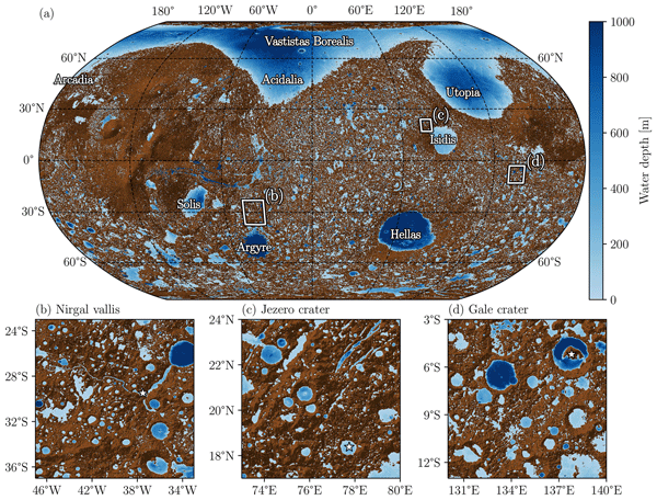
In this paper, we present a global high-resolution hydrological model to investigate how water may have once flowed and accumulated on Mars. Using detailed topography, the model tracks how lakes and seas form, grow, merge, overflow, and dry out over time. It reveals how a vast northern ocean could emerge from smaller bodies of water. This approach links surface landforms to past climates, offering new perspectives on Mars' watery history and its potential habitability.
Alexandre Gauvain, Ronan Abhervé, Alexandre Coche, Martin Le Mesnil, Clément Roques, Camille Bouchez, Jean Marçais, Sarah Leray, Etienne Marti, Ronny Figueroa, Etienne Bresciani, Camille Vautier, Bastien Boivin, June Sallou, Johan Bourcier, Benoit Combemale, Philip Brunner, Laurent Longuevergne, Luc Aquilina, and Jean-Raynald de Dreuzy
EGUsphere, https://doi.org/10.5194/egusphere-2024-3962, https://doi.org/10.5194/egusphere-2024-3962, 2025
Preprint archived
Short summary
Short summary
HydroModPy is an open-source toolbox that makes it easier to study and model groundwater flow at catchment scale. By combining mapping tools with groundwater modeling, it automates the process of building, analyzing and deploying aquifer models. This allows researchers to simulate groundwater flow that sustains stream baseflows, providing insights for the hydrology community. Designed to be accessible and customizable, HydroModPy supports sustainable water management, research, and education.
Ronan Abhervé, Clément Roques, Alexandre Gauvain, Laurent Longuevergne, Stéphane Louaisil, Luc Aquilina, and Jean-Raynald de Dreuzy
Hydrol. Earth Syst. Sci., 27, 3221–3239, https://doi.org/10.5194/hess-27-3221-2023, https://doi.org/10.5194/hess-27-3221-2023, 2023
Short summary
Short summary
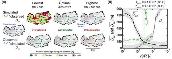
We propose a model calibration method constraining groundwater seepage in the hydrographic network. The method assesses the hydraulic properties of aquifers in regions where perennial streams are directly fed by groundwater. The estimated hydraulic conductivity appear to be highly sensitive to the spatial extent and density of streams. Such an approach improving subsurface characterization from surface information is particularly interesting for ungauged basins.
Jean-Raynald de Dreuzy, Sarah Leray, and Jean Marçais
EGUsphere, https://doi.org/10.5194/egusphere-2026-5201, https://doi.org/10.5194/egusphere-2026-5201, 2026
This preprint is open for discussion and under review for Geoscientific Model Development (GMD).
Short summary
Short summary
PyAges is an open-source tool for estimating groundwater age from elements and compounds in the water that act as tracers. It separates tracer histories, age models and calibration methods into reusable components and provides a numerical scheme for repeated calculations with uncertainty. Tests against independent calculations, existing software and two field examples confirm its performance and show how repeated observations can reduce ambiguity or reveal inconsistent assumptions.
Philippe Steer, Lucas Pelascini, and Laurent Longuevergne
EGUsphere, https://doi.org/10.5194/egusphere-2026-4142, https://doi.org/10.5194/egusphere-2026-4142, 2026
Short summary
Short summary
Landslides tend to rupture in predictable size patterns, but working out where and how deep a slope will fail has remained difficult. We built a simple slope stability model, that calculates the most likely rupture depth and shape at each point on a landscape. The model reproduced real landslide size patterns. This model also revealed the slopes which are still adjusting after past geological change, like river carving or cathment divide migration, helping pinpoint landslide-prone terrain.
Alexandre Gauvain, François Forget, Martin Turbet, Jean-Baptiste Clément, Lucas Lange, and Romain Vandemeulebrouck
Geosci. Model Dev., 19, 6909–6940, https://doi.org/10.5194/gmd-19-6909-2026, https://doi.org/10.5194/gmd-19-6909-2026, 2026
Short summary
Short summary
In this paper, we present a global high-resolution hydrological model to investigate how water may have once flowed and accumulated on Mars. Using detailed topography, the model tracks how lakes and seas form, grow, merge, overflow, and dry out over time. It reveals how a vast northern ocean could emerge from smaller bodies of water. This approach links surface landforms to past climates, offering new perspectives on Mars' watery history and its potential habitability.
Juan Pablo Sierra, Pierre Brigode, Pape Saara Ngom, Pascale Braconnot, Christian Le Carlier De Veslud, Camille Bouchez, Sly Wongchuig, Mohamed Osman Awaleh, Mohamed Jalludin, Natacha Volto, Eric Chaumillon, and Marie Revel
EGUsphere, https://doi.org/10.5194/egusphere-2026-3724, https://doi.org/10.5194/egusphere-2026-3724, 2026
Short summary
Short summary
We studied multidecadal changes in water availability in the Awash Basin in Ethiopia using lakes as a natural indicator of regional climate. By combining a hydrological model with satellite/ground observations, we reconstructed lake history from 1985 to 2024. We find strong interannual variability linked to climate modes in the Pacific and Indian Oceans, and a strong increasing trend in lake size driven by changes in rainfall and evaporation linked to shifts in regional atmospheric circulation.
Álvaro Pardo-Álvarez, Jan H. Fleckenstein, Kalliopi Koutantou, and Philip Brunner
Geosci. Model Dev., 19, 3923–3951, https://doi.org/10.5194/gmd-19-3923-2026, https://doi.org/10.5194/gmd-19-3923-2026, 2026
Short summary
Short summary
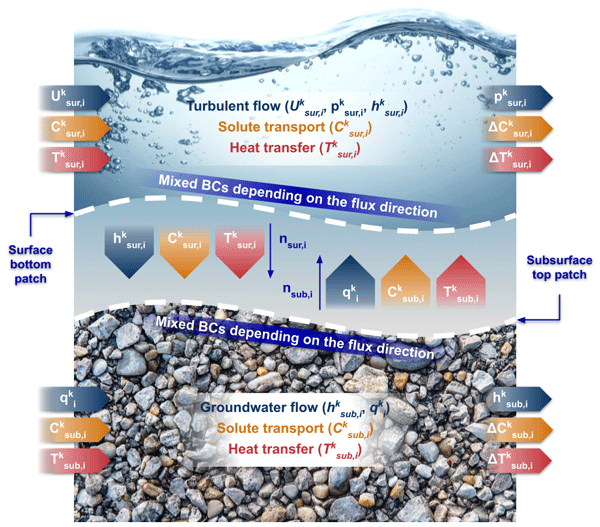
An upgraded version of a numerical solver is introduced to better capture the 3D interactions between surface water and groundwater. Built using open-source software, the custom solver adds new features to handle the complexity of real environments, including the representation of subsurface geology and the simulation of diverse dynamic processes, such as solute transport and heat transfer, in both domains. A test case and a full description of the novel features are provided in this paper.
Alex Naoki Asato Kobayashi, Clément Roques, Daniel Hunkeler, Edward A. D. Mitchell, Robin Calisti, and Philip Brunner
Geosci. Instrum. Method. Data Syst., 14, 435–446, https://doi.org/10.5194/gi-14-435-2025, https://doi.org/10.5194/gi-14-435-2025, 2025
Short summary
Short summary
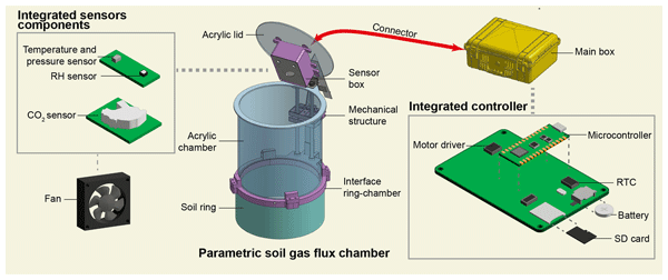
The increasing impact of climate change and human activities on greenhouse gas emissions highlights the need for effective monitoring, especially from the soil. Our design introduces a low-cost solution for measuring soil gas flux that is adaptable to various environments. Additionally, we propose a novel method for ensuring data quality before deploying these systems in the field.
Etienne Marti, Sarah Leray, and Clément Roques
Hydrol. Earth Syst. Sci., 29, 5665–5676, https://doi.org/10.5194/hess-29-5665-2025, https://doi.org/10.5194/hess-29-5665-2025, 2025
Short summary
Short summary
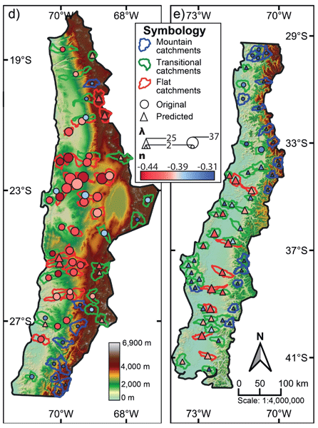
This study shows that the response of groundwater-dependent wetlands to recharge changes can be predicted from landform properties alone. Mountain catchments are less sensitive to recharge changes than flat ones, due to fewer but more persistent seepage areas. These results support a scalable approach to assessing wetland vulnerability to climate change, with practical implications for water resource management and conservation planning in diverse landscapes.
Judith Eeckman, Brian De Grenus, Floreana Marie Miesen, James Thornton, Philip Brunner, and Nadav Peleg
Hydrol. Earth Syst. Sci., 29, 4093–4107, https://doi.org/10.5194/hess-29-4093-2025, https://doi.org/10.5194/hess-29-4093-2025, 2025
Short summary
Short summary
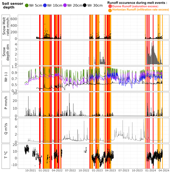
The fate of liquid water from melting snow in winter and spring is difficult to understand in the mountains. This work uses a multi-instrumental network to accurately monitor the dynamics of snowmelt and infiltration at different depths in the ground and at different altitudes. The results show that melting snow quickly infiltrates into the upper layers of the soil but is also quickly transferred through the soil along the slopes towards the river.
Hannes Müller Schmied, Simon Newland Gosling, Marlo Garnsworthy, Laura Müller, Camelia-Eliza Telteu, Atiq Kainan Ahmed, Lauren Seaby Andersen, Julien Boulange, Peter Burek, Jinfeng Chang, He Chen, Lukas Gudmundsson, Manolis Grillakis, Luca Guillaumot, Naota Hanasaki, Aristeidis Koutroulis, Rohini Kumar, Guoyong Leng, Junguo Liu, Xingcai Liu, Inga Menke, Vimal Mishra, Yadu Pokhrel, Oldrich Rakovec, Luis Samaniego, Yusuke Satoh, Harsh Lovekumar Shah, Mikhail Smilovic, Tobias Stacke, Edwin Sutanudjaja, Wim Thiery, Athanasios Tsilimigkras, Yoshihide Wada, Niko Wanders, and Tokuta Yokohata
Geosci. Model Dev., 18, 2409–2425, https://doi.org/10.5194/gmd-18-2409-2025, https://doi.org/10.5194/gmd-18-2409-2025, 2025
Short summary
Short summary
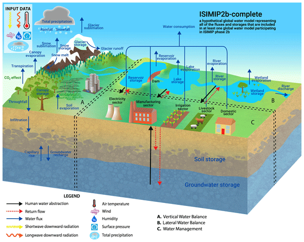
Global water models contribute to the evaluation of important natural and societal issues but are – as all models – simplified representation of reality. So, there are many ways to calculate the water fluxes and storages. This paper presents a visualization of 16 global water models using a standardized visualization and the pathway towards this common understanding. Next to academic education purposes, we envisage that these diagrams will help researchers, model developers, and data users.
Cyprien Louis, Landon J. S. Halloran, and Clément Roques
Hydrol. Earth Syst. Sci., 29, 1505–1523, https://doi.org/10.5194/hess-29-1505-2025, https://doi.org/10.5194/hess-29-1505-2025, 2025
Short summary
Short summary
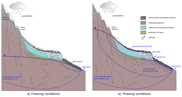
We investigate the freeze–thaw cycles of a rock glacier located in Switzerland and their influence on subsurface hydrology. By analyzing aerial pictures, we estimate the evolution of its creeping velocity on an inter-annual scale. We use geochemical tracers measured at springs to identify the mixing of meltwater and deep groundwater on seasonal to diurnal timescales. This study provides new insights into the cryo-hydrogeological processes that regulate water fluxes in mountain regions.
Alexandre Gauvain, Ronan Abhervé, Alexandre Coche, Martin Le Mesnil, Clément Roques, Camille Bouchez, Jean Marçais, Sarah Leray, Etienne Marti, Ronny Figueroa, Etienne Bresciani, Camille Vautier, Bastien Boivin, June Sallou, Johan Bourcier, Benoit Combemale, Philip Brunner, Laurent Longuevergne, Luc Aquilina, and Jean-Raynald de Dreuzy
EGUsphere, https://doi.org/10.5194/egusphere-2024-3962, https://doi.org/10.5194/egusphere-2024-3962, 2025
Preprint archived
Short summary
Short summary
HydroModPy is an open-source toolbox that makes it easier to study and model groundwater flow at catchment scale. By combining mapping tools with groundwater modeling, it automates the process of building, analyzing and deploying aquifer models. This allows researchers to simulate groundwater flow that sustains stream baseflows, providing insights for the hydrology community. Designed to be accessible and customizable, HydroModPy supports sustainable water management, research, and education.
Qi Tang, Hugo Delottier, Wolfgang Kurtz, Lars Nerger, Oliver S. Schilling, and Philip Brunner
Geosci. Model Dev., 17, 3559–3578, https://doi.org/10.5194/gmd-17-3559-2024, https://doi.org/10.5194/gmd-17-3559-2024, 2024
Short summary
Short summary
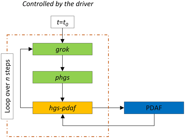
We have developed a new data assimilation framework by coupling an integrated hydrological model HydroGeoSphere with the data assimilation software PDAF. Compared to existing hydrological data assimilation systems, the advantage of our newly developed framework lies in its consideration of the physically based model; its large selection of different assimilation algorithms; and its modularity with respect to the combination of different types of observations, states and parameters.
Ronan Abhervé, Clément Roques, Alexandre Gauvain, Laurent Longuevergne, Stéphane Louaisil, Luc Aquilina, and Jean-Raynald de Dreuzy
Hydrol. Earth Syst. Sci., 27, 3221–3239, https://doi.org/10.5194/hess-27-3221-2023, https://doi.org/10.5194/hess-27-3221-2023, 2023
Short summary
Short summary
We propose a model calibration method constraining groundwater seepage in the hydrographic network. The method assesses the hydraulic properties of aquifers in regions where perennial streams are directly fed by groundwater. The estimated hydraulic conductivity appear to be highly sensitive to the spatial extent and density of streams. Such an approach improving subsurface characterization from surface information is particularly interesting for ungauged basins.
Hugo Delottier, John Doherty, and Philip Brunner
Geosci. Model Dev., 16, 4213–4231, https://doi.org/10.5194/gmd-16-4213-2023, https://doi.org/10.5194/gmd-16-4213-2023, 2023
Short summary
Short summary
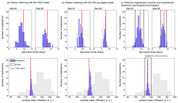
Long run times are usually a barrier to the quantification and reduction of predictive uncertainty with complex hydrological models. Data space inversion (DSI) provides an alternative and highly model-run-efficient method for uncertainty quantification. This paper demonstrates DSI's ability to robustly quantify predictive uncertainty and extend the methodology to provide practical metrics that can guide data acquisition and analysis to achieve goals of decision-support modelling.
Thomas Hermans, Pascal Goderniaux, Damien Jougnot, Jan H. Fleckenstein, Philip Brunner, Frédéric Nguyen, Niklas Linde, Johan Alexander Huisman, Olivier Bour, Jorge Lopez Alvis, Richard Hoffmann, Andrea Palacios, Anne-Karin Cooke, Álvaro Pardo-Álvarez, Lara Blazevic, Behzad Pouladi, Peleg Haruzi, Alejandro Fernandez Visentini, Guilherme E. H. Nogueira, Joel Tirado-Conde, Majken C. Looms, Meruyert Kenshilikova, Philippe Davy, and Tanguy Le Borgne
Hydrol. Earth Syst. Sci., 27, 255–287, https://doi.org/10.5194/hess-27-255-2023, https://doi.org/10.5194/hess-27-255-2023, 2023
Short summary
Short summary
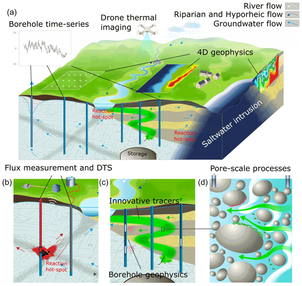
Although invisible, groundwater plays an essential role for society as a source of drinking water or for ecosystems but is also facing important challenges in terms of contamination. Characterizing groundwater reservoirs with their spatial heterogeneity and their temporal evolution is therefore crucial for their sustainable management. In this paper, we review some important challenges and recent innovations in imaging and modeling the 4D nature of the hydrogeological systems.
Luca Guillaumot, Laurent Longuevergne, Jean Marçais, Nicolas Lavenant, and Olivier Bour
Hydrol. Earth Syst. Sci., 26, 5697–5720, https://doi.org/10.5194/hess-26-5697-2022, https://doi.org/10.5194/hess-26-5697-2022, 2022
Short summary
Short summary
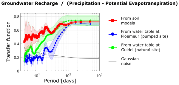
Recharge, defining the renewal rate of groundwater resources, is difficult to estimate at basin scale. Here, recharge variations are inferred from water table variations recorded in boreholes. First, results show that aquifer-scale properties controlling these variations can be inferred from boreholes. Second, groundwater is recharged by both intense and seasonal rainfall. Third, the short-term contribution appears overestimated in recharge models and depends on the unsaturated zone thickness.

Clément Roques, David E. Rupp, Jean-Raynald de Dreuzy, Laurent Longuevergne, Elizabeth R. Jachens, Gordon Grant, Luc Aquilina, and John S. Selker
Hydrol. Earth Syst. Sci., 26, 4391–4405, https://doi.org/10.5194/hess-26-4391-2022, https://doi.org/10.5194/hess-26-4391-2022, 2022
Short summary
Short summary
Streamflow dynamics are directly dependent on contributions from groundwater, with hillslope heterogeneity being a major driver in controlling both spatial and temporal variabilities in recession discharge behaviors. By analysing new model results, this paper identifies the major structural features of aquifers driving streamflow dynamics. It provides important guidance to inform catchment-to-regional-scale models, with key geological knowledge influencing groundwater–surface water interactions.
Guilherme E. H. Nogueira, Christian Schmidt, Daniel Partington, Philip Brunner, and Jan H. Fleckenstein
Hydrol. Earth Syst. Sci., 26, 1883–1905, https://doi.org/10.5194/hess-26-1883-2022, https://doi.org/10.5194/hess-26-1883-2022, 2022
Short summary
Short summary
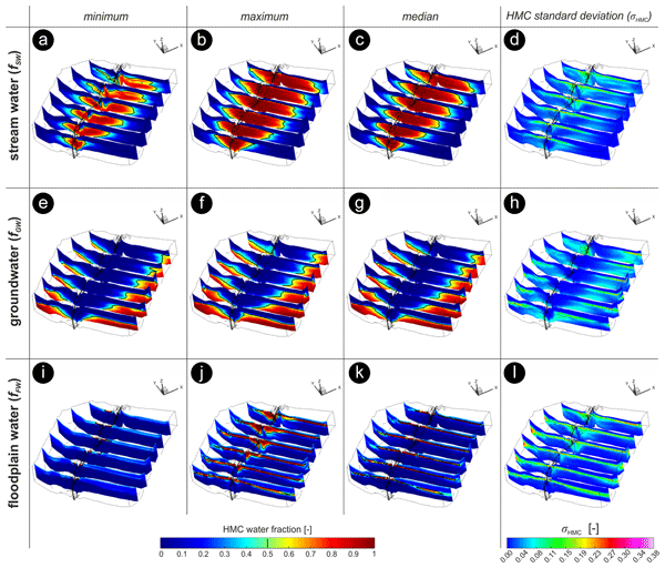
In near-stream aquifers, mixing between stream water and ambient groundwater can lead to dilution and the removal of substances that can be harmful to the water ecosystem at high concentrations. We used a numerical model to track the spatiotemporal evolution of different water sources and their mixing around a stream, which are rather difficult in the field. Results show that mixing mainly develops as narrow spots, varying In time and space, and is affected by magnitudes of discharge events.
Tom Gleeson, Thorsten Wagener, Petra Döll, Samuel C. Zipper, Charles West, Yoshihide Wada, Richard Taylor, Bridget Scanlon, Rafael Rosolem, Shams Rahman, Nurudeen Oshinlaja, Reed Maxwell, Min-Hui Lo, Hyungjun Kim, Mary Hill, Andreas Hartmann, Graham Fogg, James S. Famiglietti, Agnès Ducharne, Inge de Graaf, Mark Cuthbert, Laura Condon, Etienne Bresciani, and Marc F. P. Bierkens
Geosci. Model Dev., 14, 7545–7571, https://doi.org/10.5194/gmd-14-7545-2021, https://doi.org/10.5194/gmd-14-7545-2021, 2021
Short summary
Short summary
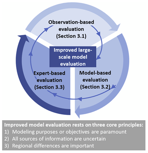
Groundwater is increasingly being included in large-scale (continental to global) land surface and hydrologic simulations. However, it is challenging to evaluate these simulations because groundwater is
hiddenunderground and thus hard to measure. We suggest using multiple complementary strategies to assess the performance of a model (
model evaluation).
Cited articles
Abhervé, R., Roques, C., Gauvain, A., Longuevergne, L., Louaisil, S., Aquilina, L., and Dreuzy, J. R. D.: Calibration of groundwater seepage against the spatial distribution of the stream network to assess catchment-scale hydraulic properties, Hydrol. Earth Syst. Sci., 27, 3221–3239, https://doi.org/10.5194/hess-27-3221-2023, 2023. a, b, c
Abhervé, R., Roques, C., de Dreuzy, J. R., Datry, T., Brunner, P., Longuevergne, L., and Aquilina, L.: Improving calibration of groundwater flow models using headwater streamflow intermittence, Hydrol. Process., 38, e15167, https://doi.org/10.1002/HYP.15167, 2024. a
Abhervé, R., Roques, C., de Dreuzy, J.-R., Van Der Veen, T., Dumaine, L., Chatton, E., Brunner, P., Aquilina, L., and Servière, L.: Projected Climate Change Impacts on Groundwater–Surface Water Connectivity in a Compartmentalized Mountain Headwater Bedrock Aquifer, Water Resour. Res., 61, e2025WR040083, https://doi.org/10.1029/2025WR040083, 2025. a
Ackerer, J., Kuppel, S., Braud, I., Pasquet, S., Fovet, O., Probst, A., Pierret, M. C., Ruiz, L., Tallec, T., Lesparre, N., Weill, S., Flechard, C., Probst, J. L., Marçais, J., Riviere, A., Habets, F., Anquetin, S., and Gaillardet, J.: Exploring the Critical Zone Heterogeneity and the Hydrological Diversity Using an Integrated Ecohydrological Model in Three Contrasted Long-Term Observatories, Water Resour. Res., 59, e2023WR035672, https://doi.org/10.1029/2023WR035672, 2023. a
Ahrens, J., Geveci, B., and Law, C.: ParaView: An End-User Tool for Large Data Visualization, Visualization Handbook, edited by: Hansen, C. D. and Johnson, C. R., Butterworth-Heinemann, Burlington, 717–731, https://doi.org/10.1016/B978-012387582-2/50038-1, 2005. a
Anderson, M. P., Woessner, W. W., and Hunt, R. J.: Applied groundwater modeling: Simulation of Flow and Advective Transport Second Edition, ISBN 9780120581030, 2015. a
Aumar, C., Nevers, P., Abhervé, R., Celle, H., Mailhot, G., Huneau, F., Vergnaud, V., Yvard, B., and Clauzet, M.-L.: Hydrochemical survey, groundwater dating and catchment-scale hydrogeological modelling for enhanced water management on understudied volcanic watershed, in: IAH World Groundwater Congress, IAH International Association of Hydrogeologists, DAVOS, Switzerland, https://hal.science/hal-04847651 (last access: 4 July 2026), 2024. a
Bagagnan, R. S., Abhervé, R., Laverman, A. M., and Vautier, C.: Groundwater controls on legacy antibiotics and pesticides in an intensive agricultural headwater catchment, J. Hydrol., 669, 135118 https://doi.org/10.1016/j.jhydrol.2026.135118, 2026. a
Bakker, M. and Kelson, V. A.: Writing analytic element programs in python, Ground Water, 47, 828–834, https://doi.org/10.1111/j.1745-6584.2009.00583.x, 2009. a
Bakker, M., Post, V., Langevin, C. D., Hughes, J. D., White, J. T., Starn, J. J., and Fienen, M. N.: Scripting MODFLOW Model Development Using Python and FloPy, Groundwater, 54, 733–739, https://doi.org/10.1111/gwat.12413, 2016. a, b
Bedekar, V., Morway, E., Langevin, C., and Tonkin, M.: MT3D-USGS version 1: A U.S. Geological Survey release of MT3DMS updated with new and expanded transport capabilities for use with MODFLOW, Groundwater Resources Program, 84, https://doi.org/10.3133/TM6A53, 2016. a
Bierkens, M. F. P.: Global hydrology 2015: State, trends, and directions, Water Resour. Res., 51, 4923–4947, https://doi.org/10.1002/2015WR017173, 2015. a
Blöschl, G., Bierkens, M. F., Chambel, A., Cudennec, C., Destouni, G., Fiori, A., Kirchner, J. W., McDonnell, J. J., Savenije, H. H., Sivapalan, M., Stumpp, C., Toth, E., Volpi, E., Carr, G., Lupton, C., Salinas, J., Széles, B., Viglione, A., Aksoy, H., Allen, S. T., Amin, A., Andréassian, V., Arheimer, B., Aryal, S. K., Baker, V., Bardsley, E., Barendrecht, M. H., Bartosova, A., Batelaan, O., Berghuijs, W. R., Beven, K., Blume, T., Bogaard, T., de Amorim, P. B., Böttcher, M. E., Boulet, G., Breinl, K., Brilly, M., Brocca, L., Buytaert, W., Castellarin, A., Castelletti, A., Chen, X., Chen, Y., Chen, Y., Chifflard, P., Claps, P., Clark, M. P., Collins, A. L., Croke, B., Dathe, A., David, P. C., de Barros, F. P., de Rooij, G., Baldassarre, G. D., Driscoll, J. M., Duethmann, D., Dwivedi, R., Eris, E., Farmer, W. H., Feiccabrino, J., Ferguson, G., Ferrari, E., Ferraris, S., Fersch, B., Finger, D., Foglia, L., Fowler, K., Gartsman, B., Gascoin, S., Gaume, E., Gelfan, A., Geris, J., Gharari, S., Gleeson, T., Glendell, M., Bevacqua, A. G., González-Dugo, M. P., Grimaldi, S., Gupta, A. B., Guse, B., Han, D., Hannah, D., Harpold, A., Haun, S., Heal, K., Helfricht, K., Herrnegger, M., Hipsey, M., Hlaváčiková, H., Hohmann, C., Holko, L., Hopkinson, C., Hrachowitz, M., Illangasekare, T. H., Inam, A., Innocente, C., Istanbulluoglu, E., Jarihani, B., Kalantari, Z., Kalvans, A., Khanal, S., Khatami, S., Kiesel, J., Kirkby, M., Knoben, W., Kochanek, K., Kohnová, S., Kolechkina, A., Krause, S., Kreamer, D., Kreibich, H., Kunstmann, H., Lange, H., Liberato, M. L., Lindquist, E., Link, T., Liu, J., Loucks, D. P., Luce, C., Mahé, G., Makarieva, O., Malard, J., Mashtayeva, S., Maskey, S., Mas-Pla, J., Mavrova-Guirguinova, M., Mazzoleni, M., Mernild, S., Misstear, B. D., Montanari, A., Müller-Thomy, H., Nabizadeh, A., Nardi, F., Neale, C., Nesterova, N., Nurtaev, B., Odongo, V. O., Panda, S., Pande, S., Pang, Z., Papacharalampous, G., Perrin, C., Pfister, L., Pimentel, R., Polo, M. J., Post, D., Sierra, C. P., Ramos, M. H., Renner, M., Reynolds, J. E., Ridolfi, E., Rigon, R., Riva, M., Robertson, D. E., Rosso, R., Roy, T., Sá, J. H., Salvadori, G., Sandells, M., Schaefli, B., Schumann, A., Scolobig, A., Seibert, J., Servat, E., Shafiei, M., Sharma, A., Sidibe, M., Sidle, R. C., Skaugen, T., Smith, H., Spiessl, S. M., Stein, L., Steinsland, I., Strasser, U., Su, B., Szolgay, J., Tarboton, D., Tauro, F., Thirel, G., Tian, F., Tong, R., Tussupova, K., Tyralis, H., Uijlenhoet, R., van Beek, R., van der Ent, R. J., van der Ploeg, M., Loon, A. F. V., van Meerveld, I., van Nooijen, R., van Oel, P. R., Vidal, J. P., von Freyberg, J., Vorogushyn, S., Wachniew, P., Wade, A. J., Ward, P., Westerberg, I. K., White, C., Wood, E. F., Woods, R., Xu, Z., Yilmaz, K. K., and Zhang, Y.: Twenty-three unsolved problems in hydrology (UPH) – a community perspective, Hydrol. Sci. J., 64, 1141–1158, https://doi.org/10.1080/02626667.2019.1620507, 2019. a
Boivin, B., Coche, A., Abhervé, R., Guillossou, R., Gaubert, J.-Y., Aquilina, L., and de Dreuzy, J.-R.: Coupled surface-water and groundwater modeling approach to optimize drinking-water dam management under climate change impacts, poster presented at the OZCAR-TERENO (Critical Zone Observatories: Research and Application – Terrestrial Environmental Observatories) Conference, https://ozcartereno2025.sciencesconf.org (last access: 4 July 2026), 2025. a
BRGM: BSS – Ouvrages de la Banque du Sous-Sol, https://www.geocatalogue.fr/geonetwork/srv/fre/catalog.search#/metadata/BR_BSS_BAA (last access: 4 July 2026), 2006. a
Clark, M. P., Fan, Y., Lawrence, D. M., Adam, J. C., Bolster, D., Gochis, D. J., Hooper, R. P., Kumar, M., Leung, L. R., Mackay, D. S., Maxwell, R. M., Shen, C., Swenson, S. C., and Zeng, X.: Improving the representation of hydrologic processes in Earth System Models, Water Resour. Res., 51, 5929–5956, https://doi.org/10.1002/2015WR017096, 2015. a, b
Condon, L. E., Kollet, S., Bierkens, M. F., Fogg, G. E., Maxwell, R. M., Hill, M. C., Fransen, H. J. H., Verhoef, A., Loon, A. F. V., Sulis, M., and Abesser, C.: Global Groundwater Modeling and Monitoring: Opportunities and Challenges, Water Resour. Res., 57, e2020WR029500, https://doi.org/10.1029/2020WR029500, 2021. a
Copernicus Climate Change Service, Climate Data Store: CMIP6 climate projections, Copernicus Climate Change Service (C3S) Climate Data Store (CDS) [data set], https://doi.org/10.24381/cds.c866074c, 2021. a
Craig, J. R., Brown, G., Chlumsky, R., Jenkinson, R. W., Jost, G., Lee, K., Mai, J., Serrer, M., Sgro, N., Shafii, M., Snowdon, A. P., and Tolson, B. A.: Flexible watershed simulation with the Raven hydrological modelling framework, Environ. Model. Softw., 129, 104728, https://doi.org/10.1016/J.ENVSOFT.2020.104728, 2020. a
Croteau, A., Nastev, M., and Lefebvre, R.: Groundwater Recharge Assessment in the Chateauguay River Watershed, Can. Water Resour. J., 35, 451–468, https://doi.org/10.4296/CWRJ3504451, 2010. a
de Graaf, I. E., van Beek, R. L., Gleeson, T., Moosdorf, N., Schmitz, O., Sutanudjaja, E. H., and Bierkens, M. F.: A global-scale two-layer transient groundwater model: Development and application to groundwater depletion, Adv. Water Resour., 102, 53–67, https://doi.org/10.1016/j.advwatres.2017.01.011, 2017. a
de Marchi, D.: Voilà dashboards for policy support, Zenodo [data set], https://doi.org/10.5281/zenodo.5082992, 2021. a
Delaigue, O., Brigode, P., Thirel, G., and Coron, L.: airGRteaching: an open-source tool for teaching hydrological modeling with R, Hydrol. Earth Syst. Sci., 27, 3293–3327, https://doi.org/10.5194/hess-27-3293-2023, 2023. a
Dequesne, J. and Portela, S.: Panorama des services et de leur performance (rapport – données 2022), Eaufrance, https://www.eaufrance.fr/publications/panorama-des-services (last access: 4 July 2026), 2024. a
Dewandel, B., Lachassagne, P., Wyns, R., Maréchal, J., and Krishnamurthy, N.: A generalized 3-D geological and hydrogeological conceptual model of granite aquifers controlled by single or multiphase weathering, J. Hydrol., 330, 260–284, https://doi.org/10.1016/j.jhydrol.2006.03.026, 2006. a
Dewandel, B., Boisson, A., Amraoui, N., Caballero, Y., Mougin, B., Baltassat, J. M., and Maréchal, J. C.: Improving our ability to model crystalline aquifers using field data combined with a regionalized approach for estimating the hydraulic conductivity field, J. Hydrol., 601, 126652, https://doi.org/10.1016/J.JHYDROL.2021.126652, 2021. a
Doherty, J.: Calibration and Uncertainty Analysis for Complex Environmental Models, Groundwater, 2, 227, ISBN 978-0-9943786-1-3, 2015. a
Fan, Y., Li, H., and Miguez-Macho, G.: Global Patterns of Groundwater Table Depth, Science, 339, 940–943, https://doi.org/10.1126/science.1229881, 2013. a
Fan, Y., Clark, M., Lawrence, D. M., Swenson, S., Band, L. E., Brantley, S. L., Brooks, P. D., Dietrich, W. E., Flores, A., Grant, G., Kirchner, J. W., Mackay, D. S., McDonnell, J. J., Milly, P. C., Sullivan, P. L., Tague, C., Ajami, H., Chaney, N., Hartmann, A., Hazenberg, P., McNamara, J., Pelletier, J., Perket, J., Rouholahnejad-freund, E., Wagener, T., Zeng, X., Beighley, E., Buzan, J., Huang, M., Livneh, B., Mohanty, B. P., Nijssen, B., Safeeq, M., Shen, C., Verseveld, W., Volk, J., and Yamazaki, D.: Hillslope Hydrology in Global Change Research and Earth System Modeling, Water Resour. Res., 55, 1737–1772, https://doi.org/10.1029/2018WR023903, 2019. a
Floriancic, M. G., Abhervé, R., Bouchez, C., Jimenez-Martinez, J., and Roques, C.: Evidence of Groundwater Seepage and Mixing at the Vicinity of a Knickpoint in a Mountain Stream, Geophys. Res. Lett., 51, e2024GL111325, https://doi.org/10.1029/2024GL111325, 2024. a
Foglia, L., Borsi, I., Mehl, S., Filippis, G. D., Cannata, M., Vasquez-Suñe, E., Criollo, R., and Rossetto, R.: FREEWAT, a Free and Open Source, GIS-Integrated, Hydrological Modeling Platform, Groundwater, 56, 521–523, https://doi.org/10.1111/GWAT.12654, 2018. a
Gaillardet, J., Braud, I., Hankard, F., Anquetin, S., Bour, O., Dorfliger, N., de Dreuzy, J., Galle, S., Galy, C., Gogo, S., Gourcy, L., Habets, F., Laggoun, F., Longuevergne, L., Borgne, T. L., Naaim-Bouvet, F., Nord, G., Simonneaux, V., Six, D., Tallec, T., Valentin, C., Abril, G., Allemand, P., Arènes, A., Arfib, B., Arnaud, L., Arnaud, N., Arnaud, P., Audry, S., Comte, V. B., Batiot, C., Battais, A., Bellot, H., Bernard, E., Bertrand, C., Bessière, H., Binet, S., Bodin, J., Bodin, X., Boithias, L., Bouchez, J., Boudevillain, B., Moussa, I. B., Branger, F., Braun, J. J., Brunet, P., Caceres, B., Calmels, D., Cappelaere, B., Celle-Jeanton, H., Chabaux, F., Chalikakis, K., Champollion, C., Copard, Y., Cotel, C., Davy, P., Deline, P., Delrieu, G., Demarty, J., Dessert, C., Dumont, M., Emblanch, C., Ezzahar, J., Estèves, M., Favier, V., Faucheux, M., Filizola, N., Flammarion, P., Floury, P., Fovet, O., Fournier, M., Francez, A. J., Gandois, L., Gascuel, C., Gayer, E., Genthon, C., Gérard, M. F., Gilbert, D., Gouttevin, I., Grippa, M., Gruau, G., Jardani, A., Jeanneau, L., Join, J. L., Jourde, H., Karbou, F., Labat, D., Lagadeuc, Y., Lajeunesse, E., Lastennet, R., Lavado, W., Lawin, E., Lebel, T., Bouteiller, C. L., Legout, C., Lejeune, Y., Meur, E. L., Moigne, N. L., Lions, J., Lucas, A., Malet, J. P., Marais-Sicre, C., Maréchal, J. C., Marlin, C., Martin, P., Martins, J., Martinez, J. M., Massei, N., Mauclerc, A., Mazzilli, N., Molénat, J., Moreira-Turcq, P., Mougin, E., Morin, S., Ngoupayou, J. N., Panthou, G., Peugeot, C., Picard, G., Pierret, M. C., Porel, G., Probst, A., Probst, J. L., Rabatel, A., Raclot, D., Ravanel, L., Rejiba, F., René, P., Ribolzi, O., Riotte, J., Rivière, A., Robain, H., Ruiz, L., Sanchez-Perez, J. M., Santini, W., Sauvage, S., Schoeneich, P., Seidel, J. L., Sekhar, M., Sengtaheuanghoung, O., Silvera, N., Steinmann, M., Soruco, A., Tallec, G., Thibert, E., Lao, D. V., Vincent, C., Viville, D., Wagnon, P., and Zitouna, R.: OZCAR: The French Network of Critical Zone Observatories, Vadose Zone J., 17, 1–24, https://doi.org/10.2136/VZJ2018.04.0067, 2018. a
Gaillardet, J., Bouchez, C., Abhervé, R., Ma, L., Borgne, T. L., and Sak, P. B.: How topography drives ecosystem nutrient provision in a tropical rain forest ecosystem, ARPHA Conference Abstracts, 8, e151706, https://doi.org/10.3897/aca.8.e151706, 2025. a
Gardner, M. A., Morton, C. G., Huntington, J. L., Niswonger, R. G., and Henson, W. R.: Input data processing tools for the integrated hydrologic model GSFLOW, Environ. Model. Softw., 109, 41–53, https://doi.org/10.1016/J.ENVSOFT.2018.07.020, 2018. a
Gauvain, A.: Intérêts de la modélisation des résurgences d'eaux souterraines pour la caractérisation des aquifères et la définition des zones inondables: application aux bassins versants côtiers sous l'effet du changement climatique, Theses.fr, https://doi.org/10.70675/030f7a02z3814z478bza6e3z0654437f7f01, 2022. a
Gauvain, A., Abhervé, R., Boivin, B., Coche, A., Le Mesnil, M., Babey, T., Maugan, E., Touzeau, T., Issolah, I., Roques, C., Bouchez, C., Marçais, J., Leray, S., Marti, E., Bresciani, E., Figueroa, R., Mathias Pélissier, Carlier, S., Guillaumot, L., et al.: HydroModPy v1.0.0 (Version v1.0.0), Zenodo [software], https://doi.org/10.5281/zenodo.22141926, 2026. a
Gillies, S. et al.: Rasterio: geospatial raster I/O for Python programmers, GitHub [code], https://github.com/rasterio/rasterio (last access: 4 July 2026), 2013. a
Gleeson, T., Smith, L., Moosdorf, N., Hartmann, J., Dürr, H. H., Manning, A. H., van Beek, L. P. H., and Jellinek, A. M.: Mapping permeability over the surface of the Earth, Geophys. Res. Lett., 38, https://doi.org/10.1029/2010GL045565, 2011. a
Gleeson, T., Cuthbert, M., Ferguson, G., and Perrone, D.: Global Groundwater Sustainability, Resources, and Systems in the Anthropocene, Annu. Rev. Earth Planet Sci., 48, 431–463, https://doi.org/10.1146/annurev-earth-071719-055251, 2020. a
Graser, A., Sutton, T., and Bernasocchi, M.: The QGIS project: Spatial without compromise, Patterns, 6, 101265, https://doi.org/10.1016/j.patter.2025.101265, 2025. a
Guillaumot, L., Smilovic, M., Burek, P., de Bruijn, J., Greve, P., Kahil, T., and Wada, Y.: Coupling a large-scale hydrological model (CWatM v1.1) with a high-resolution groundwater flow model (MODFLOW 6) to assess the impact of irrigation at regional scale, Geosci. Model Dev., 15, 7099–7120, https://doi.org/10.5194/gmd-15-7099-2022, 2022. a
Haitjema, H. M. and Mitchell-Bruker, S.: Are Water Tables a Subdued Replica of the Topography?, Groundwater, 43, 781–786, https://doi.org/10.1111/j.1745-6584.2005.00090.x, 2005. a
Harbaugh, A. W.: MODFLOW-2005: the U.S. Geological Survey modular ground-water model–the ground-water flow process, Techniques and Methods, https://doi.org/10.3133/TM6A16, 2005. a
Harris, C. R., Millman, K. J., van der Walt, S. J., Gommers, R., Virtanen, P., Cournapeau, D., Wieser, E., Taylor, J., Berg, S., Smith, N. J., Kern, R., Picus, M., Hoyer, S., van Kerkwijk, M. H., Brett, M., Haldane, A., del Río, J. F., Wiebe, M., Peterson, P., Gérard-Marchant, P., Sheppard, K., Reddy, T., Weckesser, W., Abbasi, H., Gohlke, C., and Oliphant, T. E.: Array programming with NumPy, Nature, 585, 357–362, https://doi.org/10.1038/s41586-020-2649-2, 2020. a
Hastings, W. K.: Monte Carlo sampling methods using Markov chains and their applications, Biometrika, 57, 97–109, https://doi.org/10.1093/biomet/57.1.97, 1970. a
Hersbach, H., Bell, B., Berrisford, P., Biavati, G., Horányi, A., Muñoz Sabater, J., Nicolas, J., Peubey, C., Radu, R., Rozum, I., Schepers, D., Simmons, A., Soci, C., Dee, D., and Thépaut, J.-N.: ERA5 hourly data on single levels from 1940 to present, Climate Data Store [data set], https://doi.org/10.24381/cds.adbb2d47, 2023. a
Hiltemann, S., Rasche, H., Gladman, S., Hotz, H.-R., Larivière, D., Blankenberg, D., Jagtap, P. D., Wollmann, T., Bretaudeau, A., Goué, N., Griffin, T. J., Royaux, C., Bras, Y. L., Mehta, S., Syme, A., Coppens, F., Droesbeke, B., Soranzo, N., Bacon, W., Psomopoulos, F., Gallardo-Alba, C., Davis, J., Föll, M. C., Fahrner, M., Doyle, M. A., Serrano-Solano, B., Fouilloux, A. C., van Heusden, P., Maier, W., Clements, D., Heyl, F., Grüning, B., and and, B. B.: Galaxy Training: A powerful framework for teaching!, PLoS Comput. Biol., 19, e1010752, https://doi.org/10.1371/journal.pcbi.1010752, 2023. a
Hoyer, S. and Hamman, J.: xarray: N-D labeled Arrays and Datasets in Python, J. Open Res. Softw., 5, 10, https://doi.org/10.5334/JORS.148, 2017. a
Hughes, J. D., Russcher, M. J., Langevin, C. D., Morway, E. D., and McDonald, R. R.: The MODFLOW Application Programming Interface for Simulation Control and Software Interoperability, Environ. Model. Softw., 148, 105257, https://doi.org/10.1016/j.envsoft.2021.105257, 2022. a
Hughes, J. D., Langevin, C. D., Paulinski, S. R., Larsen, J. D., and Brakenhoff, D.: FloPy Workflows for Creating Structured and Unstructured MODFLOW Models, Groundwater, pp. 1–16, https://doi.org/10.1111/gwat.13327, 2023. a
Hunter, J. D.: Matplotlib: A 2D graphics environment, Comput. Sci. Eng., 9, 90–95, https://doi.org/10.1109/MCSE.2007.55, 2007. a
Hut, R., Drost, N., van de Giesen, N., van Werkhoven, B., Abdollahi, B., Aerts, J., Albers, T., Alidoost, F., Andela, B., Camphuijsen, J., Dzigan, Y., van Haren, R., Hutton, E., Kalverla, P., van Meersbergen, M., van den Oord, G., Pelupessy, I., Smeets, S., Verhoeven, S., de Vos, M., and Weel, B.: The eWaterCycle platform for open and FAIR hydrological collaboration, Geosci. Model Dev., 15, 5371–5390, https://doi.org/10.5194/gmd-15-5371-2022, 2022. a
IGN: BD ALTI®, Descriptif de contenu, Tech. rep., https://geoservices.ign.fr/documentation/donnees/alti/bdalti (last access: 4 July 2026), 2011. a
Jordahl, K., den Bossche, J. V., Fleischmann, M., Wasserman, J., McBride, J., Gerard, J., Tratner, J., Perry, M., Badaracco, A. G., Farmer, C., Hjelle, G. A., Snow, A. D., Cochran, M., Gillies, S., Culbertson, L., Bartos, M., Eubank, N., maxalbert, Bilogur, A., Rey, S., Ren, C., Arribas-Bel, D., Wasser, L., Wolf, L. J., Journois, M., Wilson, J., Greenhall, A., Holdgraf, C., Filipe, and Leblanc, F.: geopandas/geopandas: v0.8.1, Zenodo [code], https://doi.org/10.5281/zenodo.3946761, 2020. a
Kluyver, T., Ragan-Kelley, B., Pérez, F., Granger, B., Bussonnier, M., Frederic, J., Kelley, K., Hamrick, J., Grout, J., Corlay, S., Ivanov, P., Avila, D., Abdalla, S., and Willing, C.: Jupyter Notebooks – a publishing format for reproducible computational workflows, in: Positioning and Power in Academic Publishing: Players, Agents and Agendas – Proceedings of the 20th International Conference on Electronic Publishing, ELPUB 2016, pp. 87–90, IOS Press, https://doi.org/10.3233/978-1-61499-649-1-87, 2016. a
Knoben, W. J. M., Freer, J. E., Fowler, K. J. A., Peel, M. C., and Woods, R. A.: Modular Assessment of Rainfall–Runoff Models Toolbox (MARRMoT) v1.2: an open-source, extendable framework providing implementations of 46 conceptual hydrologic models as continuous state-space formulations, Geosci. Model Dev., 12, 2463–2480, https://doi.org/10.5194/gmd-12-2463-2019, 2019. a
Knoben, W. J., Clark, M. P., Bales, J., Bennett, A., Gharari, S., Marsh, C. B., Nijssen, B., Pietroniro, A., Spiteri, R. J., Tang, G., Tarboton, D. G., and Wood, A. W.: Community Workflows to Advance Reproducibility in Hydrologic Modeling: Separating Model-Agnostic and Model-Specific Configuration Steps in Applications of Large-Domain Hydrologic Models, Water Resour. Res., 58, e2021WR031753, https://doi.org/10.1029/2021WR031753, 2022. a
Kolbe, T., Marçais, J., Thomas, Z., Abbott, B. W., de Dreuzy, J. R., Rousseau-Gueutin, P., Aquilina, L., Labasque, T., and Pinay, G.: Coupling 3D groundwater modeling with CFC-based age dating to classify local groundwater circulation in an unconfined crystalline aquifer, J. Hydrol., 543, 31–46, https://doi.org/10.1016/J.JHYDROL.2016.05.020, 2016. a
Kratzert, F., Nearing, G., Addor, N., Erickson, T., Gauch, M., Gilon, O., Gudmundsson, L., Hassidim, A., Klotz, D., Nevo, S., Shalev, G., and Matias, Y.: Caravan – A Global Community Dataset for Large-Sample Hydrology, Sci. Data, 10, 61, https://doi.org/10.1038/s41597-023-01975-w, 2023. a
Lachassagne, P., Dewandel, B., and Wyns, R.: Review: Hydrogeology of Weathered Crystalline/Hard-Rock Aquifers – Guidelines for the Operational Survey and Management of Their Groundwater Resources, Hydrogeol. J., 29, 2561–2594, https://doi.org/10.1007/s10040-021-02339-7, 2021. a
Langevin, C. D., Hughes, J. D., Banta, E., Niswonger, R. G., Panday, S., and Provost, A.: Documentation For The MODFLOW 6 Groundwater Flow Model, US. Geol. Surv., 197, https://doi.org/10.3133/TM6A57, 2017. a
Larsen, J. D., Alzraiee, A. H., Martin, D., and Niswonger, R. G.: Rapid Model Development for GSFLOW With Python and pyGSFLOW, Front. Earth Sci., 10, 907533, https://doi.org/10.3389/feart.2022.907533, 2022. a
Le Mesnil, M., Charlier, J.-B., Moussa, R., Caballero, Y., and Dörfliger, N.: Interbasin Groundwater Flow: Characterization, Role of Karst Areas, Impact on Annual Water Balance and Flood Processes, J. Hydrol., 585, 124583, https://doi.org/10.1016/j.jhydrol.2020.124583, 2020. a
Le Mesnil, M., Gauvain, A., Gresselin, F., Aquilina, L., and de Dreuzy, J. R.: Characterizing coastal aquifer heterogeneity from a single piezometer head chronicle, J. Hydrol., 642, 131859, https://doi.org/10.1016/J.JHYDROL.2024.131859, 2024. a
Le Mesnil, M., Poirier, F., Aquilina, L., de Foville, F., Gauvain, A., Gresselin, F., Lemarchand, F., Harpet, C., Guibert, F., and de Dreuzy, J.-R.: Rivages Normands 2100: transdisciplinary co-constructed knowledge for land-use adaptation to groundwater rise along Normandy coastline, Sustain. Sci., https://doi.org/10.1007/s11625-026-01896-8, 2026. a
Le Moigne, P., Besson, F., Martin, E., Boé, J., Boone, A., Decharme, B., Etchevers, P., Faroux, S., Habets, F., Lafaysse, M., Leroux, D., and Rousset-Regimbeau, F.: The latest improvements with SURFEX v8.0 of the Safran–Isba–Modcou hydrometeorological model for France, Geosci. Model Dev., 13, 3925–3946, https://doi.org/10.5194/gmd-13-3925-2020, 2020. a
Lewis, E., Birkinshaw, S., Kilsby, C., and Fowler, H. J.: Development of a system for automated setup of a physically-based, spatially-distributed hydrological model for catchments in Great Britain, Environ. Model. Softw., 108, 102–110, https://doi.org/10.1016/J.ENVSOFT.2018.07.006, 2018. a
Lindsay, J. B.: Whitebox GAT: A case study in geomorphometric analysis, Computers and Geosciences, 95, 75–84, https://doi.org/10.1016/j.cageo.2016.07.003, 2016. a
Marcais, J., de Dreuzy, J. R., and Erhel, J.: Dynamic coupling of subsurface and seepage flows solved within a regularized partition formulation, Adv. Water Resour., 109, 94–105, https://doi.org/10.1016/j.advwatres.2017.09.008, 2017. a
Markstrom, S. L., Niswonger, R. G., Regan, R. S., Prudic, D. E., and Barlow, P. M.: GSFLOW – Coupled Ground-Water and Surface-Water Flow Model Based on the Integration of the Precipitation-Runoff Modeling System (PRMS) and the Modular Ground-Water Flow Model (MODFLOW-2005), Techniques and Methods, https://doi.org/10.3133/TM6D1, 2008. a
Marti, E., Leray, S., and Roques, C.: Catchment landforms predict groundwater-dependent wetland sensitivity to recharge changes, Hydrol. Earth Syst. Sci., 29, 5665–5676, https://doi.org/10.5194/hess-29-5665-2025, 2025. a, b
McKinney, W.: Data Structures for Statistical Computing in Python, 56– 61, Proceedings of the 9th Python in Science Conference, https://doi.org/10.25080/Majora-92bf1922-00a, 2010. a
McMillan, H., Montanari, A., Cudennec, C., Savenije, H., Kreibich, H., Krueger, T., Liu, J., Mejia, A., Loon, A. V., Aksoy, H., Baldassarre, G. D., Huang, Y., Mazvimavi, D., Rogger, M., Sivakumar, B., Bibikova, T., Castellarin, A., Chen, Y., Finger, D., Gelfan, A., Hannah, D. M., Hoekstra, A. Y., Li, H., Maskey, S., Mathevet, T., Mijic, A., Acuña, A. P., Polo, M. J., Rosales, V., Smith, P., Viglione, A., Srinivasan, V., Toth, E., van Nooyen, R., and Xia, J.: Panta Rhei 2013–2015: global perspectives on hydrology, society and change, Hydrol. Sci. J., 61, 1174–1191, https://doi.org/10.1080/02626667.2016.1159308, 2016. a
Mougin, B., Dheilly, A., Thomas, E., Blanchin, R., Courtois, N., Lachassagne, P., Wyns, R., Allier, D., and Putot, E.: Cartographie régionale au 1
Musy, M., Jacquenot, G., Dalmasso, G., de Bruin, R., neoglez, Müller, J., Pollack, A., Claudi, F., Badger, C., Sol, A., Zhou, Z.-Q., Sullivan, B., Lerner, B., Hrisca, D., Volpatto, D., Evan, mkerrinrapid, Schlömer, N., RichardScottOZ, RobinEnjalbert, Lu, X., and Schneider, O.: Vedo, a python module for scientific analysis and visualization of 3D objects and point clouds, Zenodo [code], https://doi.org/10.5281/zenodo.7019968, 2022. a
Nash, J. E. and Sutcliffe, J. V.: River flow forecasting through conceptual models part I – A discussion of principles, J. Hydrol., 10, 282–290, https://doi.org/10.1016/0022-1694(70)90255-6, 1970. a, b
Nelder, J. A. and Mead, R.: A Simplex Method for Function Minimization, Comput. J., 7, 308–313, https://doi.org/10.1093/COMJNL/7.4.308, 1965. a
Niswonger, R. G.: MODFLOW-NWT, A Newton Formulation for MODFLOW-2005 Section A, Groundwater Book 6, Modeling Techniques Groundwater Resources Program, http://www.usgs.gov/pubprod (last access: 4 July 2026), 2011. a
Nowak, C. and Durozoi, B.: Observatoire national des Etiages, Tech. report, OFB, https://onde.eaufrance.fr/ (last access: 4 July 2026), 2012. a
O'Neill, B. C., Tebaldi, C., van Vuuren, D. P., Eyring, V., Friedlingstein, P., Hurtt, G., Knutti, R., Kriegler, E., Lamarque, J.-F., Lowe, J., Meehl, G. A., Moss, R., Riahi, K., and Sanderson, B. M.: The Scenario Model Intercomparison Project (ScenarioMIP) for CMIP6, Geosci. Model Dev., 9, 3461–3482, https://doi.org/10.5194/gmd-9-3461-2016, 2016. a
Oudin, L., Andréassian, V., Mathevet, T., Perrin, C., and Michel, C.: Dynamic averaging of rainfall–runoff model simulations from complementary model parameterizations, Water Resour. Res., 42, https://doi.org/10.1029/2005WR004636, 2006. a
Pérez, F., Granger, B. E., and Hunter, J. D.: Python: An ecosystem for scientific computing, Comput. Sci. Eng., 13, 13–21, https://doi.org/10.1109/MCSE.2010.119, 2011. a
Perrin, C., Michel, C., and Andréassian, V.: Improvement of a parsimonious model for streamflow simulation, J. Hydrol., 279, 275–289, https://doi.org/10.1016/S0022-1694(03)00225-7, 2003. a
Pollock, D. W.: User guide for MODPATH version 6 – A particle-tracking model for MODFLOW, Techniques and Methods, https://doi.org/10.3133/TM6A41, 2012. a
QGIS Development Team: QGIS Geographic Information System, https://www.qgis.org (last access: 4 July 2026), 2024. a
Regan, R., Niswonger, R. G., Markstrom, S., and Barlow, P.: Documentation of a Restart Option for the US Geological Survey Coupled Groundwater and Surface-Water Flow (GSFLOW) Model, Report 6-D3, Reston, VA, https://doi.org/10.3133/tm6D3, 2015. a
Richts, A., Struckmeier, W. F., and Zaepke, M.: WHYMAP and the Groundwater Resources Map of the World 1:25 000 000, in: Sustaining Groundwater Resources: A Critical Element in the Global Water Crisis, edited by: Jones, J. and Anthony, A., Springer Netherlands, https://doi.org/10.1007/978-90-481-3426-7_10, 2011. a, b
Roques, C., Bour, O., Aquilina, L., and Dewandel, B.: High-yielding aquifers in crystalline basement: insights about the role of fault zones, exemplified by Armorican Massif, France, Hydrogeol. J., 24, 2157–2170, https://doi.org/10.1007/s10040-016-1451-6, 2016. a
Sallou, J., Gauvain, A., Bourcier, J., Combemale, B., and de Dreuzy, J.-R.: Loop Aggregation for Approximate Scientific Computing, in: Computational Science – ICCS 2020, edited by: Krzhizhanovskaya, V. V., Závodszky, G., Lees, M. H., Dongarra, J. J., Sloot, P. M. A., Brissos, S., and Teixeira, J., 141–155, Springer International Publishing, Cham, ISBN 978-3-030-50417-5, 2020. a
Seibert, J. and Vis, M. J. P.: Teaching hydrological modeling with a user-friendly catchment-runoff-model software package, Hydrol. Earth Syst. Sci., 16, 3315–3325, https://doi.org/10.5194/hess-16-3315-2012, 2012. a
Stacke, T. and Hagemann, S.: HydroPy (v1.0): a new global hydrology model written in Python, Geosci. Model Dev., 14, 7795–7816, https://doi.org/10.5194/gmd-14-7795-2021, 2021. a
Staudinger, M., Stoelzle, M., Cochand, F., Seibert, J., Weiler, M., and Hunkeler, D.: Your work is my boundary condition!: Challenges and approaches for a closer collaboration between hydrologists and hydrogeologists, J. Hydrol., 571, 235–243, https://doi.org/10.1016/J.JHYDROL.2019.01.058, 2019. a
Steer, P., Pelascini, L., Longuevergne, L., and Lo, M.-H.: The impact of groundwater dynamics on landsliding and hillslope morphology: insights from typhoon Morakot and landscape evolution modelling, EGU General Assembly 2024, Vienna, Austria, 14–19 Apr 2024, EGU24-15523, https://doi.org/10.5194/egusphere-egu24-15523, 2024. a
Taylor, R. G., Scanlon, B., Döll, P., Rodell, M., Beek, R. V., Wada, Y., Longuevergne, L., Leblanc, M., Famiglietti, J. S., Edmunds, M., Konikow, L., Green, T. R., Chen, J., Taniguchi, M., Bierkens, M. F., Macdonald, A., Fan, Y., Maxwell, R. M., Yechieli, Y., Gurdak, J. J., Allen, D. M., Shamsudduha, M., Hiscock, K., Yeh, P. J., Holman, I., and Treidel, H.: Ground water and climate change, Nat. Clim. Change, 3, 322–329, https://doi.org/10.1038/nclimate1744, 2013. a, b
Touzeau, T., Nardon, T., Abhervé, R., Nédélec, R., Dupas, R., , Aquilina, L., and de Dreuzy, J.-R.: Assessing the impact of wastewater discharge under climate change: a methodological framework for headwater catchments, poster presented at the OZCAR-TERENO (Critical Zone Observatories: Research and Application – Terrestrial Environmental Observatories) Conference, https://ozcartereno2025.sciencesconf.org (last access: 4 July 2026), 2025. a
Trefry, M. G. and Muffels, C.: FEFLOW: A finite-element ground water flow and transport modeling tool, Groundwater, 45, 525–528, https://doi.org/10.1111/j.1745-6584.2007.00358.x, 2007. a
van Jaarsveld, B., Wanders, N., Sutanudjaja, E. H., Hoch, J., Droppers, B., Janzing, J., van Beek, R. L. P. H., and Bierkens, M. F. P.: A first attempt to model global hydrology at hyper-resolution, Earth Syst. Dyn., 16, 29–54, https://doi.org/10.5194/esd-16-29-2025, 2025. a
Velásquez, N., Vélez, J. I., Álvarez Villa, O. D., and Salamanca, S. P.: Comprehensive Analysis of Hydrol. Process. in a Programmable Environment: The Watershed Modeling Framework, Hydrology, 10, 76, https://doi.org/10.3390/hydrology10040076, 2023. a
Wang, L., Warix, S., Callahan, R., Sullivan, P., and Singha, K.: Data-Model Integration to Unravel Critical Zone Dynamics: Challenges, Successes, and Future Directions, WIREs Water, 12, e70040, https://doi.org/10.1002/wat2.70040, e70040 WATER-1070.R2, 2025. a
White, J. T., Fienen, M. N., and Doherty, J. E.: A python framework for environmental model uncertainty analysis, Environ. Model. Softw., 85, 217–228, https://doi.org/10.1016/J.ENVSOFT.2016.08.017, 2016. a
Wilkinson, M. D., Dumontier, M., Aalbersberg, I. J., Appleton, G., Axton, M., Baak, A., Blomberg, N., Boiten, J.-W., da Silva Santos, L. B., Bourne, P. E., Bouwman, J., Brookes, A. J., Clark, T., Crosas, M., Dillo, I., Dumon, O., Edmunds, S., Evelo, C. T., Finkers, R., Gonzalez-Beltran, A., Gray, A. J., Groth, P., Goble, C., Grethe, J. S., Heringa, J., 't Hoen, P. A., Hooft, R., Kuhn, T., Kok, R., Kok, J., Lusher, S. J., Martone, M. E., Mons, A., Packer, A. L., Persson, B., Rocca-Serra, P., Roos, M., van Schaik, R., Sansone, S.-A., Schultes, E., Sengstag, T., Slater, T., Strawn, G., Swertz, M. A., Thompson, M., van der Lei, J., van Mulligen, E., Velterop, J., Waagmeester, A., Wittenburg, P., Wolstencroft, K., Zhao, J., and Mons, B.: The FAIR Guiding Principles for Sci. Data Management and Stewardship, Sci. Data, 3, 160018, https://doi.org/10.1038/sdata.2016.18, 2016. a
Winckel, A., Ollagnier, S., and Gabillard, S.: Managing groundwater resources using a national reference database: the French ADES concept, SN Appl. sCI., 4, 1–12, https://doi.org/10.1007/S42452-022-05082-0, 2022. a
Winston, R.: ModelMuse – A Graphical User Interface for MODFLOW-2005 and PHAST, US Geol. Surv. Tech. Methods, 6, 1–52, 2009. a
Wood, E. F., Roundy, J. K., Troy, T. J., van Beek, L. P. H., Bierkens, M. F. P., Blyth, E., de Roo, A., Döll, P., Ek, M., Famiglietti, J., Gochis, D., van de Giesen, N., Houser, P., Jaffé, P. R., Kollet, S., Lehner, B., Lettenmaier, D. P., Peters-Lidard, C., Sivapalan, M., Sheffield, J., Wade, A., and Whitehead, P.: Hyperresolution global land surface modeling: Meeting a grand challenge for monitoring Earth's terrestrial water, Water Resour. Res., 47, https://doi.org/10.1029/2010WR010090, 2011. a, b
Zipper, S., Befus, K. M., Reinecke, R., Zamrsky, D., Gleeson, T., Ruzzante, S., Jordan, K., Compare, K., Kretschmer, D., Cuthbert, M., Castronova, A. M., Wagener, T., and Bierkens, M. F.: GroMoPo: A Groundwater Model Portal for Findable, Accessible, Interoperable, and Reusable (FAIR) Modeling, Groundwater, 61, 764–767, https://doi.org/10.1111/GWAT.13343, 2023. a
Short summary
HydroModPy was developed to make it easier and faster to deploy groundwater models across multiple catchments. Although such models are widely used, setting them up often requires significant time and expertise. HydroModPy automates key steps, from preparing maps and input data to building models and running simulations. It is specifically designed for shallow aquifers and supports transparent, reproducible studies of groundwater. This tool can improve water management, research, and education.
HydroModPy was developed to make it easier and faster to deploy groundwater models across...


